1876 Territory of Arizona United States Map Wall Art Print – Historic Prints
100% Satisfaction Guaranteed: Free Returns
Free Standard Shipping
Get 10% OFF your First Order

Shop Now and Get Free Shipping to Anywhere in the United States and Puerto Rico.*

Follow us

Digitally Restored and Enhanced 1876 Arizona Territory Map - Vintage Arizona Map - Old Arizona Territory Map - Historic Map of Arizona Wall Art from The Official Records of General Land Office
  • Load image into Gallery viewer, Digitally Restored and Enhanced 1876 Arizona Territory Map - Vintage Arizona Map - Old Arizona Territory Map - Historic Map of Arizona Wall Art from The Official Records of General Land Office
  • Load image into Gallery viewer, Digitally Restored and Enhanced 1876 Arizona Territory Map - Vintage Arizona Map - Old Arizona Territory Map - Historic Map of Arizona Wall Art from The Official Records of General Land Office
  • Load image into Gallery viewer, Digitally Restored and Enhanced 1876 Arizona Territory Map - Vintage Arizona Map - Old Arizona Territory Map - Historic Map of Arizona Wall Art from The Official Records of General Land Office
  • Load image into Gallery viewer, Digitally Restored and Enhanced 1876 Arizona Territory Map - Vintage Arizona Map - Old Arizona Territory Map - Historic Map of Arizona Wall Art from The Official Records of General Land Office
  • Load image into Gallery viewer, Digitally Restored and Enhanced 1876 Arizona Territory Map - Vintage Arizona Map - Old Arizona Territory Map - Historic Map of Arizona Wall Art from The Official Records of General Land Office
  • Load image into Gallery viewer, Digitally Restored and Enhanced 1876 Arizona Territory Map - Vintage Arizona Map - Old Arizona Territory Map - Historic Map of Arizona Wall Art from The Official Records of General Land Office
  • Load image into Gallery viewer, Digitally Restored and Enhanced 1876 Arizona Territory Map - Vintage Arizona Map - Old Arizona Territory Map - Historic Map of Arizona Wall Art from The Official Records of General Land Office
  • Load image into Gallery viewer, Digitally Restored and Enhanced 1876 Arizona Territory Map - Vintage Arizona Map - Old Arizona Territory Map - Historic Map of Arizona Wall Art from The Official Records of General Land Office
  • Load image into Gallery viewer, Digitally Restored and Enhanced 1876 Arizona Territory Map - Vintage Arizona Map - Old Arizona Territory Map - Historic Map of Arizona Wall Art from The Official Records of General Land Office

1876 Arizona Territory Map - Vintage Arizona Map - Old Arizona Territory Map - Historic Map of Arizona Wall Art from The Official Records of General Land Office

Regular price
$39.99
Sale price
$39.99
Regular price
$79.99
Sold out
Brand : HISTORIX
Unit price
per 


Feature Points

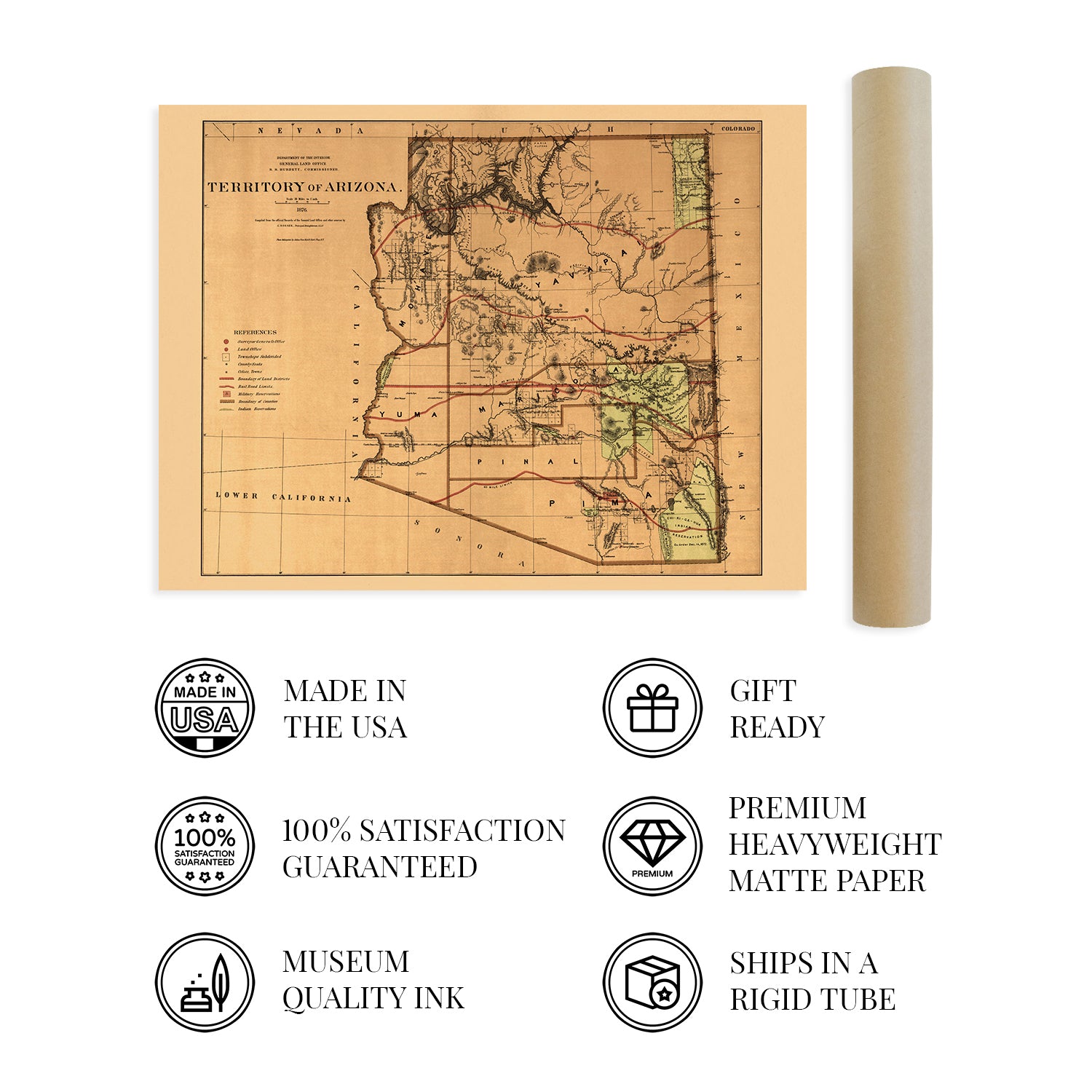
  • VINTAGE MAP REPRODUCTION: You’ll love this high quality historic reproduction of 1876 Arizona Map. Our museum quality maps are archival grade, which means it will look great and last without fading for over 100 years. Our print to order maps are made in the USA and each map is inspected for quality. This beautiful artwork is a perfect addition to your themed decor. Vintage maps look great in the home, study or office. They make a perfect gift as well.
  • MUSEUM QUALITY: This high quality map print will be a great addition to your vintage-themed wall. Don't waste money on cheap-looking, thin paper posters. We use thick, fine art print quality matte paper. Our professional’s choice matte paper displays artwork in high detail without glare. The color is vibrant and the text is easy to read. When framed, this map looks absolutely stunning.
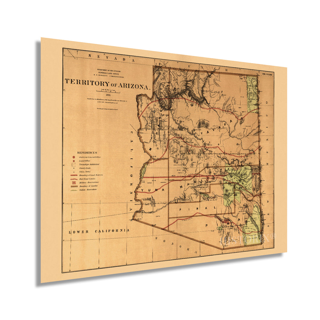
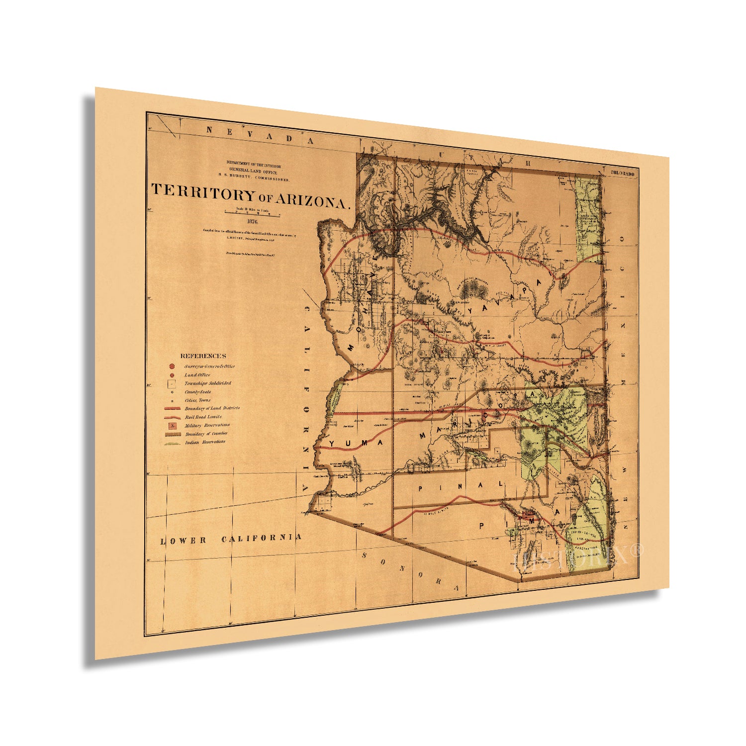
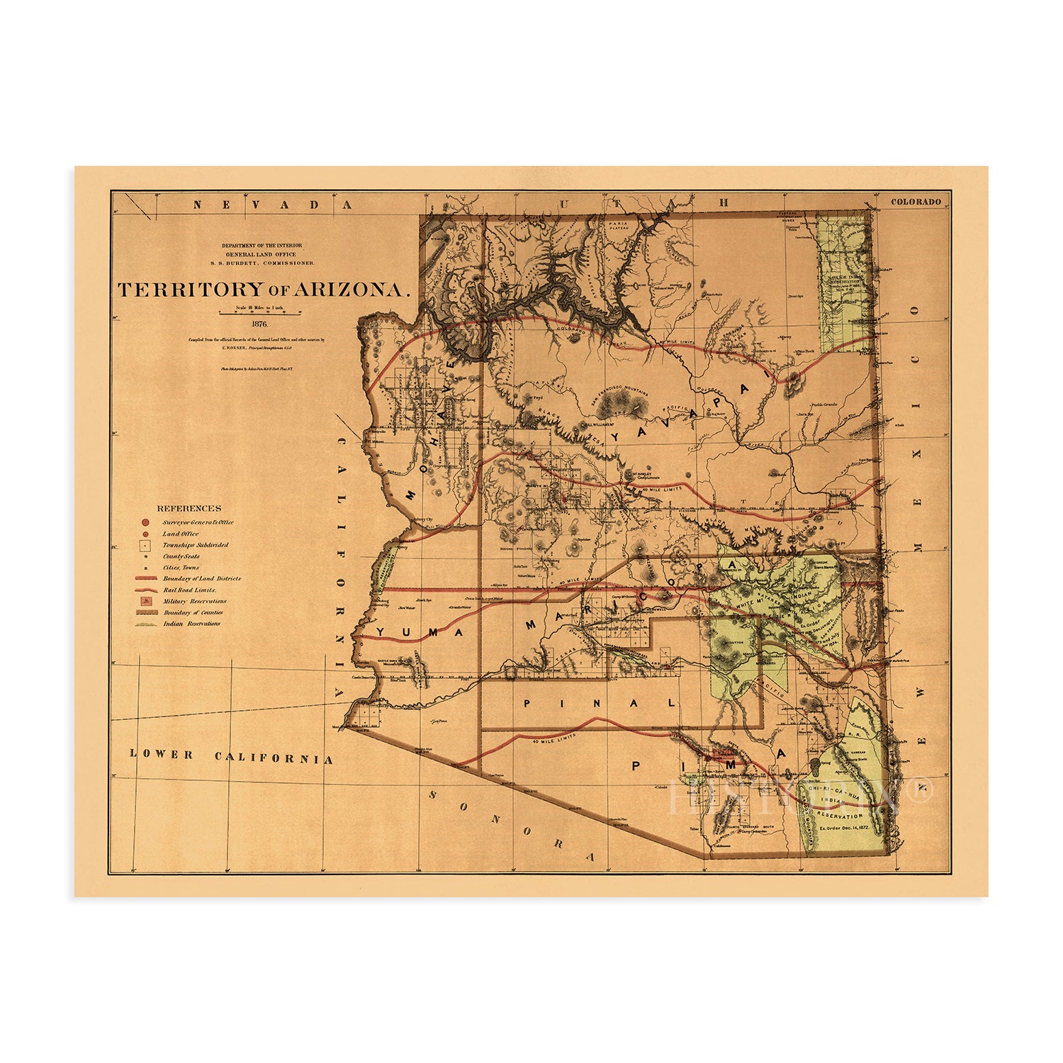
  • A LOOK BACK AT HISTORY: This is an impressive, historic reproduction of 1876 Vintage Arizona Map. This print is from an original found in the maps and geography division of the US Library of Congress. A true piece of history. See our product description section for more fascinating information about this historic map and its significance.
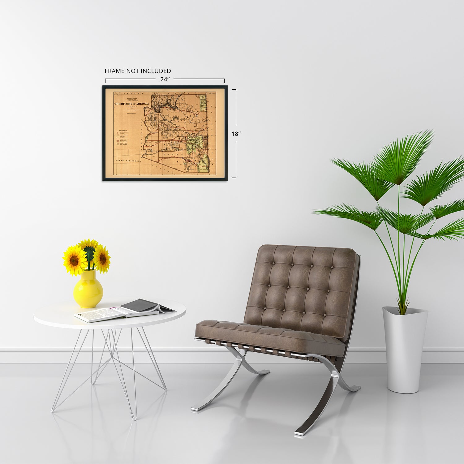
  • READY TO FRAME: This print includes a 0.2 inch border for a perfect frame fit and look. Our maps are designed to fit easy-to-find standard frame sizes, saving you money from having to pay for a custom frame. Each map is inspected for quality and shipped in a rigid tube.
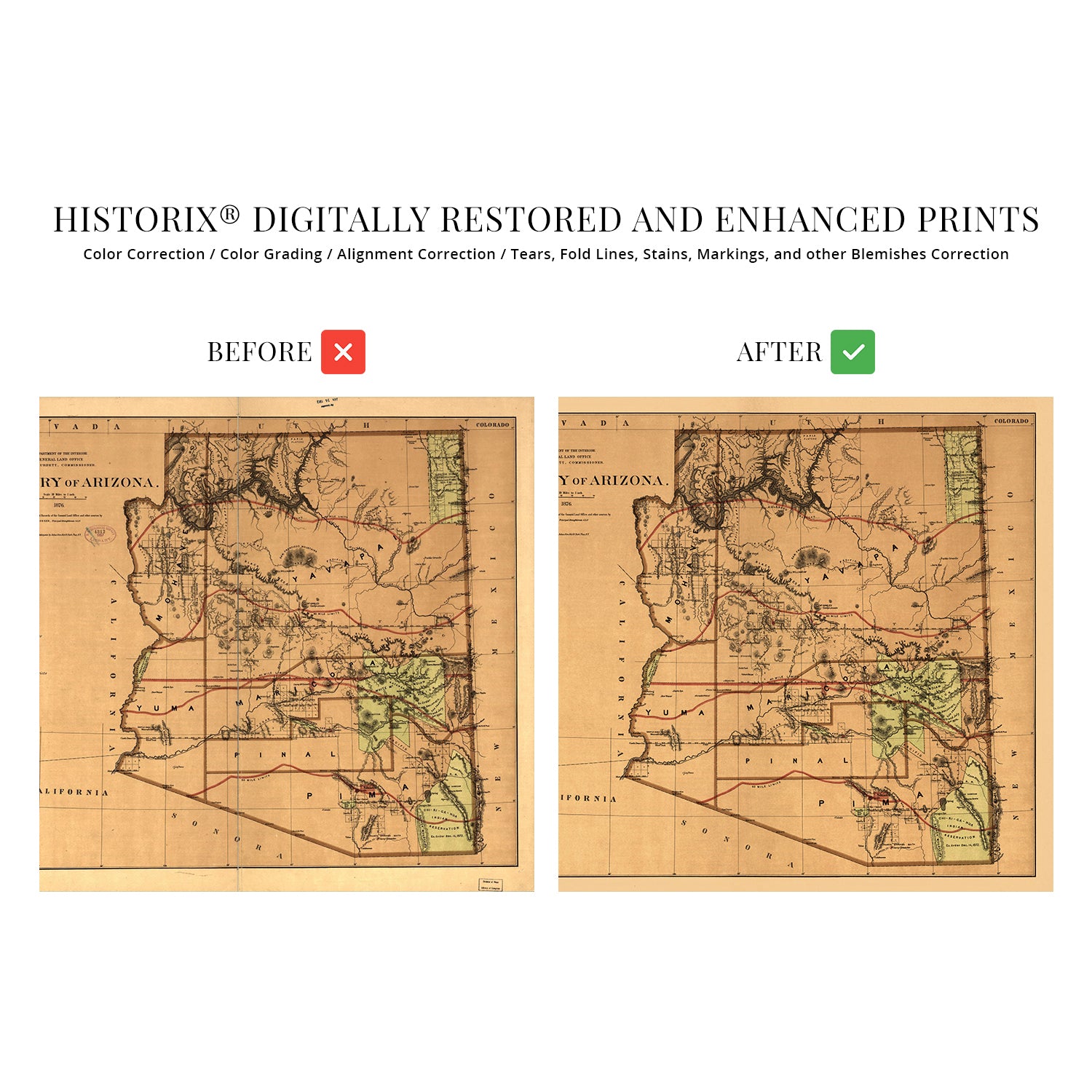
  • HISTORIX: We love history and art. Sometimes old maps have tears, folds, separations and other blemishes. We digitally restore and enhance maps while keeping its historical character. All our maps are proudly made in the USA. Customers all over the world love our vintage maps and we know you will too.


Additional Information

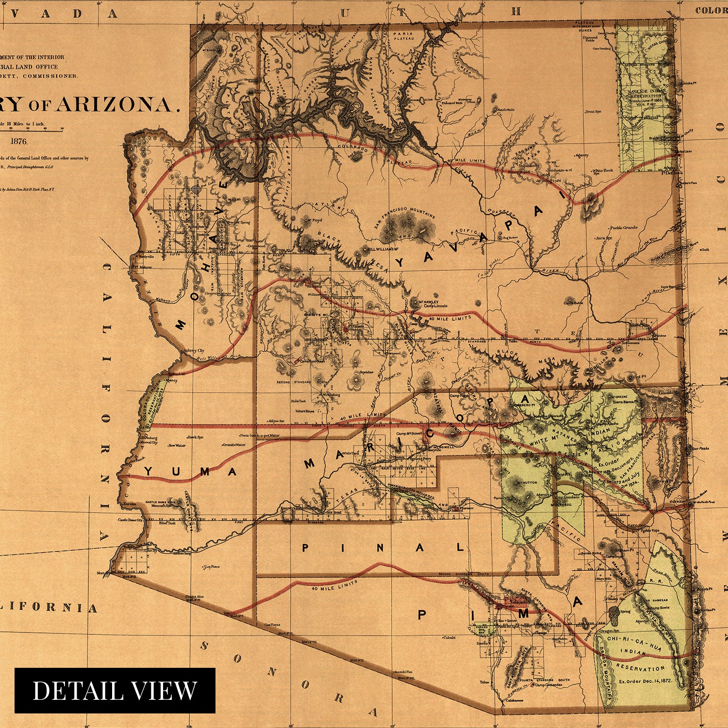
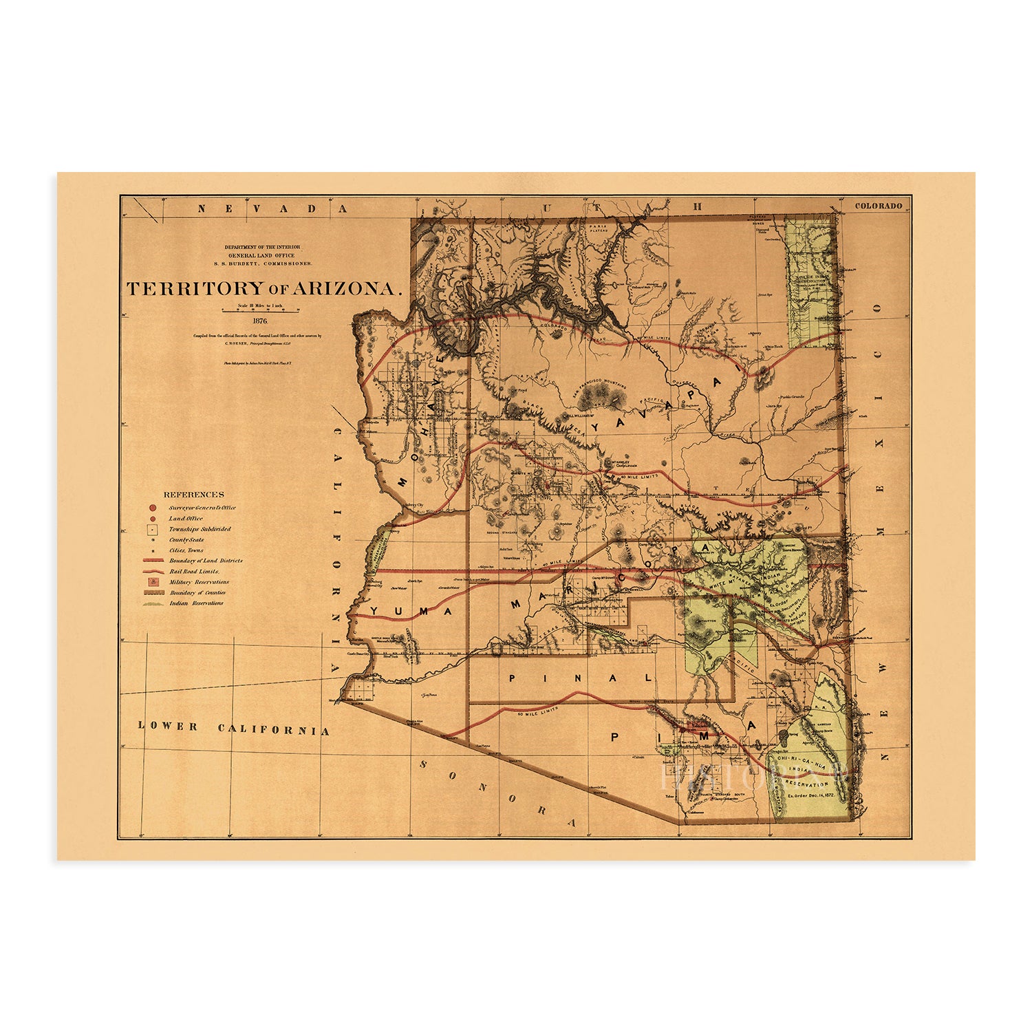
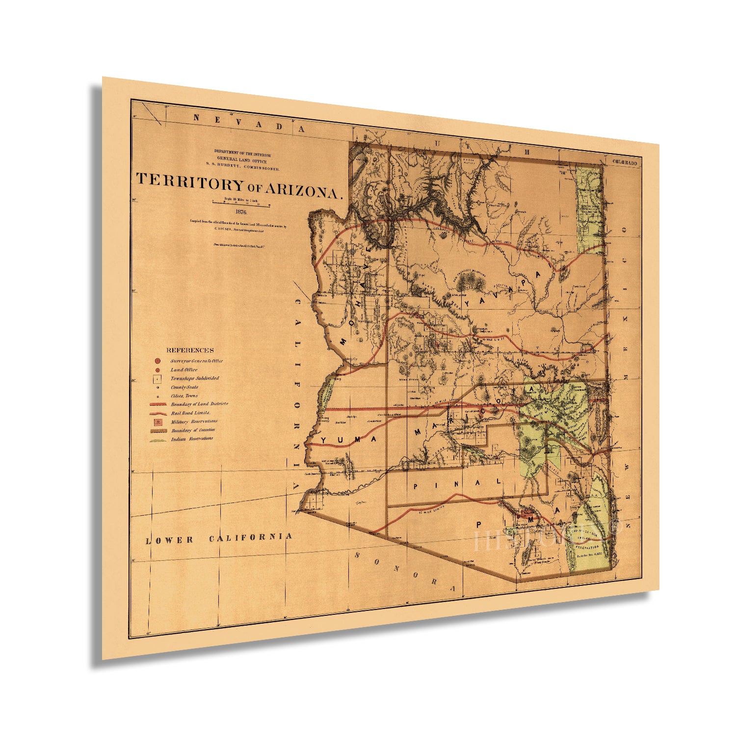
Published fourteen years after the region had been officially declared a territory, this depiction of Arizona shows the state in a period of relative growth as eager homesteaders arrived to establish vast cattle ranches and miners flocked to the region for the copper reserves which the state would eventually become famous for. Arizona’s remote landscape had kept the territory relatively untouched. Still, with Union Pacific completing the first transcontinental rail line in 1869, access had opened up access throughout much of the American Southwest. 

While Arizona would not achieve statehood until 1912, it was critical for the United States to gain control of the region to establish a national boundary from the Atlantic to the Pacific ocean. The territory had been ceded to the United States from Mexico in the Treaty of Hidalgo in 1848, following their defeat in the Mexican-American War. Arizona had been a member of the Confederacy during the Civil War, but following a Confederate defeat at the Battle of Glorietta Pass in 1862, Confederate troops were forced to retreat to El Paso. 

The landscape shifts from arid deserts in the southern portion of the state to the Rocky Mountains' southernmost reaches in the North. Produced by noted German-born lithographer Julien Bien, the unique aesthetic and distinctive style immediately transports the viewer back in time. Bien was one of the most prolific lithographers of the nineteenth century, and his works spanned three decades. This is a genuine piece of American cartographical history. 

Our museum quality giclee print comes printed with archival ink on premium heavyweight matte paper. Shipped in a sturdy cardboard tube your print will arrive ready to be framed. This eye-catching vintage map reproduction print makes the perfect gift for anyone that loves history and imagery.

*Free shipping for framed and canvas products limited to the 48 contiguous United States.