1893 Topographical Map of the Hawaiian Islands Wall Art Print – Historic Prints
100% Satisfaction Guaranteed: Free Returns
Free Standard Shipping
Get 10% OFF your First Order

Shop Now and Get Free Shipping to Anywhere in the United States and Puerto Rico.*

Follow us

Digitally Restored and Enhanced - 1893 Map of Hawaii - Vintage Map of Hawaiian Islands Wall Art - Hawaii Vintage Map Includes Text and Statistical Data - Vintage Map Hawaii - Hawaii Map Poster
  • Load image into Gallery viewer, Digitally Restored and Enhanced - 1893 Map of Hawaii - Vintage Map of Hawaiian Islands Wall Art - Hawaii Vintage Map Includes Text and Statistical Data - Vintage Map Hawaii - Hawaii Map Poster
  • Load image into Gallery viewer, Digitally Restored and Enhanced - 1893 Map of Hawaii - Vintage Map of Hawaiian Islands Wall Art - Hawaii Vintage Map Includes Text and Statistical Data - Vintage Map Hawaii - Hawaii Map Poster
  • Load image into Gallery viewer, Digitally Restored and Enhanced - 1893 Map of Hawaii - Vintage Map of Hawaiian Islands Wall Art - Hawaii Vintage Map Includes Text and Statistical Data - Vintage Map Hawaii - Hawaii Map Poster
  • Load image into Gallery viewer, Digitally Restored and Enhanced - 1893 Map of Hawaii - Vintage Map of Hawaiian Islands Wall Art - Hawaii Vintage Map Includes Text and Statistical Data - Vintage Map Hawaii - Hawaii Map Poster
  • Load image into Gallery viewer, Digitally Restored and Enhanced - 1893 Map of Hawaii - Vintage Map of Hawaiian Islands Wall Art - Hawaii Vintage Map Includes Text and Statistical Data - Vintage Map Hawaii - Hawaii Map Poster
  • Load image into Gallery viewer, Digitally Restored and Enhanced - 1893 Map of Hawaii - Vintage Map of Hawaiian Islands Wall Art - Hawaii Vintage Map Includes Text and Statistical Data - Vintage Map Hawaii - Hawaii Map Poster
  • Load image into Gallery viewer, Digitally Restored and Enhanced - 1893 Map of Hawaii - Vintage Map of Hawaiian Islands Wall Art - Hawaii Vintage Map Includes Text and Statistical Data - Vintage Map Hawaii - Hawaii Map Poster
  • Load image into Gallery viewer, Digitally Restored and Enhanced - 1893 Map of Hawaii - Vintage Map of Hawaiian Islands Wall Art - Hawaii Vintage Map Includes Text and Statistical Data - Vintage Map Hawaii - Hawaii Map Poster
  • Load image into Gallery viewer, Digitally Restored and Enhanced - 1893 Map of Hawaii - Vintage Map of Hawaiian Islands Wall Art - Hawaii Vintage Map Includes Text and Statistical Data - Vintage Map Hawaii - Hawaii Map Poster

1893 Map of Hawaii - Vintage Map of Hawaiian Islands Wall Art - Hawaii Vintage Map Includes Text and Statistical Data - Vintage Map Hawaii - Hawaii Map Poster

Regular price
$39.99
Sale price
$39.99
Regular price
$79.99
Sold out
Brand : HISTORIX
Unit price
per 


Feature Points

  • VINTAGE MAP REPRODUCTION: You’ll love this high quality historic reproduction of 1893 Map of Hawaii. Our museum quality maps are archival grade, which means it will look great and last without fading for over 100 years. Our print to order maps are made in the USA and each map is inspected for quality. This beautiful artwork is a perfect addition to your themed decor. Vintage maps look great in the home, study or office. They make a perfect gift as well.
  • MUSEUM QUALITY: This high quality map print will be a great addition to your vintage-themed wall. Don't waste money on cheap-looking, thin paper posters. We use thick, fine art print quality matte paper. Our professional’s choice matte paper displays artwork in high detail without glare. The color is vibrant and text is easy to read. When framed, this map looks absolutely stunning.
  • A LOOK BACK AT HISTORY: This is an impressive, historic reproduction of 1893 Map of Hawaii. This print is from an original found in the maps and geography division of the US Library of Congress. A true piece of history. See our product description section for more fascinating information about this historic map and its significance.
  • READY TO FRAME: This print includes a 0.2 inch border for a perfect frame fit and look. Our maps are designed to fit easy-to-find standard frame sizes, saving you money from having to pay for a custom frame. Each map is inspected for quality and shipped in a rigid tube.
  • HISTORIX: We love history and art. Sometimes old maps have tears, folds, separations and other blemishes. We digitally restore and enhance maps while keeping its historical character. All our maps are proudly made in the USA. Customers all over the world love our vintage maps and we know you will too.


Additional Information

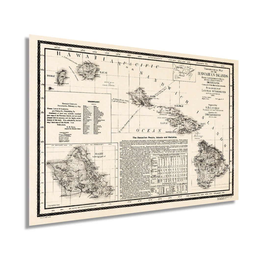
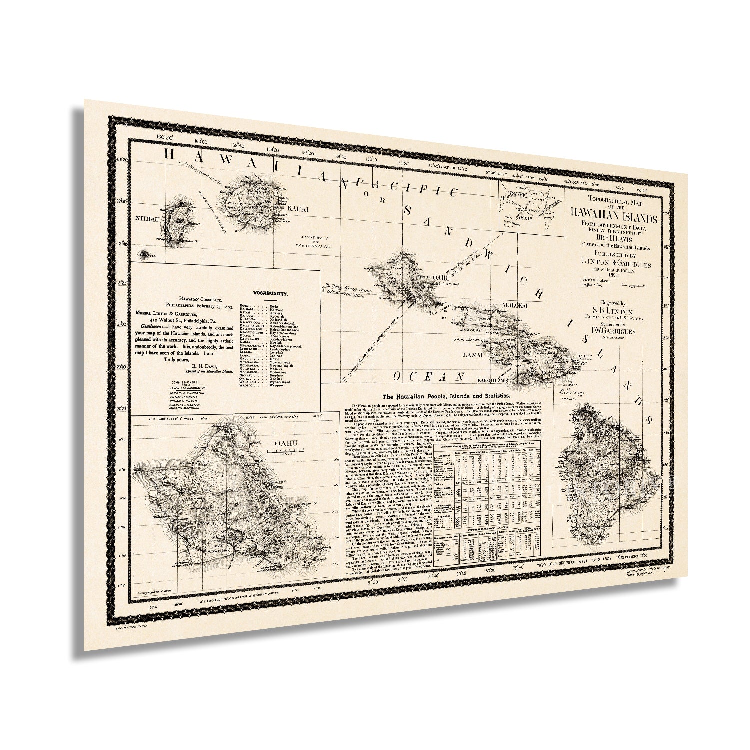
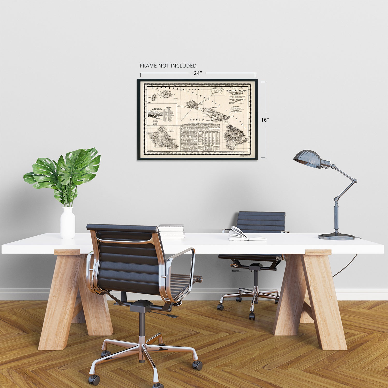
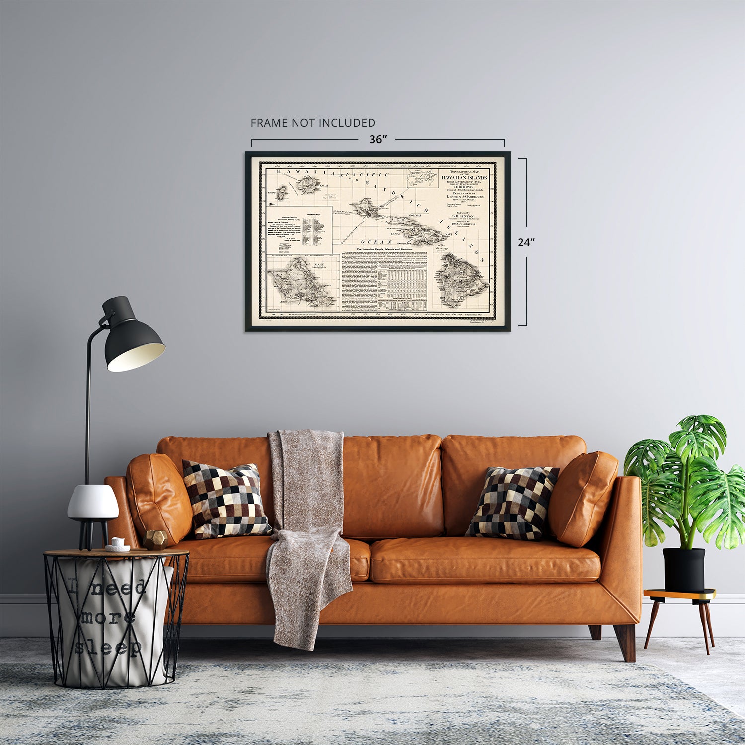
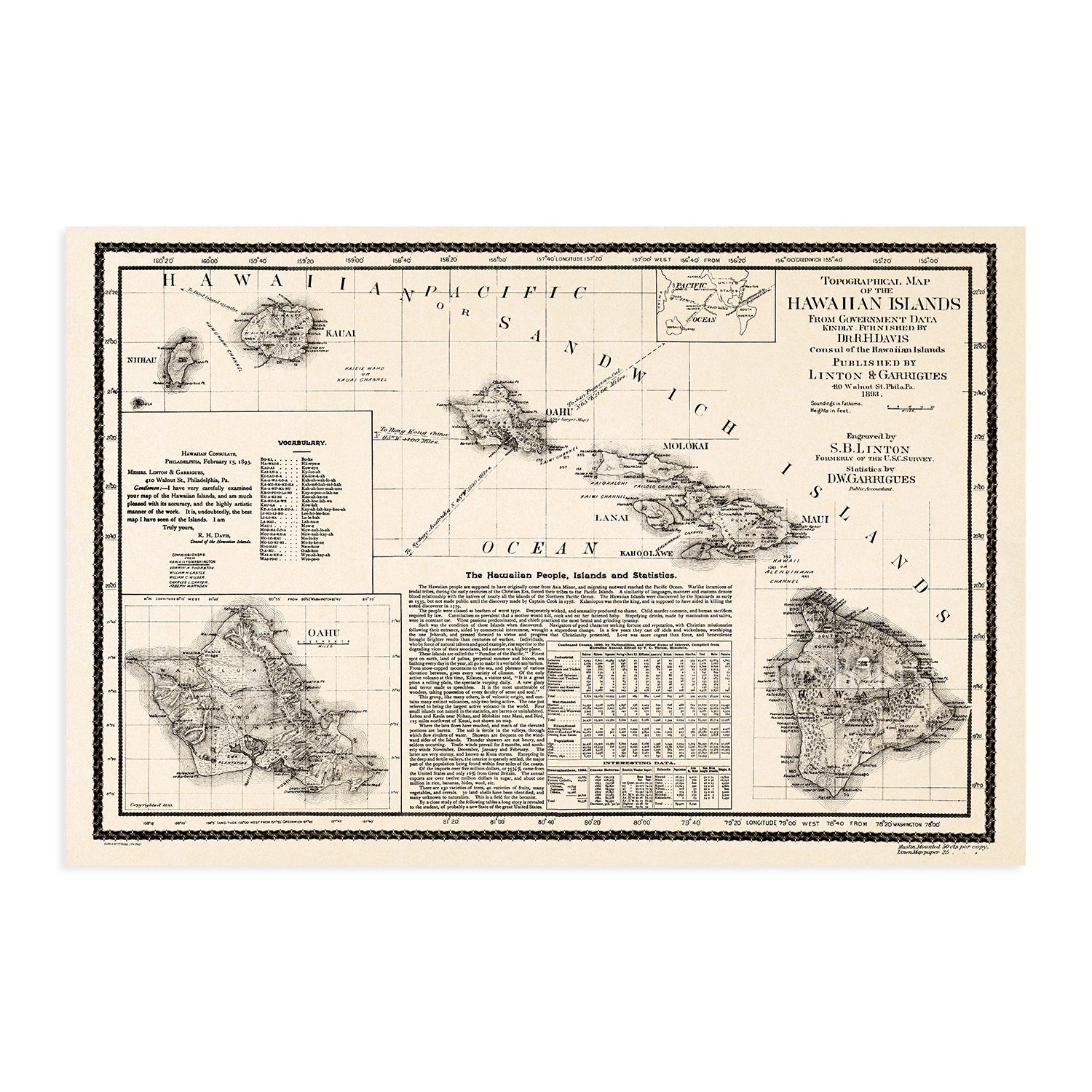
The 1890s were a time of significant transition for the Hawaiian Islands, and the depiction of the iconic archipelago in this 1893 publication transports the viewer back in time. Printed just five years before The United States would annex the island chain, the area was already being transformed by a thriving sugarcane farming industry, and vast fortunes were being made. 1893 marked the overthrowing of the last monarch following her attempt to ratify a new constitution granting her absolute authority, and a provisional government was formed.

This map was published before the five years when Hawaii was recognized as a sovereign nation, one of two states in the Union to have done so. The Islands were first documented in 1778 by British explorer Captain James Cook and were dubbed The Sandwich Islands. Cook was killed by natives on the island in 1779 following a dispute over the theft of a small ship.

The storied history of the islands has captivated American tourists for years, and tourism has always been a primary economic driver. The 1890s saw advances in sea travel, and the ability to quickly cross vast oceans opened the islands up to visitors. Tales spread through mainland America after authors Mark Twain and Jack London experienced the local tradition of ‘wave sliding’ or surfing.

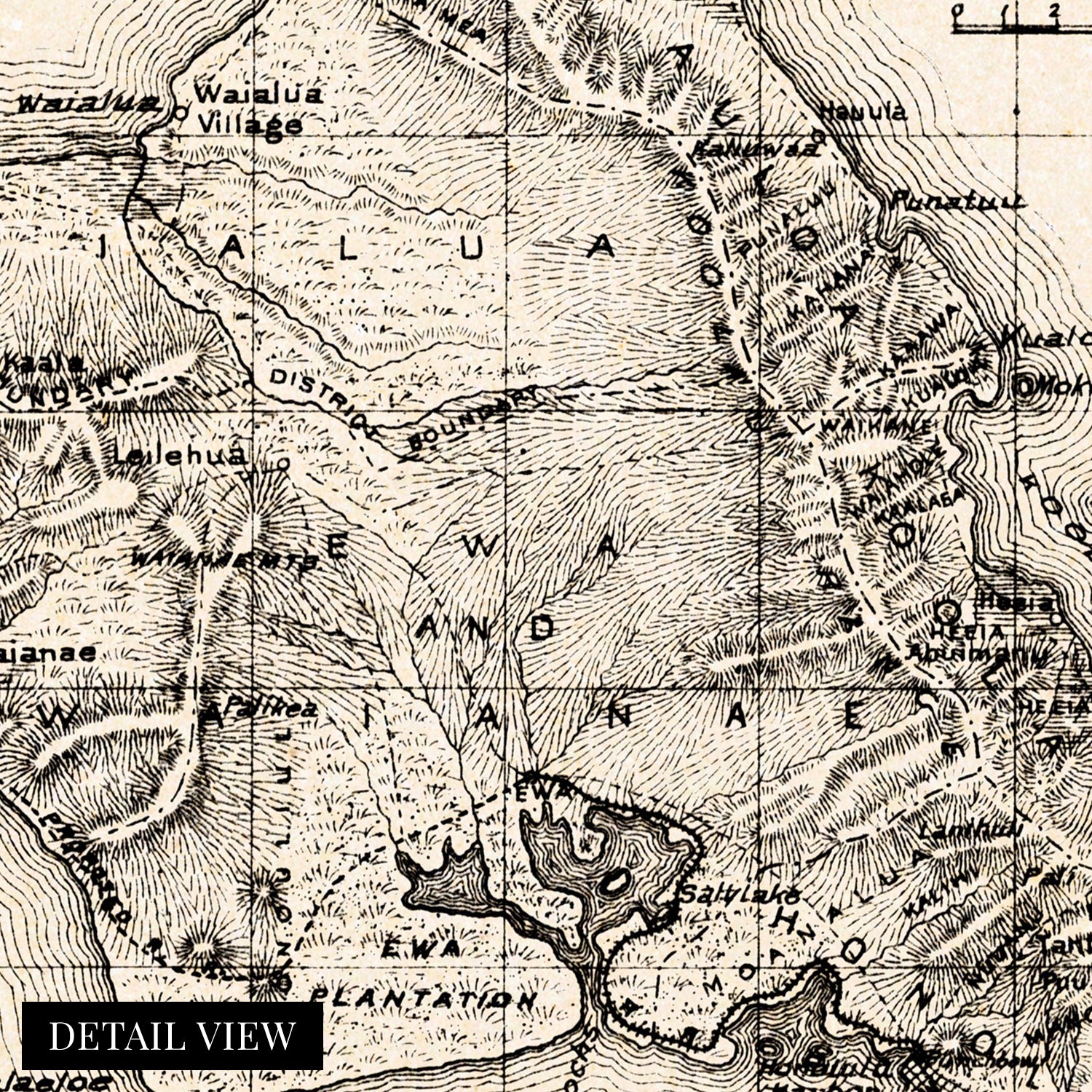
This topographical map represented the vanguard of depth maps, with soundings being laboriously produced by vessels in coastal waters and surveyors using the latest technology to indicate the heights of the mountain; this an authentic piece of cartographical history.

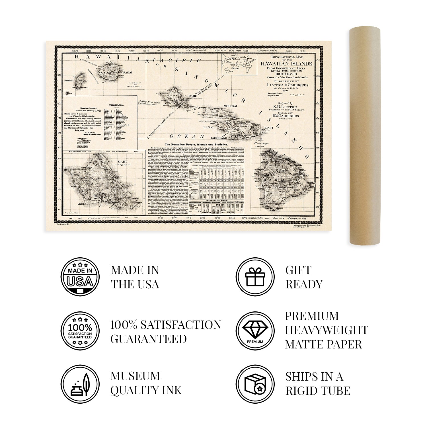
Our museum quality giclee print comes printed with archival ink on premium heavyweight matte paper. Shipped in a sturdy cardboard tube your print will arrive ready to be framed. This eye-catching vintage map print makes the perfect gift for anyone that loves history and imagery.

*Free shipping for framed and canvas products limited to the 48 contiguous United States.