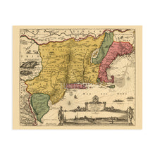
1690 New Belgium & New England United States Map Wall Art Print – Historic Prints
100% Satisfaction Guaranteed: Free Returns
Free Standard Shipping
Get 10% OFF your First Order

Shop Now and Get Free Shipping to Anywhere in the United States and Puerto Rico.*

Follow us

Digitally Restored and Enhanced 1690 Eastern United States Map Poster - Vintage Wall Map of New England Poster - New Netherland Map History - Old New Amsterdam New York City Map Wall Art
  • Load image into Gallery viewer, Digitally Restored and Enhanced 1690 Eastern United States Map Poster - Vintage Wall Map of New England Poster - New Netherland Map History - Old New Amsterdam New York City Map Wall Art
  • Load image into Gallery viewer, Digitally Restored and Enhanced 1690 Eastern United States Map Poster - Vintage Wall Map of New England Poster - New Netherland Map History - Old New Amsterdam New York City Map Wall Art
  • Load image into Gallery viewer, Digitally Restored and Enhanced 1690 Eastern United States Map Poster - Vintage Wall Map of New England Poster - New Netherland Map History - Old New Amsterdam New York City Map Wall Art
  • Load image into Gallery viewer, Digitally Restored and Enhanced 1690 Eastern United States Map Poster - Vintage Wall Map of New England Poster - New Netherland Map History - Old New Amsterdam New York City Map Wall Art
  • Load image into Gallery viewer, Digitally Restored and Enhanced 1690 Eastern United States Map Poster - Vintage Wall Map of New England Poster - New Netherland Map History - Old New Amsterdam New York City Map Wall Art
  • Load image into Gallery viewer, Digitally Restored and Enhanced 1690 Eastern United States Map Poster - Vintage Wall Map of New England Poster - New Netherland Map History - Old New Amsterdam New York City Map Wall Art
  • Load image into Gallery viewer, Digitally Restored and Enhanced 1690 Eastern United States Map Poster - Vintage Wall Map of New England Poster - New Netherland Map History - Old New Amsterdam New York City Map Wall Art
  • Load image into Gallery viewer, Digitally Restored and Enhanced 1690 Eastern United States Map Poster - Vintage Wall Map of New England Poster - New Netherland Map History - Old New Amsterdam New York City Map Wall Art
  • Load image into Gallery viewer, Digitally Restored and Enhanced 1690 Eastern United States Map Poster - Vintage Wall Map of New England Poster - New Netherland Map History - Old New Amsterdam New York City Map Wall Art

1690 Eastern United States Map - Vintage Wall Map of New England - New Netherland History Map - Old Map of New Amsterdam New York City Wall Art Poster

Regular price
$39.99
Sale price
$39.99
Regular price
$79.99
Sold out
Brand : Historic Prints
Unit price
per 
Shipping calculated at checkout.

Feature Points

  • VINTAGE MAP REPRODUCTION: You’ll love this high quality historic reproduction of 1690 1690 Eastern United States Map Poster. Our museum quality prints are archival grade, which means it will look great and last without fading for over 100 years. Our print to order maps are made in the USA and each map is inspected for quality. This beautiful artwork is a perfect addition to your themed decor. Vintage maps look great in the home, study or office. They make a perfect gift as well.
  • MUSEUM QUALITY: This high quality map print will be a great addition to your vintage-themed wall. Don't waste money on cheap-looking, thin paper posters. We use thick, fine art print quality matte paper. Our professional’s choice matte paper displays artwork in high detail without glare. The color is vibrant and text is easy to read. When framed, this map looks absolutely stunning.
  • A LOOK BACK AT HISTORY: This is an impressive, historic reproduction of 1690 New England Wall Art. A true piece of history. See our product description section for more fascinating information about this historic map and its significance.
  • READY TO FRAME: This print includes a 0.2 inch border for a perfect frame fit and look. Our maps are designed to fit easy-to-find standard frame sizes, saving you money from having to pay for a custom frame. Each map is inspected for quality and shipped in a rigid tube.
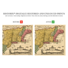
  • HISTORIX: We love history and art. Sometimes old maps have tears, folds, separations and other blemishes. We digitally restore and enhance maps while keeping its historical character. All our maps are proudly made in the USA. Customers all over the world love our vintage maps and we know you will too.


Additional Information
 

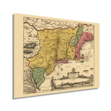
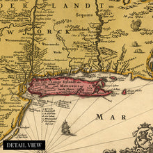
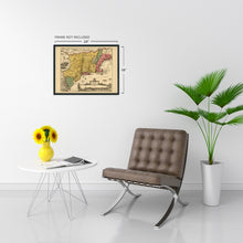
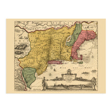
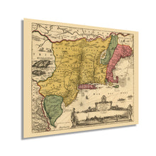
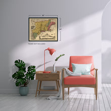
Illustrated by noted Dutch engraver, publisher, and cartographer Nicholas Visscher, this early depiction of New England shows the region in some of its earliest phases of settlement. The first English settlers established Plymouth Colony in 1620. A large number of puritans settled in the Boston and Salem regions, establishing farms, towns, and thriving fishing and whaling industries. By 1690 numerous towns, villages, and cities had been established throughout the Northeast, and the English colony was being transformed as settlers flocked from England and Western Europe. 

Visscher is considered an essential link in early cartographical history, and his distinctive style and ornate flourishes make this piece immediately recognizable. His works represent the most advanced engravings of the time, and he is among the masters of Dutch cartography. The so-called Glorious Revolution in England in 1689 had the colony in a period of increasing desires for independence following the ousting of King James II. The colonies had implemented self-governing charters, were openly flouting the Navigation Acts and had established local militias that operated outside of the English Army. Following the Glorious Revolution, Royal Governors were appointed to nearly every colony creating tension between the colonists and the unelected officials. 

The regional economy was growing in the seventeenth century due to an abundance of fertile land and was home to nearly one hundred thousand residents by the turn of the century. New England’s economy focused on self-sufficiency and small homesteads instead of relying on extensive trade networks.

Our museum quality giclee print comes printed with archival ink on premium heavyweight matte paper. Shipped in a sturdy cardboard tube your print will arrive ready to be framed. This eye-catching vintage map reproduction print makes the perfect gift for anyone that loves history and imagery.

*Free shipping for framed and canvas products limited to the 48 contiguous United States.