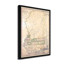
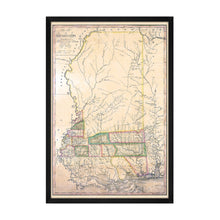
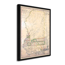
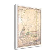
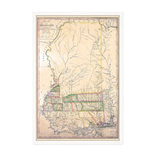
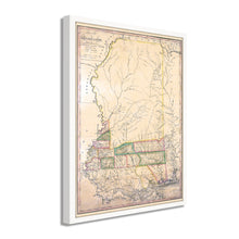
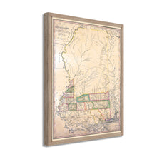
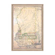
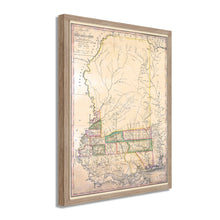
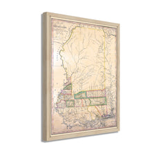
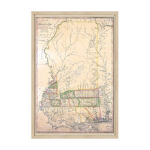
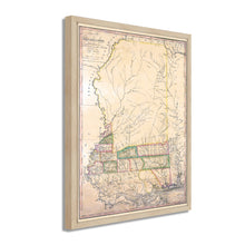
1820 Map of Mississippi Constructed from Surveys Framed Wall Art – Historic Prints
100% Satisfaction Guaranteed: Free Returns
Free Standard Shipping
Get 10% OFF your First Order

Shop Now and Get Free Shipping to Anywhere in the United States and Puerto Rico.*

Follow us

Digitally Restored and Enhanced 1820 Mississippi State Map - Framed Vintage Wall Map of Mississippi Poster - Old Mississippi Wall Art - Restored Mississippi Map from Surveys
  • Load image into Gallery viewer, Digitally Restored and Enhanced 1820 Mississippi State Map - Framed Vintage Wall Map of Mississippi Poster - Old Mississippi Wall Art - Restored Mississippi Map from Surveys
  • Load image into Gallery viewer, Digitally Restored and Enhanced 1820 Mississippi State Map - Framed Vintage Wall Map of Mississippi Poster - Old Mississippi Wall Art - Restored Mississippi Map from Surveys
  • Load image into Gallery viewer, Digitally Restored and Enhanced 1820 Mississippi State Map - Framed Vintage Wall Map of Mississippi Poster - Old Mississippi Wall Art - Restored Mississippi Map from Surveys
  • Load image into Gallery viewer, Digitally Restored and Enhanced 1820 Mississippi State Map - Framed Vintage Wall Map of Mississippi Poster - Old Mississippi Wall Art - Restored Mississippi Map from Surveys
  • Load image into Gallery viewer, Digitally Restored and Enhanced 1820 Mississippi State Map - Framed Vintage Wall Map of Mississippi Poster - Old Mississippi Wall Art - Restored Mississippi Map from Surveys
  • Load image into Gallery viewer, Digitally Restored and Enhanced 1820 Mississippi State Map - Framed Vintage Wall Map of Mississippi Poster - Old Mississippi Wall Art - Restored Mississippi Map from Surveys
  • Load image into Gallery viewer, Digitally Restored and Enhanced 1820 Mississippi State Map - Framed Vintage Wall Map of Mississippi Poster - Old Mississippi Wall Art - Restored Mississippi Map from Surveys
  • Load image into Gallery viewer, Digitally Restored and Enhanced 1820 Mississippi State Map - Framed Vintage Wall Map of Mississippi Poster - Old Mississippi Wall Art - Restored Mississippi Map from Surveys
  • Load image into Gallery viewer, Digitally Restored and Enhanced 1820 Mississippi State Map - Framed Vintage Wall Map of Mississippi Poster - Old Mississippi Wall Art - Restored Mississippi Map from Surveys
  • Load image into Gallery viewer, Digitally Restored and Enhanced 1820 Mississippi State Map - Framed Vintage Wall Map of Mississippi Poster - Old Mississippi Wall Art - Restored Mississippi Map from Surveys
  • Load image into Gallery viewer, Digitally Restored and Enhanced 1820 Mississippi State Map - Framed Vintage Wall Map of Mississippi Poster - Old Mississippi Wall Art - Restored Mississippi Map from Surveys
  • Load image into Gallery viewer, Digitally Restored and Enhanced 1820 Mississippi State Map - Framed Vintage Wall Map of Mississippi Poster - Old Mississippi Wall Art - Restored Mississippi Map from Surveys
  • Load image into Gallery viewer, Digitally Restored and Enhanced 1820 Mississippi State Map - Framed Vintage Wall Map of Mississippi Poster - Old Mississippi Wall Art - Restored Mississippi Map from Surveys
  • Load image into Gallery viewer, Digitally Restored and Enhanced 1820 Mississippi State Map - Framed Vintage Wall Map of Mississippi Poster - Old Mississippi Wall Art - Restored Mississippi Map from Surveys
  • Load image into Gallery viewer, Digitally Restored and Enhanced 1820 Mississippi State Map - Framed Vintage Wall Map of Mississippi Poster - Old Mississippi Wall Art - Restored Mississippi Map from Surveys
  • Load image into Gallery viewer, Digitally Restored and Enhanced 1820 Mississippi State Map - Framed Vintage Wall Map of Mississippi Poster - Old Mississippi Wall Art - Restored Mississippi Map from Surveys

1820 Mississippi State Map - Framed Vintage Wall Map of Mississippi - Old Mississippi Map - Restored Mississippi Map from Surveys Wall Art Poster

Regular price
$172.99
Sale price
$172.99
Regular price
$345.99
Sold out
Brand : Historic Prints
Unit price
per 

Feature Points

  • VINTAGE MAP FRAMED: You’ll love this high-quality framed historic reproduction of 1820 Mississippi State Map. Our ready-to-hang maps are printed and framed in the USA by professional art framers using the highest quality materials. Each order is inspected for quality. This beautiful artwork is a perfect addition to your themed decor. Vintage maps look great in the home, study or office. They also make an unforgettable gift.
  • A LOOK BACK AT HISTORY: This is an impressive, historic reproduction of 1820 State Map of Mississippi. A true piece of history. Historic prints beautifully link the past with the present. You may find yourself staring at your historic wall art for hours in amazement. See our product description section for more fascinating information about this historic map and its significance.
  • PREMIUM QUALITY: To display this amazing piece of history, we use museum-quality heavyweight (230gsm), fine art print matte paper. Our paper is acid-free which allows the print to retain its color quality for generations. Our paper displays vintage map art with accurate color reproduction. This high quality print will be a wonderful addition to your vintage-themed wall.
  • READY TO HANG: This high-quality frame displays art beautifully in almost any environment. The frame is made out of poplar wood (for black and white) and pine wood (for walnut and natural) with a matte finish. The frame profile is 1.5 inches high and 0.75 (for size 16x24) and 1.125 (for size 24x36) inches wide. To protect artwork, we use high-quality, lightweight, shatter-resistant frame-grade acrylic. Frames arrive ready-to-hang, preinstalled with hanging hardware.
  • HISTORIC PRINTS: We love history and art. Sometimes old maps have tears, folds, stamps, separations and other blemishes. We digitally restore and enhance maps while keeping its historical character. Our framed prints are made-to-order in the USA by professional art framers. Customers all over the world love our historic prints and we know you will too.


Additional Information

Published by noted Scottish mapmaker John Melish in 1820, this depiction of Mississippi shows the state just three years after it’s inclusion into the United States. Melish was one of the earliest surveyors to produce maps and created the first map of the United States that extended to the Pacific Ocean. He had settled in Philadelphia in 1811 and is considered one of the most prominent cartographers of the United States in its early years. His publication of the United Stated is deemed to have been influential in the westward expansion doctrine known as manifest destiny.

The Mississippi River played a pivotal role in the economic development of the region, and towns were typically established due to their proximity to the river. The Mississippi is one of the most iconic waterways in America and holds a unique place in the history and lore of the nation. The river allowed trade into the mid-west and became vital for the economic success of the gulf coast, including Mississippi and Louisiana. The river also allowed further exploration into the western portion of the united states, encouraging growth and settlement west of the river as well as into northern areas.

Melish’s maps were renowned for their accuracy and fulfilled the contemporary need for precise cartography. As Mississippi entered the United States, it was in a period of significant transition in the early 19th century, and the distinctive aesthetic of this illustration immediately transports the viewer back in time and is an authentic piece of cartographical history.

Our ready-to-hang wall art are printed and framed in the USA using the highest quality materials with professional craftsmanship. This beautiful artwork is a perfect addition to your themed decor. Historic prints look great in the home, study or office. They also make an unforgettable gift.

*Free shipping for framed and canvas products limited to the 48 contiguous United States.