1825 Greenville District South Carolina Map Canvas Wall Art – Historic Prints
100% Satisfaction Guaranteed: Free Returns
Free Standard Shipping
Get 10% OFF your First Order

Shop Now and Get Free Shipping to Anywhere in the United States and Puerto Rico.*

Follow us

Digitally Restored and Enhanced1825 Map of Greenville SC Canvas Art - Canvas Wrap Vintage Greenville County South Carolina Map Wall Art - History Map of Greenville District South Carolina Poster
  • Load image into Gallery viewer, Digitally Restored and Enhanced1825 Map of Greenville SC Canvas Art - Canvas Wrap Vintage Greenville County South Carolina Map Wall Art - History Map of Greenville District South Carolina Poster
  • Load image into Gallery viewer, Digitally Restored and Enhanced1825 Map of Greenville SC Canvas Art - Canvas Wrap Vintage Greenville County South Carolina Map Wall Art - History Map of Greenville District South Carolina Poster
  • Load image into Gallery viewer, Digitally Restored and Enhanced1825 Map of Greenville SC Canvas Art - Canvas Wrap Vintage Greenville County South Carolina Map Wall Art - History Map of Greenville District South Carolina Poster
  • Load image into Gallery viewer, Digitally Restored and Enhanced1825 Map of Greenville SC Canvas Art - Canvas Wrap Vintage Greenville County South Carolina Map Wall Art - History Map of Greenville District South Carolina Poster
  • Load image into Gallery viewer, Digitally Restored and Enhanced1825 Map of Greenville SC Canvas Art - Canvas Wrap Vintage Greenville County South Carolina Map Wall Art - History Map of Greenville District South Carolina Poster
  • Load image into Gallery viewer, Digitally Restored and Enhanced1825 Map of Greenville SC Canvas Art - Canvas Wrap Vintage Greenville County South Carolina Map Wall Art - History Map of Greenville District South Carolina Poster
  • Load image into Gallery viewer, Digitally Restored and Enhanced1825 Map of Greenville SC Canvas Art - Canvas Wrap Vintage Greenville County South Carolina Map Wall Art - History Map of Greenville District South Carolina Poster
  • Load image into Gallery viewer, Digitally Restored and Enhanced1825 Map of Greenville SC Canvas Art - Canvas Wrap Vintage Greenville County South Carolina Map Wall Art - History Map of Greenville District South Carolina Poster
  • Load image into Gallery viewer, Digitally Restored and Enhanced1825 Map of Greenville SC Canvas Art - Canvas Wrap Vintage Greenville County South Carolina Map Wall Art - History Map of Greenville District South Carolina Poster

1825 Map of Greenville SC Canvas Art - Canvas Wrap Vintage Greenville County South Carolina Map - History Map of Greenville District South Carolina Wall Art Poster

Regular price
$153.99
Sale price
$153.99
Regular price
$307.99
Sold out
Brand : Historic Prints
Unit price
per 

Feature Points

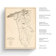
  • VINTAGE MAP CANVAS ART: You’ll love this high-quality canvas art reproduction of 1825 Map of Greenville SC Canvas Art. Our ready-to-hang maps are printed and framed in the USA by professional art framers using the highest quality materials. Each order is inspected for quality. This beautiful artwork is a perfect addition to your themed decor. Vintage maps look great in the home, study or office. They also make an unforgettable gift.
  • A LOOK BACK AT HISTORY: This is an impressive, historic reproduction of 1825 Greenville County Map of South Carolina. A true piece of history. Historic prints beautifully link the past with the present. You may find yourself staring at your historic wall art for hours in wonderment. See our product description section for more fascinating information about this historic map and its significance.
  • QUALITY CANVAS: To display this amazing piece of history, we use museum-quality heavyweight (400gsm), satin/gloss, American made canvas. Our canvas is OBA-free which allows the print to retain its color quality for generations. The canvas displays vintage map art with accurate color reproduction. This high quality canvas print will be a wonderful addition to your vintage-themed wall.
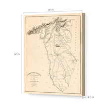
  • READY TO HANG: This high-quality canvas wrap wall art displays beautifully in almost any environment. The stretcher bar is made out of kiln-dried poplar wood. This canvas wall art has a 1.5 inch wrap on each side. Our canvas wrap prints are made-to-order in the USA by professional art framers. Frames arrive ready-to-hang, preinstalled with hanging hardware.
  • HISTORIC PRINTS: We love history and art. Sometimes old maps have tears, folds, stamps, separations and other blemishes. We digitally restore and enhance maps while keeping its historical character. Customers all over the world love our historic prints and we know you will too.


Additional Information
 

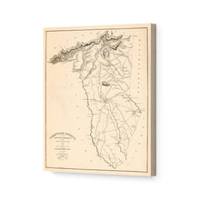
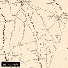
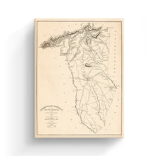
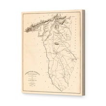
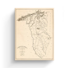
This property ownership and county map of the Greenville District of South Carolina was produced in 1825 and provides a sense of the rich history of the region. Printed to scale and used as a valuable resource for the merchants and residents of the area, this map connects the viewer to the past.

Modern-day Greenville lies atop land initially forbidden to colonists as it was Cherokee hunting land. In 1777 the Treaty of Dewitt’s Corner and agreement between the Cherokee Nation and American colonists ceded the territory to South Carolina. The County was established in 1786, and locals say the area was named for General Nathanael Greene in honor of his service in the American Revolutionary War. Greene was known as one of George Washingtons’ most gifted and dependable Generals and brought American victory in the Battles of Guilford Court House, Hobkirk’s Hill, and Eutaw Springs.

This map pre-dates the annexation of Pleasantburg in 1831 and was printed for Mills’ Atlas to depict all ownership and property claims. The publisher of the atlas later went on the design the Washington Monument. Mills was also the architect for the original Greenville Courthouse, which was completed in 1823.

The economy at this time relied heavily on cotton and wool milling, and the numerous mills were documented here. The town eventually became home to the Greenville and Columbia Railway, causing the city to grow as a central hub, and allowing residents more access to the rest of the state and country.

Our ready-to-hang canvas wall art prints are made in the USA using the highest quality materials with professional craftsmanship. This beautiful artwork is a perfect addition to your themed decor. Historic prints look great in the home, study or office. They also make an unforgettable gift.

*Free shipping for framed and canvas products limited to the 48 contiguous United States.