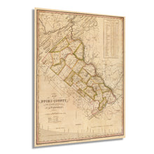
1831 Map of Bucks County Pennsylvania State Wall Art Print – Historic Prints
100% Satisfaction Guaranteed: Free Returns
Free Standard Shipping
Get 10% OFF your First Order

Shop Now and Get Free Shipping to Anywhere in the United States and Puerto Rico.*

Follow us

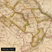
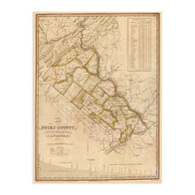
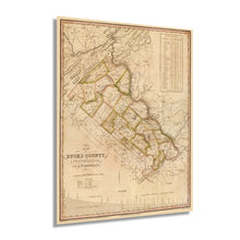
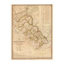
Digitally Restored and Enhanced 1831 Map of Bucks County Pennsylvania - Vintage Map of Bucks County Wall Art - Map of Bucks County PA with Townships and Statistics - Old Bucks County PA Map
  • Load image into Gallery viewer, Digitally Restored and Enhanced 1831 Map of Bucks County Pennsylvania - Vintage Map of Bucks County Wall Art - Map of Bucks County PA with Townships and Statistics - Old Bucks County PA Map
  • Load image into Gallery viewer, Digitally Restored and Enhanced 1831 Map of Bucks County Pennsylvania - Vintage Map of Bucks County Wall Art - Map of Bucks County PA with Townships and Statistics - Old Bucks County PA Map
  • Load image into Gallery viewer, Digitally Restored and Enhanced 1831 Map of Bucks County Pennsylvania - Vintage Map of Bucks County Wall Art - Map of Bucks County PA with Townships and Statistics - Old Bucks County PA Map
  • Load image into Gallery viewer, Digitally Restored and Enhanced 1831 Map of Bucks County Pennsylvania - Vintage Map of Bucks County Wall Art - Map of Bucks County PA with Townships and Statistics - Old Bucks County PA Map
  • Load image into Gallery viewer, Digitally Restored and Enhanced 1831 Map of Bucks County Pennsylvania - Vintage Map of Bucks County Wall Art - Map of Bucks County PA with Townships and Statistics - Old Bucks County PA Map
  • Load image into Gallery viewer, Digitally Restored and Enhanced 1831 Map of Bucks County Pennsylvania - Vintage Map of Bucks County Wall Art - Map of Bucks County PA with Townships and Statistics - Old Bucks County PA Map
  • Load image into Gallery viewer, Digitally Restored and Enhanced 1831 Map of Bucks County Pennsylvania - Vintage Map of Bucks County Wall Art - Map of Bucks County PA with Townships and Statistics - Old Bucks County PA Map
  • Load image into Gallery viewer, Digitally Restored and Enhanced 1831 Map of Bucks County Pennsylvania - Vintage Map of Bucks County Wall Art - Map of Bucks County PA with Townships and Statistics - Old Bucks County PA Map
  • Load image into Gallery viewer, Digitally Restored and Enhanced 1831 Map of Bucks County Pennsylvania - Vintage Map of Bucks County Wall Art - Map of Bucks County PA with Townships and Statistics - Old Bucks County PA Map

1831 Map of Bucks County Pennsylvania - Vintage Map of Bucks County Wall Art - Map of Bucks County PA with Townships and Statistics - Old Bucks County PA Map

Regular price
$39.99
Sale price
$39.99
Regular price
$79.99
Sold out
Brand : HISTORIX
Unit price
per 


Feature Points

  • VINTAGE MAP REPRODUCTION: You’ll love this high quality historic reproduction of 1831 Map of Bucks County Pennsylvania. Our museum quality maps are archival grade, which means it will look great and last without fading for over 100 years. Our print to order maps are made in the USA and each map is inspected for quality. This beautiful artwork is a perfect addition to your themed decor. Vintage maps look great in the home, study or office. They make a perfect gift as well.
  • MUSEUM QUALITY: This high quality map print will be a great addition to your vintage-themed wall. Don't waste money on cheap-looking, thin paper posters. We use thick, fine art print quality matte paper. Our professional’s choice matte paper displays artwork in high detail without glare. The color is vibrant and text is easy to read. When framed, this map looks absolutely stunning.
  • A LOOK BACK AT HISTORY: This is an impressive, historic reproduction of 1831 Map of Bucks County Pennsylvania. This print is from an original found in the maps and geography division of the US Library of Congress. A true piece of history. See our product description section for more fascinating information about this historic map and its significance.
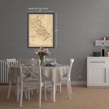
  • READY TO FRAME: This print includes a 0.2 inch border for a perfect frame fit and look. Our maps are designed to fit easy-to-find standard frame sizes, saving you money from having to pay for a custom frame. Each map is inspected for quality and shipped in a rigid tube.
  • HISTORIX: We love history and art. Sometimes old maps have tears, folds, separations and other blemishes. We digitally restore and enhance maps while keeping its historical character. All our maps are proudly made in the USA. Customers all over the world love our vintage maps and we know you will too.


Additional Information

One of the three original counties founded by William Penn in 1632, Bucks County, has a rich history and deep roots in American History. Published by prolific American cartographer and engraver Henry Schenck Tanner in 1831 during what is considered the ‘golden age’ of American mapmaking, this is truly an authentic piece of cartographical History and unique depiction of the past.

During the American Revolution, General Washington and his troops camped in Bucks County as they prepared to attack Hessian encampments in Trenton, NJ. They crossed the Delaware River on December 26, 1776, and defeated Johann Rall and his troops in the Battle of Trenton; this victory marked a turning point in the War for Independence and was commemorated in 1917 with the opening of the Washington Crossing Park, where 13 historic structures stand to this day.

Immediately Northeast of Philadelphia, this depiction shows the region in a time of considerable growth and prosperity. As Philadelphia grew, immigrants and residents moved into the town of Bensalem, the largest in Bucks County. In the early 19th century, the rise of manufacturing jobs spurred population growth. One of the most iconic estates in Pennsylvania, Andalusia, or the Nicholas Biddle Estate is found in Bensalem, and the Greek Revival architecture is one of the most excellent examples in the United States.

Pennsylvania’s rich heritage goes back as far as any place in American History, and Bucks County is deeply rooted in this legacy.

Bucks County Townships Today: Bedminster, Bensalem, Bridgeton, Bristol, Buckingham, Doylestown, Durham, East Rockhill, Falls, Haycock, Hilltown, Lower Makefield, Lower Southampton, Middletown, Milford, New Britain, Newtown, Nockamixon, Northampton, Plumstead, Richland, Solebury, Springfield, Tinicum, Upper Makefield, Upper Southampton, Warminster, Warrington, Warwick, West Rockhill, Wrightstown.

*Free shipping for framed and canvas products limited to the 48 contiguous United States.