Feature Points
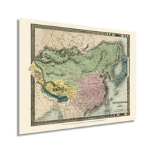
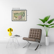
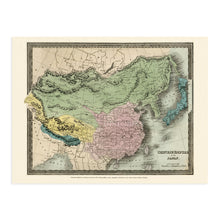
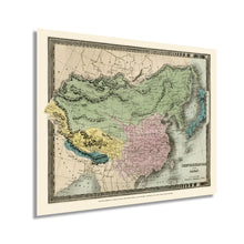
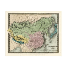
- VINTAGE MAP REPRODUCTION: You’ll love this high quality historic reproduction of 1835 Chinese Empire Map. Our museum quality prints are archival grade, which means it will look great and last without fading for over 100 years. Our print to order maps are made in the USA and each map is inspected for quality. This beautiful artwork is a perfect addition to your themed decor. Vintage maps look great in the home, study or office. They make a perfect gift as well.
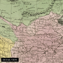
- MUSEUM QUALITY: This high quality map print will be a great addition to your vintage-themed wall. Don't waste money on cheap-looking, thin paper posters. We use thick, fine art print quality matte paper. Our professional’s choice matte paper displays artwork in high detail without glare. The color is vibrant and text is easy to read. When framed, this map looks absolutely stunning.
- A LOOK BACK AT HISTORY: This is an impressive, historic reproduction of 1835 China Map. A true piece of history. See our product description section for more fascinating information about this historic map and its significance.
- READY TO FRAME: This print includes a 0.2 inch border for a perfect frame fit and look. Our maps are designed to fit easy-to-find standard frame sizes, saving you money from having to pay for a custom frame. Each map is inspected for quality and shipped in a rigid tube.
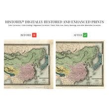
- HISTORIX: We love history and art. Sometimes old maps have tears, folds, separations and other blemishes. We digitally restore and enhance maps while keeping its historical character. All our maps are proudly made in the USA. Customers all over the world love our vintage maps and we know you will too.
Additional Information
David Burr worked closely with New York to survey numerous roads and saw the need for quality depictions or survey work. In 1829 Burr produced the second map and Atlas of New York. Produced by one of the most important cartographers of his era, this unique depiction of China and Japan shows the areas in a significant period of transformation and cultural shifts. This work is considered one of the most essential pieces of American cartographical history. Burr was later appointed as Topographer to the Post Office in 1841 and Geographer to the House of Representatives. Burr worked closely with noted engraver Thomas Illman to produce his signature maps which bears a distinctive style and unique aesthetic that immediately transports the viewer back in time.Â
In 1853 Commodore Matthew Perry sailed into the Tokyo Bay harbor to establish Japan's connection to the West. The United States' goal was to gain access to Chinese ports as well as the annexation of California to establish a major port on the American west coast. American missionaries had been in China since the 1830s, and the Manifest Destiny doctrine drew merchants and missionaries alike across the pacific to develop an international trade route with Southeast Asia.Â
Perry's expedition was the first successful voyage by an American commander, though they had been attempting to open relations since the 1830s. The detail and accuracy of this map make it an authentic piece of cartographical history, while its publication date further exhibits what a remarkable piece this is.
Our museum quality giclee print comes printed with archival ink on premium heavyweight matte paper. Shipped in a sturdy cardboard tube your print will arrive ready to be framed. This eye-catching vintage map reproduction print makes the perfect gift for anyone that loves history and imagery.


