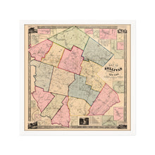
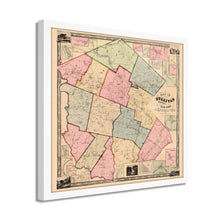
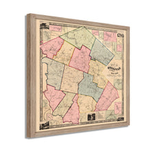
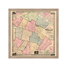
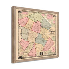
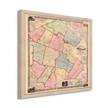
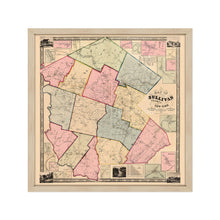
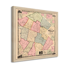
1856 Map of Sullivan County New York State Framed Wall Art – Historic Prints
100% Satisfaction Guaranteed: Free Returns
Free Standard Shipping
Get 10% OFF your First Order

Shop Now and Get Free Shipping to Anywhere in the United States and Puerto Rico.*

Follow us

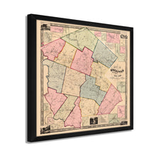
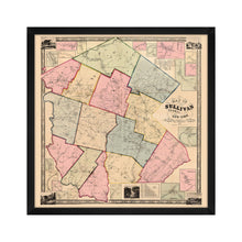
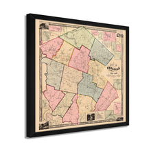
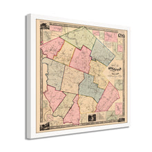
Digitally Restored and Enhanced 1856 Sullivan County NY Map - Framed Vintage Map of New York State - Old New York Map Poster - Restored Sullivan County Wall Art from Actual Surveys
  • Load image into Gallery viewer, Digitally Restored and Enhanced 1856 Sullivan County NY Map - Framed Vintage Map of New York State - Old New York Map Poster - Restored Sullivan County Wall Art from Actual Surveys
  • Load image into Gallery viewer, Digitally Restored and Enhanced 1856 Sullivan County NY Map - Framed Vintage Map of New York State - Old New York Map Poster - Restored Sullivan County Wall Art from Actual Surveys
  • Load image into Gallery viewer, Digitally Restored and Enhanced 1856 Sullivan County NY Map - Framed Vintage Map of New York State - Old New York Map Poster - Restored Sullivan County Wall Art from Actual Surveys
  • Load image into Gallery viewer, Digitally Restored and Enhanced 1856 Sullivan County NY Map - Framed Vintage Map of New York State - Old New York Map Poster - Restored Sullivan County Wall Art from Actual Surveys
  • Load image into Gallery viewer, Digitally Restored and Enhanced 1856 Sullivan County NY Map - Framed Vintage Map of New York State - Old New York Map Poster - Restored Sullivan County Wall Art from Actual Surveys
  • Load image into Gallery viewer, Digitally Restored and Enhanced 1856 Sullivan County NY Map - Framed Vintage Map of New York State - Old New York Map Poster - Restored Sullivan County Wall Art from Actual Surveys
  • Load image into Gallery viewer, Digitally Restored and Enhanced 1856 Sullivan County NY Map - Framed Vintage Map of New York State - Old New York Map Poster - Restored Sullivan County Wall Art from Actual Surveys
  • Load image into Gallery viewer, Digitally Restored and Enhanced 1856 Sullivan County NY Map - Framed Vintage Map of New York State - Old New York Map Poster - Restored Sullivan County Wall Art from Actual Surveys
  • Load image into Gallery viewer, Digitally Restored and Enhanced 1856 Sullivan County NY Map - Framed Vintage Map of New York State - Old New York Map Poster - Restored Sullivan County Wall Art from Actual Surveys
  • Load image into Gallery viewer, Digitally Restored and Enhanced 1856 Sullivan County NY Map - Framed Vintage Map of New York State - Old New York Map Poster - Restored Sullivan County Wall Art from Actual Surveys
  • Load image into Gallery viewer, Digitally Restored and Enhanced 1856 Sullivan County NY Map - Framed Vintage Map of New York State - Old New York Map Poster - Restored Sullivan County Wall Art from Actual Surveys
  • Load image into Gallery viewer, Digitally Restored and Enhanced 1856 Sullivan County NY Map - Framed Vintage Map of New York State - Old New York Map Poster - Restored Sullivan County Wall Art from Actual Surveys
  • Load image into Gallery viewer, Digitally Restored and Enhanced 1856 Sullivan County NY Map - Framed Vintage Map of New York State - Old New York Map Poster - Restored Sullivan County Wall Art from Actual Surveys
  • Load image into Gallery viewer, Digitally Restored and Enhanced 1856 Sullivan County NY Map - Framed Vintage Map of New York State - Old New York Map Poster - Restored Sullivan County Wall Art from Actual Surveys
  • Load image into Gallery viewer, Digitally Restored and Enhanced 1856 Sullivan County NY Map - Framed Vintage Map of New York State - Old New York Map Poster - Restored Sullivan County Wall Art from Actual Surveys
  • Load image into Gallery viewer, Digitally Restored and Enhanced 1856 Sullivan County NY Map - Framed Vintage Map of New York State - Old New York Map Poster - Restored Sullivan County Wall Art from Actual Surveys

1856 Sullivan County NY Map - Framed Vintage Map of New York State - Restored Sullivan County Wall Map from Actual Surveys Wall Art Poster

Regular price
$156.99
Sale price
$156.99
Regular price
$313.99
Sold out
Brand : Historic Prints
Unit price
per 

Feature Points

  • VINTAGE MAP FRAMED: You’ll love this high-quality framed historic reproduction of 1856 Sullivan County NY Map. Our ready-to-hang maps are printed and framed in the USA by professional art framers using the highest quality materials. Each order is inspected for quality. This beautiful artwork is a perfect addition to your themed decor. Vintage maps look great in the home, study or office. They also make an unforgettable gift. 
  • A LOOK BACK AT HISTORY: This is an impressive, historic reproduction of 1856 Sullivan County New York State Map. A true piece of history. Historic prints beautifully link the past with the present. You may find yourself staring at your historic wall art for hours in amazement. See our product description section for more fascinating information about this historic map and its significance.
  • PREMIUM QUALITY: To display this amazing piece of history, we use museum-quality heavyweight (230gsm), fine art print matte paper. Our paper is acid-free which allows the print to retain its color quality for generations. Our paper displays vintage map art with accurate color reproduction. This high quality print will be a wonderful addition to your vintage-themed wall.
  • READY TO HANG: This high-quality frame displays art beautifully in almost any environment. The frame is made out of poplar wood (for black and white) and pine wood (for walnut and natural) with a matte finish. The frame profile is 1.5 inches high and 0.75 inches wide. To protect artwork, we use high-quality, lightweight, shatter-resistant frame-grade acrylic. Frames arrive ready-to-hang, preinstalled with hanging hardware.
  • HISTORIC PRINTS: We love history and art. Sometimes old maps have tears, folds, stamps, separations and other blemishes. We digitally restore and enhance maps while keeping its historical character. Our framed prints are made-to-order in the USA by professional art framers. Customers all over the world love our historic prints and we know you will too.


Additional Information

Located in Southwestern New York and along the Pennsylvania border, Sullivan County is located in the iconic Catskill Mountains. Named after hero of the American Revolution John Sullivan. Sullivan served under General Washington in the defeat of British General Howe and Long Island, as well as engaging in battle through New Jersey, Pennsylvania, and Rhode Island.

As the country found itself nearing Civil War, Sullivan County provided a regiment for Union Forces led by John C. Holley. The conflict would never reach the county itself though they did provide munitions and troops for Union Forces.

The county became known as the Borscht Belt as immigrants from Eastern Europe flocked to the region for it’s thriving manufacturing and milling industries driven bu its proximity to the Delaware River. The region became known for its stunning natural scenery and saw the establishment of numerous hotels and resorts. During the mid 19th century the landscape would provide the setting for the popular Hudson River School of painting. The region has a long history of attracting artists, writers, and musicians.

Sullivan County was the site for the incomparable Woodstock festival in 1969 when nearly five hundred thousand attendees attended a four day festival featuring some of the most popular musical acts of the era and becoming an indelible part of American History. 

The distinctive aesthetic and classic style of this illustration immediately transport the viewer back in time and this is truly an authentic piece of American cartographical history.

Our ready-to-hang wall art are printed and framed in the USA using the highest quality materials with professional craftsmanship. This beautiful artwork is a perfect addition to your themed decor. Historic prints look great in the home, study or office. They also make an unforgettable gift.


*Free shipping for framed and canvas products limited to the 48 contiguous United States.