1856 Sectional & Geological Map of Iowa State Wall Art Print – Historic Prints
100% Satisfaction Guaranteed: Free Returns
Free Standard Shipping
Get 10% OFF your First Order

Shop Now and Get Free Shipping to Anywhere in the United States and Puerto Rico.*

Follow us

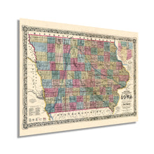
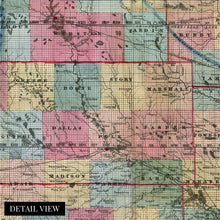
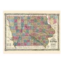
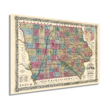
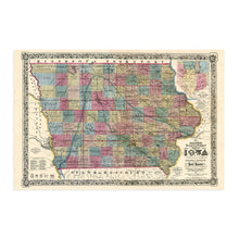
Digitally Restored and Enhanced 1856 Iowa State Map Poster - Vintage Map of Iowa Wall Art Print - Exhibiting Iron Lead Copper Coal Rail Roads and Other Geological Resources - Iowa Wall Decor
  • Load image into Gallery viewer, Digitally Restored and Enhanced 1856 Iowa State Map Poster - Vintage Map of Iowa Wall Art Print - Exhibiting Iron Lead Copper Coal Rail Roads and Other Geological Resources - Iowa Wall Decor
  • Load image into Gallery viewer, Digitally Restored and Enhanced 1856 Iowa State Map Poster - Vintage Map of Iowa Wall Art Print - Exhibiting Iron Lead Copper Coal Rail Roads and Other Geological Resources - Iowa Wall Decor
  • Load image into Gallery viewer, Digitally Restored and Enhanced 1856 Iowa State Map Poster - Vintage Map of Iowa Wall Art Print - Exhibiting Iron Lead Copper Coal Rail Roads and Other Geological Resources - Iowa Wall Decor
  • Load image into Gallery viewer, Digitally Restored and Enhanced 1856 Iowa State Map Poster - Vintage Map of Iowa Wall Art Print - Exhibiting Iron Lead Copper Coal Rail Roads and Other Geological Resources - Iowa Wall Decor
  • Load image into Gallery viewer, Digitally Restored and Enhanced 1856 Iowa State Map Poster - Vintage Map of Iowa Wall Art Print - Exhibiting Iron Lead Copper Coal Rail Roads and Other Geological Resources - Iowa Wall Decor
  • Load image into Gallery viewer, Digitally Restored and Enhanced 1856 Iowa State Map Poster - Vintage Map of Iowa Wall Art Print - Exhibiting Iron Lead Copper Coal Rail Roads and Other Geological Resources - Iowa Wall Decor
  • Load image into Gallery viewer, Digitally Restored and Enhanced 1856 Iowa State Map Poster - Vintage Map of Iowa Wall Art Print - Exhibiting Iron Lead Copper Coal Rail Roads and Other Geological Resources - Iowa Wall Decor
  • Load image into Gallery viewer, Digitally Restored and Enhanced 1856 Iowa State Map Poster - Vintage Map of Iowa Wall Art Print - Exhibiting Iron Lead Copper Coal Rail Roads and Other Geological Resources - Iowa Wall Decor
  • Load image into Gallery viewer, Digitally Restored and Enhanced 1856 Iowa State Map Poster - Vintage Map of Iowa Wall Art Print - Exhibiting Iron Lead Copper Coal Rail Roads and Other Geological Resources - Iowa Wall Decor

1856 Iowa State Map Poster - Vintage Map of Iowa Wall Art Print - Exhibiting Iron Lead Copper Coal Rail Roads and Other Geological Resources - Iowa Wall Decor

Regular price
$39.99
Sale price
$39.99
Regular price
$79.99
Sold out
Brand : HISTORIX
Unit price
per 
Shipping calculated at checkout.


Feature Points

  • VINTAGE MAP REPRODUCTION: You’ll love this high quality historic reproduction of 1856 Iowa State Map Poster. Our museum quality maps are archival grade, which means it will look great and last without fading for over 100 years. Our print to order maps are made in the USA and each map is inspected for quality. This beautiful artwork is a perfect addition to your themed decor. Vintage maps look great in the home, study or office. They make a perfect gift as well.
  • MUSEUM QUALITY: This high quality map print will be a great addition to your vintage-themed wall. Don't waste money on cheap-looking, thin paper posters. We use thick, fine art print quality matte paper. Our professional’s choice matte paper displays artwork in high detail without glare. The color is vibrant and the text is easy to read. When framed, this map looks absolutely stunning.
  • A LOOK BACK AT HISTORY: This is an impressive, historic reproduction of 1856 Iowa State Map Poster. This print is from an original found in the maps and geography division of the US Library of Congress. A true piece of history. See our product description section for more fascinating information about this historic map and its significance.
  • READY TO FRAME: This print includes a 0.2 inch border for a perfect frame fit and look. Our maps are designed to fit easy-to-find standard frame sizes, saving you money from having to pay for a custom frame. Each map is inspected for quality and shipped in a rigid tube.
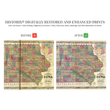
  • HISTORIX: We love history and art. Sometimes old maps have tears, folds, separations and other blemishes. We digitally restore and enhance maps while keeping its historical character. All our maps are proudly made in the USA. Customers all over the world love our vintage maps and we know you will too.


Additional Information

Produced by noted American illustrator Nathan Howe Parker and published by prolific American mapmaker JH Colton, this distinctive depiction of Iowa shows it only a decade after achieving statehood in 1846. Colton’s maps bear ornate borders that distinguish them from other maps produced during the same period, and he also utilized have steel engraving plates, which were later hand-colored, making them the highest quality productions at the time.

Iowa’s fertile soil drew settlers west, and the establishment of many farms and ranches throughout the state became its primary economic driver. The state is also known for its popular tradition of fairs, with the first fair being held in 1854, and has been held every year since, excluding during the Spanish American War, and World War II.

During the American Civil War, Iowa supplied Union troops with large supplies of food, and the state remained loyal to Union causes. Iowan farms produced a diverse range of crops, but corn was the most widely grown, with vast fields being planted for export to the growing cities in the midwest and east.

As railroads expanded and access became easier, Iowa saw growth in manufacturing industries as well, mostly producing farm equipment. Mineral reserves did not provide the stable economic opportunities found in agriculture, though some were making their livelihood in drilling for oil and mining lead and copper. The Hawkeye State, as it came to be known, saw an explosion of population growth following the Civil War swelling to over 1.5 million by 1880.

Our museum quality giclee print comes printed with archival ink on premium heavyweight matte paper. Shipped in a sturdy cardboard tube your print will arrive ready to be framed. This eye-catching vintage map reproduction print makes the perfect gift for anyone that loves history and imagery.

*Free shipping for framed and canvas products limited to the 48 contiguous United States.