Feature Points
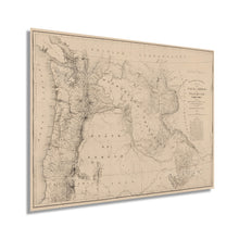
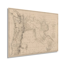
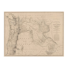
- VINTAGE MAP REPRODUCTION: You’ll love this high quality historic reproduction of 1859 State of Oregon and Washington Territory Map. Our museum quality maps are archival grade, which means it will look great and last without fading for over 100 years. Our print to order maps are made in the USA and each map is inspected for quality. This beautiful artwork is a perfect addition to your themed decor. Vintage maps look great in the home, study or office. They make a perfect gift as well.
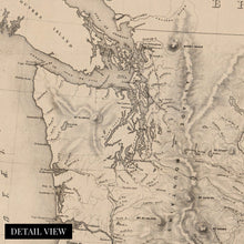
- MUSEUM QUALITY: This high quality map print will be a great addition to your vintage-themed wall. Don't waste money on cheap-looking, thin paper posters. We use thick, fine art print quality matte paper. Our professional’s choice matte paper displays artwork in high detail without glare. The color is vibrant and the text is easy to read. When framed, this map looks absolutely stunning.
- A LOOK BACK AT HISTORY: This is an impressive, historic reproduction of 1859 State of Oregon and Washington Territory Map. This print is from an original found in the maps and geography division of the US Library of Congress. A true piece of history. See our product description section for more fascinating information about this historic map and its significance.
- READY TO FRAME: This print includes a 0.2 inch border for a perfect frame fit and look. Our maps are designed to fit easy-to-find standard frame sizes, saving you money from having to pay for a custom frame. Each map is inspected for quality and shipped in a rigid tube.
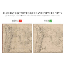
- HISTORIX: We love history and art. Sometimes old maps have tears, folds, separations and other blemishes. We digitally restore and enhance maps while keeping its historical character. All our maps are proudly made in the USA. Customers all over the world love our vintage maps and we know you will too.
Additional Information
Published in the same year, Oregon joined the Union as the 33rd State; this map was produced in a time of great transition for the Northwestern area. It would take another four decades for Washington to achieve statehood. Lewis and Clark had concluded their trans-continental trek fifty years prior, and the region was experiencing rapid growth and development. The logging and commercial fishing industries supported by the ports in Seattle and Portland respectively allowed the territory to thrive and established economies that endure today. The territory had been established in 1848, and settlers were building farms and ranches in the plains of the East while enjoying fruits of the sea and forest in the West.
The Northwest Territories had throngs of settlers coming from the East as missionaries and miners, while the ports saw immigrants arriving from Asia. The thriving ports had a reputation as rough places with numerous saloons and gambling dens frequented by sailors from around the world.
The Fraser Canyon Gold Rush in British Columbia started in 1858, had eager miners traveling north on the Oregon Trail, and merchants throughout the western portion of the territory enjoyed a robust trade in outfitting and provisions. Mining would continue to be a part of the region's economy, and prospecting would cause the most significant population expansion at the close of the century with the Yukon Gold Rush. The unique aesthetic of this representation immediately transports the viewer back in time and links the past and present with its distinct characteristics.
Our museum quality giclee Washington State Wall Art / Oregon map print comes printed with archival ink on premium heavyweight matte paper. Shipped in a sturdy cardboard tube your will arrive ready to be framed. This eye-catching vintage Oregon wall art / Oregon poster map / Pacific Northwest Decor makes the perfect gift for anyone that loves history and imagery.


