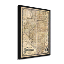
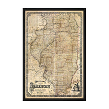
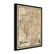
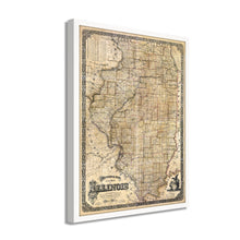
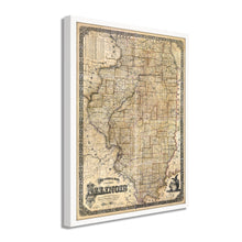
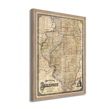
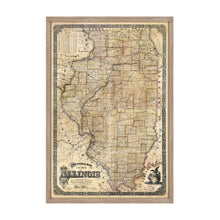
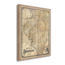
1861 Sectional Map of the State of Illinois Framed Wall Art – Historic Prints
100% Satisfaction Guaranteed: Free Returns
Free Standard Shipping
Get 10% OFF your First Order

Shop Now and Get Free Shipping to Anywhere in the United States and Puerto Rico.*

Follow us

Digitally Restored and Enhanced 1861 Illinois State Map - Framed Vintage Map of Illinois Wall Art - Old State of Illinois Map Poster - Sectional Map of the State of Illinois Poster
  • Load image into Gallery viewer, Digitally Restored and Enhanced 1861 Illinois State Map - Framed Vintage Map of Illinois Wall Art - Old State of Illinois Map Poster - Sectional Map of the State of Illinois Poster
  • Load image into Gallery viewer, Digitally Restored and Enhanced 1861 Illinois State Map - Framed Vintage Map of Illinois Wall Art - Old State of Illinois Map Poster - Sectional Map of the State of Illinois Poster
  • Load image into Gallery viewer, Digitally Restored and Enhanced 1861 Illinois State Map - Framed Vintage Map of Illinois Wall Art - Old State of Illinois Map Poster - Sectional Map of the State of Illinois Poster
  • Load image into Gallery viewer, Digitally Restored and Enhanced 1861 Illinois State Map - Framed Vintage Map of Illinois Wall Art - Old State of Illinois Map Poster - Sectional Map of the State of Illinois Poster
  • Load image into Gallery viewer, Digitally Restored and Enhanced 1861 Illinois State Map - Framed Vintage Map of Illinois Wall Art - Old State of Illinois Map Poster - Sectional Map of the State of Illinois Poster
  • Load image into Gallery viewer, Digitally Restored and Enhanced 1861 Illinois State Map - Framed Vintage Map of Illinois Wall Art - Old State of Illinois Map Poster - Sectional Map of the State of Illinois Poster
  • Load image into Gallery viewer, Digitally Restored and Enhanced 1861 Illinois State Map - Framed Vintage Map of Illinois Wall Art - Old State of Illinois Map Poster - Sectional Map of the State of Illinois Poster
  • Load image into Gallery viewer, Digitally Restored and Enhanced 1861 Illinois State Map - Framed Vintage Map of Illinois Wall Art - Old State of Illinois Map Poster - Sectional Map of the State of Illinois Poster
  • Load image into Gallery viewer, Digitally Restored and Enhanced 1861 Illinois State Map - Framed Vintage Map of Illinois Wall Art - Old State of Illinois Map Poster - Sectional Map of the State of Illinois Poster
  • Load image into Gallery viewer, Digitally Restored and Enhanced 1861 Illinois State Map - Framed Vintage Map of Illinois Wall Art - Old State of Illinois Map Poster - Sectional Map of the State of Illinois Poster
  • Load image into Gallery viewer, Digitally Restored and Enhanced 1861 Illinois State Map - Framed Vintage Map of Illinois Wall Art - Old State of Illinois Map Poster - Sectional Map of the State of Illinois Poster
  • Load image into Gallery viewer, Digitally Restored and Enhanced 1861 Illinois State Map - Framed Vintage Map of Illinois Wall Art - Old State of Illinois Map Poster - Sectional Map of the State of Illinois Poster
  • Load image into Gallery viewer, Digitally Restored and Enhanced 1861 Illinois State Map - Framed Vintage Map of Illinois Wall Art - Old State of Illinois Map Poster - Sectional Map of the State of Illinois Poster
  • Load image into Gallery viewer, Digitally Restored and Enhanced 1861 Illinois State Map - Framed Vintage Map of Illinois Wall Art - Old State of Illinois Map Poster - Sectional Map of the State of Illinois Poster
  • Load image into Gallery viewer, Digitally Restored and Enhanced 1861 Illinois State Map - Framed Vintage Map of Illinois Wall Art - Old State of Illinois Map Poster - Sectional Map of the State of Illinois Poster
  • Load image into Gallery viewer, Digitally Restored and Enhanced 1861 Illinois State Map - Framed Vintage Map of Illinois Wall Art - Old State of Illinois Map Poster - Sectional Map of the State of Illinois Poster

1861 Illinois State Map - Framed Vintage Map of Illinois - Old State of Illinois Map - Sectional Map of the State of Illinois Wall Art Poster Print

Regular price
$172.99
Sale price
$172.99
Regular price
$345.99
Sold out
Brand : Historic Prints
Unit price
per 

Feature Points

  • VINTAGE MAP FRAMED: You’ll love this high-quality framed historic reproduction of 1861 Illinois State Map. Our ready-to-hang maps are printed and framed in the USA by professional art framers using the highest quality materials. Each order is inspected for quality. This beautiful artwork is a perfect addition to your themed decor. Vintage maps look great in the home, study or office. They also make an unforgettable gift. 
  • A LOOK BACK AT HISTORY: This is an impressive, historic reproduction of 1861 Illinois Map Print. A true piece of history. Historic prints beautifully link the past with the present. You may find yourself staring at your historic wall art for hours in amazement. See our product description section for more fascinating information about this historic map and its significance.
  • PREMIUM QUALITY: To display this amazing piece of history, we use museum-quality heavyweight (230gsm), fine art print matte paper. Our paper is acid-free which allows the print to retain its color quality for generations. Our paper displays vintage map art with accurate color reproduction. This high quality print will be a wonderful addition to your vintage-themed wall.
  • READY TO HANG: This high-quality frame displays art beautifully in almost any environment. The frame is made out of poplar wood (for black and white) and pine wood (for walnut and natural) with a matte finish. The frame profile is 1.5 inches high and 0.75 inches wide. To protect artwork, we use high-quality, lightweight, shatter-resistant frame-grade acrylic. Frames arrive ready-to-hang, preinstalled with hanging hardware.
  • HISTORIC PRINTS: We love history and art. Sometimes old maps have tears, folds, stamps, separations and other blemishes. We digitally restore and enhance maps while keeping its historical character. Our framed prints are made-to-order in the USA by professional art framers. Customers all over the world love our historic prints and we know you will too.


Additional Information

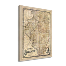
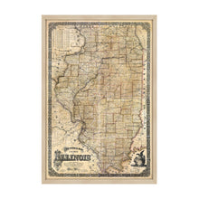
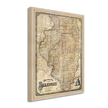
1861 sectional map of the state of Illinois: Exhibiting the exact boundaries of counties as established by law and the general topography of the state as towns, streams, lakes, ponds, bluffs, rail-roads, state & common-roads, etc. also the main coal field, mineral districts, outcrops of coalbanks, mines, etc.

The publication of this map coincided with President Abraham Lincoln leaving his home state to be inaugurated in Washington DC, as well as the outbreak of the American Civil War. Though the state would not see significant battles on its soil, its meat processing and manufacturing industries, especially those coming out of Chicago, would be instrumental in the Union’s ultimate defeat of the confederacy. The state was also a significant source for Union troops. Additionally, the proximity of the state to the Mississippi River provided a starting point for General Ulysses S. Grant to begin his assault and secure the vital trade route for the Union.

The expansion of railroads into Chicago, as well as its bustling manufacturing economies, had attracted thousands of immigrants from Western Europe, where famine and civil unrest were forcing many immigrants to find new homes. Since the 1850s, Chicago had become one of the most prominent cities and played a central role in the development of American economic, political, and cultural life. Its location on Lake Michigan allowed the city to control access to the Great Lakes, giving it significant economic power.

Leading into the 1860s, Chicago had seen rapid expansion, and the state as a whole was experiencing economic prosperity afforded by the 30 railings that created the hub of the Midwest. This sectional map depicts the great state in remarkable detail and transports the viewer back in time with its distinctive aesthetic, and these maps were valued in their time by residents and merchants alike.

Our ready-to-hang wall art are printed and framed in the USA using the highest quality materials with professional craftsmanship. This beautiful artwork is a perfect addition to your themed decor. Historic prints look great in the home, study or office. They also make an unforgettable gift.

*Free shipping for framed and canvas products limited to the 48 contiguous United States.