1862 Military Map of the United States Civil War Wall Art Print – Historic Prints
100% Satisfaction Guaranteed: Free Returns
Free Standard Shipping
Get 10% OFF your First Order

Shop Now and Get Free Shipping to Anywhere in the United States and Puerto Rico.*

Follow us

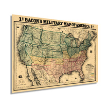
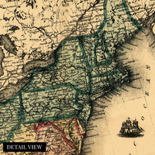
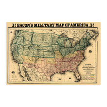
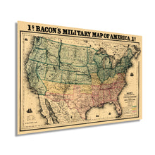
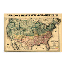
Digitally Restored and Enhanced 1862 Military Map of the United States - Vintage Map of the United States - American Civil War Map showing forts and fortifications - US Civil War Map
  • Load image into Gallery viewer, Digitally Restored and Enhanced 1862 Military Map of the United States - Vintage Map of the United States - American Civil War Map showing forts and fortifications - US Civil War Map
  • Load image into Gallery viewer, Digitally Restored and Enhanced 1862 Military Map of the United States - Vintage Map of the United States - American Civil War Map showing forts and fortifications - US Civil War Map
  • Load image into Gallery viewer, Digitally Restored and Enhanced 1862 Military Map of the United States - Vintage Map of the United States - American Civil War Map showing forts and fortifications - US Civil War Map
  • Load image into Gallery viewer, Digitally Restored and Enhanced 1862 Military Map of the United States - Vintage Map of the United States - American Civil War Map showing forts and fortifications - US Civil War Map
  • Load image into Gallery viewer, Digitally Restored and Enhanced 1862 Military Map of the United States - Vintage Map of the United States - American Civil War Map showing forts and fortifications - US Civil War Map
  • Load image into Gallery viewer, Digitally Restored and Enhanced 1862 Military Map of the United States - Vintage Map of the United States - American Civil War Map showing forts and fortifications - US Civil War Map
  • Load image into Gallery viewer, Digitally Restored and Enhanced 1862 Military Map of the United States - Vintage Map of the United States - American Civil War Map showing forts and fortifications - US Civil War Map
  • Load image into Gallery viewer, Digitally Restored and Enhanced 1862 Military Map of the United States - Vintage Map of the United States - American Civil War Map showing forts and fortifications - US Civil War Map
  • Load image into Gallery viewer, Digitally Restored and Enhanced 1862 Military Map of the United States - Vintage Map of the United States - American Civil War Map showing forts and fortifications - US Civil War Map

1862 Military Map of the United States - Vintage Map of the United States - American Civil War Map showing forts and fortifications - US Civil War Map

Regular price
$39.99
Sale price
$39.99
Regular price
$79.99
Sold out
Brand : HISTORIX
Unit price
per 
Shipping calculated at checkout.


Feature Points

  • VINTAGE MAP REPRODUCTION: You’ll love this high quality historic reproduction of 1862 Military Map of the United States. Our museum quality maps are archival grade, which means it will look great and last without fading for over 100 years. Our print to order maps are made in the USA and each map is inspected for quality. This beautiful artwork is a perfect addition to your themed decor. Vintage maps look great in the home, study or office. They make a perfect gift as well.
  • MUSEUM QUALITY: This high quality map print will be a great addition to your vintage-themed wall. Don't waste money on cheap-looking, thin paper posters. We use thick, fine art print quality matte paper. Our professional’s choice matte paper displays artwork in high detail without glare. The color is vibrant and text is easy to read. When framed, this map looks absolutely stunning.
  • A LOOK BACK AT HISTORY: This is an impressive, historic reproduction of 1862 Military Map of the United States. This print is from an original found in the maps and geography division of the US Library of Congress. A true piece of history. See our product description section for more fascinating information about this historic map and its significance.
  • READY TO FRAME: This print includes a 0.2 inch border for a perfect frame fit and look. Our maps are designed to fit easy-to-find standard frame sizes, saving you money from having to pay for a custom frame. Each map is inspected for quality and shipped in a rigid tube.
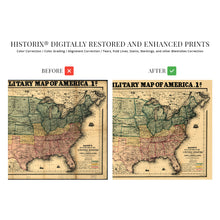
  • HISTORIX: We love history and art. Sometimes old maps have tears, folds, separations and other blemishes. We digitally restore and enhance maps while keeping its historical character. All our maps are proudly made in the USA. Customers all over the world love our vintage maps and we know you will too.


Additional Information

Published in 1862, this depiction of all military fortifications and forts was produced during the Civil War by prolific American cartographer George Washington Bacon. Bacon was initially successful producing maps of London but by this period had shifted to his focus to the United States, and his unmistakable style would be imitated until the mid-1950s.

War had erupted on April 12, 1861, with Confederate President Jefferson Davis ordered General PT Beauregard to fire upon Fort Sumter; this attack rallied northern support for the war and troops rallied in preparation to quelch the southern rebellion and attempted secession.

President Abraham Lincoln had resolved to maintain control of all forts located in the Confederacy, and the first clash at Sumter sparked the flame of all-out war. The war would last four years until the devastated Confederacy admitted defeat in 1865; the United States remained intact, but the process of reconstruction was arduous.

Because the early Industrial Revolution had started before the outbreak of the war, it also marked a period of advancements in military and Naval technology. The Union had heavily armored warships, referred to as Ironclads, and the Confederacy experimented with a submarine.

The Battle of Antietam occurred in 1862 and was a turning point as it halted Confederate invasion attempts into Maryland with the defeat of General Lee and led to President Lincoln’s Emancipation Proclamation. This illustrations' distinct aesthetic and historical significance make it an authentic piece of cartographical history and transport the viewer back in time.

Our museum quality giclee print comes printed with archival ink on premium heavyweight matte paper. Shipped in a sturdy cardboard tube your print will arrive ready to be framed. This eye-catching vintage map print makes the perfect gift for anyone that loves history and imagery.

*Free shipping for framed and canvas products limited to the 48 contiguous United States.