Feature Points
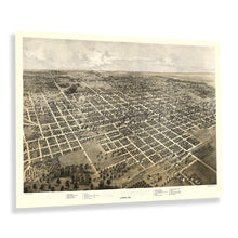
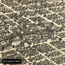
- VINTAGE MAP REPRODUCTION: You’ll love this high quality historic reproduction of 1867 Bloomington Illinois Map Poster. Our museum quality prints are archival grade, which means it will look great and last without fading for over 100 years. Our print to order maps are made in the USA and each map is inspected for quality. This beautiful artwork is a perfect addition to your themed decor. Vintage maps look great in the home, study or office. They make a perfect gift as well.
- MUSEUM QUALITY: This high quality map print will be a great addition to your vintage-themed wall. Don't waste money on cheap-looking, thin paper posters. We use thick, fine art print quality matte paper. Our professional’s choice matte paper displays artwork in high detail without glare. The color is vibrant and text is easy to read. When framed, this map looks absolutely stunning.
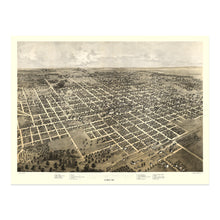
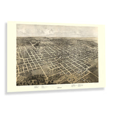
- A LOOK BACK AT HISTORY: This is an impressive, historic reproduction of 1867 Bloomginton Illinois Bird's Eye View Perspective Map. A true piece of history. See our product description section for more fascinating information about this historic map and its significance.
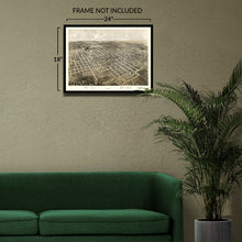
- READY TO FRAME: This print includes a 0.2 inch border for a perfect frame fit and look. Our maps are designed to fit easy-to-find standard frame sizes, saving you money from having to pay for a custom frame. Each map is inspected for quality and shipped in a rigid tube.
- HISTORIX: We love history and art. Sometimes old maps have tears, folds, separations and other blemishes. We digitally restore and enhance maps while keeping its historical character. All our maps are proudly made in the USA. Customers all over the world love our vintage maps and we know you will too.
Â
Additional Information
Published only two years after the conclusion of the American Civil War, this bird's eye perspective of Bloomington, Illinois, was produced by Prussian immigrant Albert Ruger. His lithography firm was an early pioneer of the form and would go on to inspire numerous other companies to create similar works in an effort to attract residents and merchants to towns and cities across the nation during the late eighteenth and early twentieth centuries. Ruger's panoramic maps became widely popular and featured a distinctive style and aesthetic that is immediately recognizable with artistic flourishes and unique color palettes that make them stand out compared to other works from the era.
After McLean County was formed, Bloomington was laid out, and an auction was held in 1831 to divide the land in the city. In the following decades, the city would experience considerable growth and, by the time of this publication, was expanding rapidly as immigrants from Western Europe, as well as the American South, were flocking to the region for economic opportunities in the manufacturing and agricultural industries. Bloomington would continue to thrive through the early parts of the twentieth century and is home to Illinois State University, which remains a respected institute for higher education in the region.
This depiction captures Bloomington in a period of significant growth and transformation as the nation recovered from the Civil War and entered the industrial revolution, a period marked by considerable prosperity and expansion. This is an authentic piece of American cartographical history with a distinct aesthetic.


