Feature Points
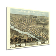
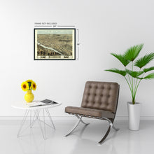
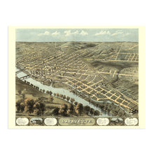
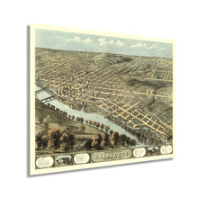
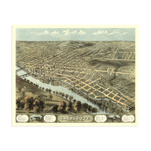
- VINTAGE MAP REPRODUCTION: You’ll love this high quality historic reproduction of 1868 Lafayette Indiana Map Poster. Our museum quality prints are archival grade, which means it will look great and last without fading for over 100 years. Our print to order maps are made in the USA and each map is inspected for quality. This beautiful artwork is a perfect addition to your themed decor. Vintage maps look great in the home, study or office. They make a perfect gift as well.
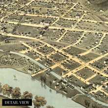
- MUSEUM QUALITY: This high quality map print will be a great addition to your vintage-themed wall. Don't waste money on cheap-looking, thin paper posters. We use thick, fine art print quality matte paper. Our professional’s choice matte paper displays artwork in high detail without glare. The color is vibrant and text is easy to read. When framed, this map looks absolutely stunning.
- A LOOK BACK AT HISTORY: This is an impressive, historic reproduction of 1868 Lafayette Indiana Wall Map. A true piece of history. See our product description section for more fascinating information about this historic map and its significance.
- READY TO FRAME: This print includes a 0.2 inch border for a perfect frame fit and look. Our maps are designed to fit easy-to-find standard frame sizes, saving you money from having to pay for a custom frame. Each map is inspected for quality and shipped in a rigid tube.
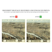
- HISTORIX: We love history and art. Sometimes old maps have tears, folds, separations and other blemishes. We digitally restore and enhance maps while keeping its historical character. All our maps are proudly made in the USA. Customers all over the world love our vintage maps and we know you will too.
Additional Information
The seat of Tippecanoe County and situated on the banks of the Wabash River, Lafayette, Indiana, remains an enduring icon of the Midwest since its establishment in 1825. Its location on the river was significant as it marks the point where the river becomes impassable for upstream navigation making it a significant shipping hub for the region since its earliest days. The arrival of railroads in the 1850s allowed for rapid population growth, and immigrants from across America, England, Ireland, and Western Europe flocked to the town, establishing neighborhoods and communities, many of which exist to this day.
This stunning birds eye perspective was produced and published by Albert Ruger, an early proponent of the form which served to promote prominent civic and economic features of towns and cities across the United States. Panoramic maps were widely popular from the mid-nineteenth century until the 1920s, as advances in aviation and photography allowed aerial images to be produced. Their unique aesthetic and distinctive style are immediately recognizable and transport the viewer back in time, creating an indelible bond between the past and present. Ruger’s work bears a signature attention to detail and artistic flourishes, including insets and illustrating the prominence of the Wabash River.
This is an authentic piece of American cartographical history that captures a significant moment in the nation’s history as rebuilding efforts spurred prosperity in the years following the conclusion of the American Civil War. This depiction is a classic representation of one of Indiana’s most iconic cities.
Our museum quality giclee print comes printed with archival ink on premium heavyweight matte paper. Shipped in a sturdy cardboard tube your print will arrive ready to be framed. This eye-catching vintage map reproduction print makes the perfect gift for anyone that loves history and imagery.


