Feature Points
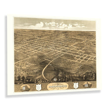
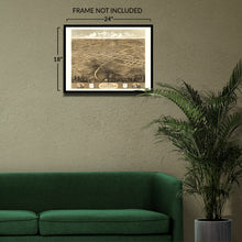
- VINTAGE MAP REPRODUCTION: You’ll love this high quality historic reproduction of 1868 Independence Jackson County Missouri Map Poster. Our museum quality prints are archival grade, which means it will look great and last without fading for over 100 years. Our print to order maps are made in the USA and each map is inspected for quality. This beautiful artwork is a perfect addition to your themed decor. Vintage maps look great in the home, study or office. They make a perfect gift as well.
- MUSEUM QUALITY: This high quality map print will be a great addition to your vintage-themed wall. Don't waste money on cheap-looking, thin paper posters. We use thick, fine art print quality matte paper. Our professional’s choice matte paper displays artwork in high detail without glare. The color is vibrant and text is easy to read. When framed, this map looks absolutely stunning.
- A LOOK BACK AT HISTORY: This is an impressive, historic reproduction of 1868 Independence City Map of Missouri Poster. A true piece of history. See our product description section for more fascinating information about this historic map and its significance.
- READY TO FRAME: This print includes a 0.2 inch border for a perfect frame fit and look. Our maps are designed to fit easy-to-find standard frame sizes, saving you money from having to pay for a custom frame. Each map is inspected for quality and shipped in a rigid tube.
- HISTORIX: We love history and art. Sometimes old maps have tears, folds, separations and other blemishes. We digitally restore and enhance maps while keeping its historical character. All our maps are proudly made in the USA. Customers all over the world love our vintage maps and we know you will too.
Â
Additional Information
The fifth-largest city in Missouri and part of the Kansas City metropolitan area, Jackson was experiencing a period of significant growth and transformation following the conclusion of the Civil War. Independence was known as the "Queen City of the Trails" due to its location as the departure point for settlers making their way across the American West en route to destinations in the Pacific Northwest and California seeking to establish neighborhoods and communities. Independence was officially established in 1827 though it had been growing since the region was acquired in the Louisiana Purchase in 1803 in a deal brokered by Thomas Jefferson that would transform the American landscape permanently.
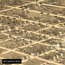
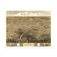
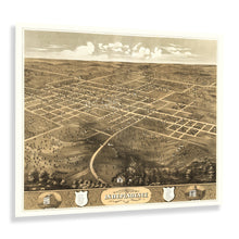
This bird's eye perspective was produced by one of the early adopters of the form Albert Ruger and bears his distinctive style and aesthetic. Panoramic maps were used as marketing materials to promote towns and cities across the nation and featured attractive economic opportunities and notable buildings to entice residents and merchants alike. Ruger's works inspired numerous other illustrators, and bird's eye perspectives would become some of the most popular works during the middle of the nineteenth and early twentieth century. Ruger primarily focused on the Midwest, as his firm was based in Chicago.
This panoramic map immediately transports the viewer back in time, creating an indelible bond between the past and present. During the 1860s, Independence had become a prosperous city with numerous outfitters giving settlers the last opportunity to stock up on provisions before starting their arduous journey West.


