Feature Points
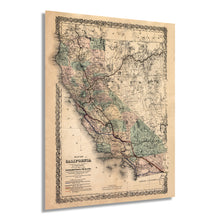
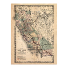
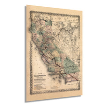
- VINTAGE MAP REPRODUCTION: You’ll love his high quality historic reproduction of 1876 Map of California . Our museum quality maps are archival grade, which means it will look great and last without fading for over 100 years. Our print to order maps are made in the USA and each map is inspected for quality. This beautiful artwork is a perfect addition to your themed decor. Vintage maps look great in the home, study or office. They make a perfect gift as well.
- MUSEUM QUALITY: This high quality map print will be a great addition to your vintage-themed wall. Don't waste money on cheap-looking, thin paper posters. We use thick, fine art print quality matte paper. Our professional’s choice matte paper displays artwork in high detail without glare. The color is vibrant and text is easy to read. When framed, this map looks absolutely stunning.
- A LOOK BACK AT HISTORY: This is an impressive, historic reproduction of 1876 Map of California . This print is from an original found in the maps and geography division of the US Library of Congress. A true piece of history. See our product description section for more fascinating information about this historic map and its significance.
- READY TO FRAME: This print includes a 0.2 inch border for a perfect frame fit and look. Our maps are designed to fit easy-to-find standard frame sizes, saving you money from having to pay for a custom frame. Each map is inspected for quality and shipped in a rigid tube.
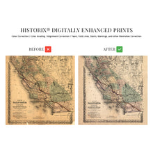
- HISTORIX: We love history and art. Sometimes old maps have tears, folds, separations and other blemishes. We digitally restore and enhance maps while keeping its historical character. All our maps are proudly made in the USA. Customers all over the world love our vintage maps and we know you will too.
Â
Additional Information
As one of the most expansive and lush states in the country, California has always loomed large in the consciousness of the American West. In the late 1800's this expansion was no longer by horse and wagon and the steam engine was charging forward.
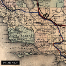
Our enhanced map of the proposed S.O. Houghton and Southern Pacific Railroad company is a rare glimpse into the history and lore of the American West. Cross country transit and trade was to be made possible with this agreement and the construction of these railways. This map detailed the topography, existing rail-lines, and proposed new railways. This proposed new system of railroads was considered one of the greatest undertakings of its time and upon completion represented a true American feat of engineering.
The Transcontinental Railroad route can be seen crossing present day Nevada and where it navigates across the western Sierra Nevada mountains at the Donner Pass. This museum quality archival print is perfect for any lover of the American West and will transport you to another time. Our enhancements allow this aesthetically compelling piece to augment any office, classroom, or home. An ideal gift for the historian in your life.
These maps were originally hand drawn artifacts because cartography was one of the most skilled and labor intensive aspects of land expansion. This map truly comes to life when enhanced and printed on heavy matte stock with archival ink, ready to be matted and framed.


