Feature Points
- VINTAGE MAP REPRODUCTION: You’ll love this high quality historic reproduction of 1876 Salem Oregon Map Poster. Our museum quality maps are archival grade, which means it will look great and last without fading for over 100 years. Our print to order maps are made in the USA and each map is inspected for quality. This beautiful artwork is a perfect addition to your themed decor. Vintage maps look great in the home, study or office. They make a perfect gift as well.
- MUSEUM QUALITY: This high quality map print will be a great addition to your vintage-themed wall. Don't waste money on cheap-looking, thin paper posters. We use thick, fine art print quality matte paper. Our professional’s choice matte paper displays artwork in high detail without glare. The color is vibrant and text is easy to read. When framed, this map looks absolutely stunning.
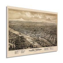
- A LOOK BACK AT HISTORY: This is an impressive, historic reproduction of 1876 Salem Oregon Map Poster. This print is from an original found in the maps and geography division of the US Library of Congress. A true piece of history. See our product description section for more fascinating information about this historic map and its significance.
- READY TO FRAME: This print includes a 0.2 inch border for a perfect frame fit and look. Our maps are designed to fit easy-to-find standard frame sizes, saving you money from having to pay for a custom frame. Each map is inspected for quality and shipped in a rigid tube.
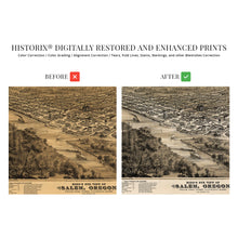
- HISTORIX: We love history and art. Sometimes old maps have tears, folds, separations and other blemishes. We digitally restore and enhance maps while keeping its historical character. All our maps are proudly made in the USA. Customers all over the world love our vintage maps and we know you will too.
Â
Additional Information
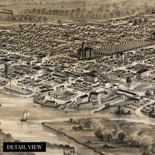
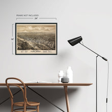
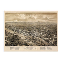
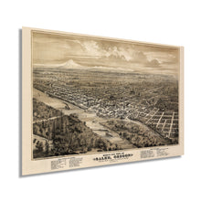
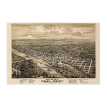
Capital city Salem, Oregon, has a rich history and is depicted here by one of the most prolific city illustrators of the era Eli Glover. Illustrated using an eastern facing perspective with Mt Hood as a backdrop, the Capitol State Building proudly depicted as a focal point. Geographically Salem is the center of the Willamette Valley and became the capital of the Oregon territory in 1851.
This map produced in 1876 is of particular historical importance as the year marked the completion of the second state capital, which was rebuilt on the site of the previous State House. The second capitol was built with revival-style architecture and found inspiration in the nation’s capitol building.
Illustrated to highlight important regional buildings and manufacturing interests, perspective maps were not drawn to scale and typically showed the area from an oblique angle. These unique maps were intended to give the viewer a sense of place, now they provide a link to the past and instill a connection to the region’s history. Prominent businesses would display these maps with pride as they were often notated in the legend.
Outside of the city, one sees the importance of agriculture for the area with the depiction of the numerous fields and farmhouses dotting the landscape. Agriculture has always been an essential part of Salem’s domestic economy, and it’s vast production of cherries led to its nickname “Cherry City.†Salem is also bisected by the 45th parallel, the halfway point between the North Pole and the equator.
Our museum quality giclee print comes printed with archival ink on premium heavyweight matte paper. Shipped in a sturdy cardboard tube your print will arrive ready to be framed. This eye-catching Map of Salem Showing Public Buildings, Factories, Churches, and Societies in 1876 makes the perfect gift for anyone that loves history and imagery.Â


