1883 St. Paul City Ramsey County Minnesota Map Wall Art Print – Historic Prints
100% Satisfaction Guaranteed: Free Returns
Free Standard Shipping
Get 10% OFF your First Order

Shop Now and Get Free Shipping to Anywhere in the United States and Puerto Rico.*

Follow us

Digitally Restored and Enhanced 1883 Saint Paul Minnesota Map Poster - St Paul Minnesota Vintage Map - St Paul Minnesota Wall Art - Old St Paul Map - MN State Capital - Ramsey County
  • Load image into Gallery viewer, Digitally Restored and Enhanced 1883 Saint Paul Minnesota Map Poster - St Paul Minnesota Vintage Map - St Paul Minnesota Wall Art - Old St Paul Map - MN State Capital - Ramsey County
  • Load image into Gallery viewer, Digitally Restored and Enhanced 1883 Saint Paul Minnesota Map Poster - St Paul Minnesota Vintage Map - St Paul Minnesota Wall Art - Old St Paul Map - MN State Capital - Ramsey County
  • Load image into Gallery viewer, Digitally Restored and Enhanced 1883 Saint Paul Minnesota Map Poster - St Paul Minnesota Vintage Map - St Paul Minnesota Wall Art - Old St Paul Map - MN State Capital - Ramsey County
  • Load image into Gallery viewer, Digitally Restored and Enhanced 1883 Saint Paul Minnesota Map Poster - St Paul Minnesota Vintage Map - St Paul Minnesota Wall Art - Old St Paul Map - MN State Capital - Ramsey County
  • Load image into Gallery viewer, Digitally Restored and Enhanced 1883 Saint Paul Minnesota Map Poster - St Paul Minnesota Vintage Map - St Paul Minnesota Wall Art - Old St Paul Map - MN State Capital - Ramsey County
  • Load image into Gallery viewer, Digitally Restored and Enhanced 1883 Saint Paul Minnesota Map Poster - St Paul Minnesota Vintage Map - St Paul Minnesota Wall Art - Old St Paul Map - MN State Capital - Ramsey County
  • Load image into Gallery viewer, Digitally Restored and Enhanced 1883 Saint Paul Minnesota Map Poster - St Paul Minnesota Vintage Map - St Paul Minnesota Wall Art - Old St Paul Map - MN State Capital - Ramsey County
  • Load image into Gallery viewer, Digitally Restored and Enhanced 1883 Saint Paul Minnesota Map Poster - St Paul Minnesota Vintage Map - St Paul Minnesota Wall Art - Old St Paul Map - MN State Capital - Ramsey County
  • Load image into Gallery viewer, Digitally Restored and Enhanced 1883 Saint Paul Minnesota Map Poster - St Paul Minnesota Vintage Map - St Paul Minnesota Wall Art - Old St Paul Map - MN State Capital - Ramsey County

1883 Saint Paul Minnesota Map Poster - St Paul Minnesota Vintage Map - St Paul Minnesota Wall Art - Old St Paul Map - MN State Capital - Ramsey County

Regular price
$39.99
Sale price
$39.99
Regular price
$79.99
Sold out
Brand : HISTORIX
Unit price
per 

Features

  • VINTAGE MAP REPRODUCTION: You'll love this high quality historic reproduction of 1883 Saint Paul Minnesota Map Poster. Our museum quality maps are archival grade, which means it will look great and last without fading for over 100 years. Our print to order maps are made in the USA and each map is inspected for quality. This beautiful artwork is a perfect addition to your themed decor. Vintage maps look great in the home, study or office. They make a perfect gift as well.
  • MUSEUM QUALITY: This high quality map print will be a great addition to your vintage-themed wall. Don't waste money on cheap-looking, thin paper posters. We use thick, fine art print quality matte paper. Our professional's choice matte paper displays artwork in high detail without glare. The color is vibrant and the text is easy to read. When framed, this map looks absolutely stunning.
  • A LOOK BACK AT HISTORY: This is an impressive, historic reproduction of 1883 Old St Paul Minnesota Map. This print is from an original found in the maps and geography division of the US Library of Congress. A true piece of history. See our product description section for more fascinating information about this historic map and its significance.
  • READY TO FRAME: This print includes a 0.2 inch border for a perfect frame fit and look. Our maps are designed to fit easy-to-find standard frame sizes, saving you money from having to pay for a custom frame. Each map is inspected for quality and shipped in a rigid tube.
  • HISTORIX: We love history and art. Sometimes old maps have tears, folds, separations and other blemishes. We digitally restore and enhance maps while keeping its historical character. All our maps are proudly made in the USA. Customers all over the world love our vintage maps and we know you will too.


Additional Information

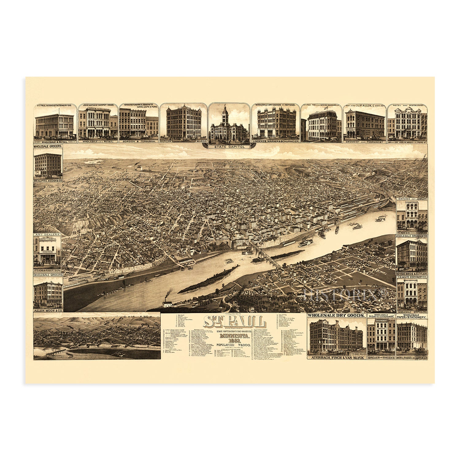
Produced by Minneapolis-based cartographer Henry Wellge, this stunning bird's eye perspective shows Minnesota's State Capital, St. Paul, in a period of significant growth, prosperity, and transformation. By the late nineteenth century, St. Paul had grown from a military outpost that was bolstered by fur traders into a bustling metropolis that served as the gateway to the great expanses of the North, which were granted further access by the establishment of the Great Northern and Northern Pacific Railways, both of which were headquartered in St. Paul.

Following derisive comments from a reporter in New York regarding St. Paul's long cold winter, the Saint Paul Winter Carnival was established in 1885 to demonstrate the city' resilience and fortitude. The annual tradition exists to this day and has become one of the city's most prominent events. The Capitol building in St. Paul was completed in 1882 and remains a central feature of the city's vibrant downtown and testimony to the city's prosperity at the time given its opulence and grandeur. The late nineteenth century saw St. Paul establish itself as a financial and commercial hub for the Northern-Midwest and Great Lakes region.

Bird's eye perspectives were wildly popular from the late nineteenth century until the 1920s and bear a unique aesthetic that immediately transports the viewer back in time, creating an indelible link between the past and present. Wellge's illustration would have been used as a marketing tool to attract industrialists and workers alike. This is truly an authentic piece of American cartographical history.

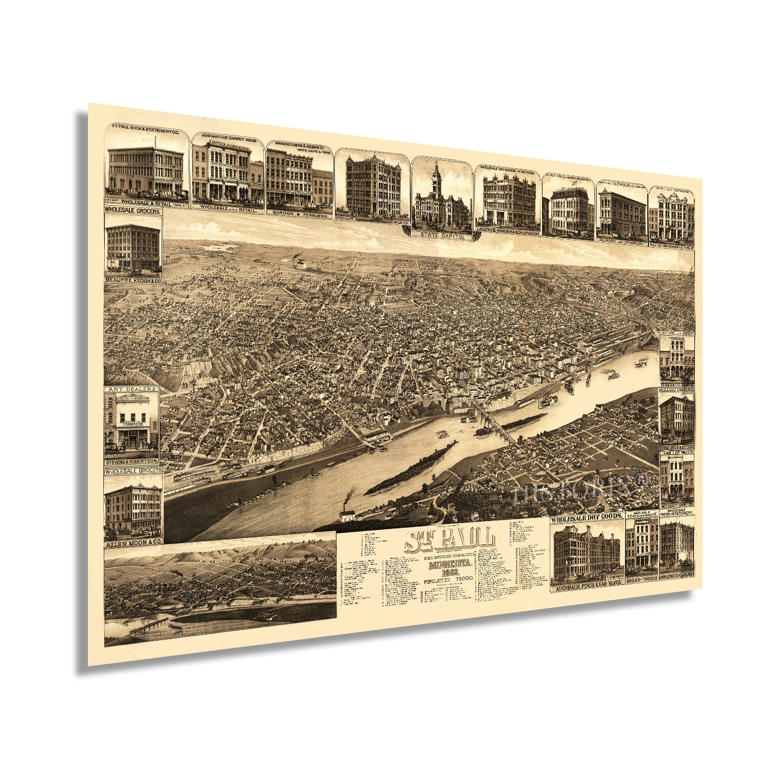
Our museum quality giclee print comes printed with archival ink on premium heavyweight matte paper. Shipped in a sturdy cardboard tube your print will arrive ready to be framed. This eye-catching vintage map reproduction print makes the perfect gift for anyone that loves history and imagery.

*Free shipping for framed and canvas products limited to the 48 contiguous United States.