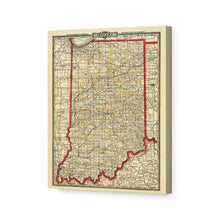
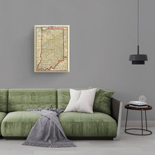
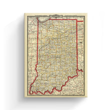
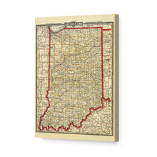
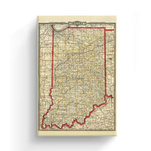
1888 Township & Railroad Map of Indiana Wall Art Canvas – Historic Prints
100% Satisfaction Guaranteed: Free Returns
Free Standard Shipping
Get 10% OFF your First Order

Shop Now and Get Free Shipping to Anywhere in the United States and Puerto Rico.*

Follow us

Digitally Restored and Enhanced 1888 Indiana Map Poster Canvas Art - Canvas Wrap Vintage Map of Indiana Wall Art - Old Indiana State Map Print - Restored Township & Rail Road Map of Indiana State
  • Load image into Gallery viewer, Digitally Restored and Enhanced 1888 Indiana Map Poster Canvas Art - Canvas Wrap Vintage Map of Indiana Wall Art - Old Indiana State Map Print - Restored Township & Rail Road Map of Indiana State
  • Load image into Gallery viewer, Digitally Restored and Enhanced 1888 Indiana Map Poster Canvas Art - Canvas Wrap Vintage Map of Indiana Wall Art - Old Indiana State Map Print - Restored Township & Rail Road Map of Indiana State
  • Load image into Gallery viewer, Digitally Restored and Enhanced 1888 Indiana Map Poster Canvas Art - Canvas Wrap Vintage Map of Indiana Wall Art - Old Indiana State Map Print - Restored Township & Rail Road Map of Indiana State
  • Load image into Gallery viewer, Digitally Restored and Enhanced 1888 Indiana Map Poster Canvas Art - Canvas Wrap Vintage Map of Indiana Wall Art - Old Indiana State Map Print - Restored Township & Rail Road Map of Indiana State
  • Load image into Gallery viewer, Digitally Restored and Enhanced 1888 Indiana Map Poster Canvas Art - Canvas Wrap Vintage Map of Indiana Wall Art - Old Indiana State Map Print - Restored Township & Rail Road Map of Indiana State
  • Load image into Gallery viewer, Digitally Restored and Enhanced 1888 Indiana Map Poster Canvas Art - Canvas Wrap Vintage Map of Indiana Wall Art - Old Indiana State Map Print - Restored Township & Rail Road Map of Indiana State
  • Load image into Gallery viewer, Digitally Restored and Enhanced 1888 Indiana Map Poster Canvas Art - Canvas Wrap Vintage Map of Indiana Wall Art - Old Indiana State Map Print - Restored Township & Rail Road Map of Indiana State
  • Load image into Gallery viewer, Digitally Restored and Enhanced 1888 Indiana Map Poster Canvas Art - Canvas Wrap Vintage Map of Indiana Wall Art - Old Indiana State Map Print - Restored Township & Rail Road Map of Indiana State
  • Load image into Gallery viewer, Digitally Restored and Enhanced 1888 Indiana Map Poster Canvas Art - Canvas Wrap Vintage Map of Indiana Wall Art - Old Indiana State Map Print - Restored Township & Rail Road Map of Indiana State

1888 Indiana Map Canvas Art - Canvas Wrap Vintage Map of Indiana - Old Indiana State Map Print - Restored Township & Rail Road Map of Indiana State Wall Art Poster

Regular price
$153.99
Sale price
$153.99
Regular price
$307.99
Sold out
Brand : Historic Prints
Unit price
per 

Feature Points

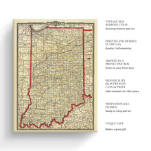
  • VINTAGE MAP CANVAS ART: You’ll love this high-quality canvas art reproduction of 1888 Vintage Indiana Map Poster Canvas. Our ready-to-hang maps are printed and framed in the USA by professional art framers using the highest quality materials. Each order is inspected for quality. This beautiful artwork is a perfect addition to your themed decor. Vintage maps look great in the home, study or office. They also make an unforgettable gift.
  • A LOOK BACK AT HISTORY: This is an impressive, historic reproduction of 1888 Indiana Road Map. A true piece of history. Historic prints beautifully link the past with the present. You may find yourself staring at your historic wall art for hours in wonderment. See our product description section for more fascinating information about this historic map and its significance.
  • QUALITY CANVAS: To display this amazing piece of history, we use museum-quality heavyweight (400gsm), satin/gloss, American made canvas. Our canvas is OBA-free which allows the print to retain its color quality for generations. The canvas displays vintage map art with accurate color reproduction. This high quality canvas print will be a wonderful addition to your vintage-themed wall.
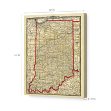
  • READY TO HANG: This high-quality canvas wrap wall art displays beautifully in almost any environment. The stretcher bar is made out of kiln-dried poplar wood. This canvas wall art has a 1.5 inch wrap on each side. Our canvas wrap prints are made-to-order in the USA by professional art framers. Frames arrive ready-to-hang, preinstalled with hanging hardware.
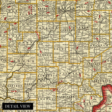
  • HISTORIC PRINTS: We love history and art. Sometimes old maps have tears, folds, stamps, separations and other blemishes. We digitally restore and enhance maps while keeping its historical character. Customers all over the world love our historic prints and we know you will too.


Additional Information

Initially published in 1888, this Railway map was produced by one of the most well-known 19th-century map makers George Cram. Cram’s company went on to become the first American company to release a World Atlas in 1901. This incredibly detailed illustration provided a wealth of information for merchants and residents alike and is a unique link to life as an American in the mid-1800s.

Before the Railway system was completed in 1865, the Mississippi River was the primary form of transit for exporting goods out of Indiana via the Wabash and Ohio River. The Railways became necessary for the northern regions of Indiana, especially in the 1880s, when a natural gas boom transformed the economy and spurred massive growth and population expansions. At the time, the Indiana Gas Field was the largest in the world. By allowing east-west transport, the Railways were Indiana’s connection to the rest of the nation, and the links permitted the state economy to thrive.

The rails carried a romance of the time, and in the mid-1850s, Indiana was rapidly building tracks with young men enamored with a life outside of the agrarian establishment. Indianapolis became known as “The City of Railroads,” with seven railroads converging in the city. Following the conclusion of the Civil War, the rail line became a useful tool for passengers as well as freight and interurban travel. This map was published the same year as the completion of the new Union Station in Indianapolis.

Our ready-to-hang canvas wall art prints are made in the USA using the highest quality materials with professional craftsmanship. This beautiful artwork is a perfect addition to your themed decor. Historic prints look great in the home, study or office. They also make an unforgettable gift.

*Free shipping for framed and canvas products limited to the 48 contiguous United States.