1926 Proposed Great Smoky Mountains National Park Map Wall Art Print – Historic Prints
100% Satisfaction Guaranteed: Free Returns
Free Standard Shipping
Get 10% OFF your First Order

Shop Now and Get Free Shipping to Anywhere in the United States and Puerto Rico.*

Follow us

Digitally Restored and Enhanced 1926 Proposed Great Smoky Mountains National Park Map - Vintage Map Wall Art - U.S. Geological Survey Planning Map - North Carolina Tennessee Poster
  • Load image into Gallery viewer, Digitally Restored and Enhanced 1926 Proposed Great Smoky Mountains National Park Map - Vintage Map Wall Art - U.S. Geological Survey Planning Map - North Carolina Tennessee Poster
  • Load image into Gallery viewer, Digitally Restored and Enhanced 1926 Proposed Great Smoky Mountains National Park Map - Vintage Map Wall Art - U.S. Geological Survey Planning Map - North Carolina Tennessee Poster
  • Load image into Gallery viewer, Digitally Restored and Enhanced 1926 Proposed Great Smoky Mountains National Park Map - Vintage Map Wall Art - U.S. Geological Survey Planning Map - North Carolina Tennessee Poster
  • Load image into Gallery viewer, Digitally Restored and Enhanced 1926 Proposed Great Smoky Mountains National Park Map - Vintage Map Wall Art - U.S. Geological Survey Planning Map - North Carolina Tennessee Poster
  • Load image into Gallery viewer, Digitally Restored and Enhanced 1926 Proposed Great Smoky Mountains National Park Map - Vintage Map Wall Art - U.S. Geological Survey Planning Map - North Carolina Tennessee Poster
  • Load image into Gallery viewer, Digitally Restored and Enhanced 1926 Proposed Great Smoky Mountains National Park Map - Vintage Map Wall Art - U.S. Geological Survey Planning Map - North Carolina Tennessee Poster
  • Load image into Gallery viewer, Digitally Restored and Enhanced 1926 Proposed Great Smoky Mountains National Park Map - Vintage Map Wall Art - U.S. Geological Survey Planning Map - North Carolina Tennessee Poster
  • Load image into Gallery viewer, Digitally Restored and Enhanced 1926 Proposed Great Smoky Mountains National Park Map - Vintage Map Wall Art - U.S. Geological Survey Planning Map - North Carolina Tennessee Poster
  • Load image into Gallery viewer, Digitally Restored and Enhanced 1926 Proposed Great Smoky Mountains National Park Map - Vintage Map Wall Art - U.S. Geological Survey Planning Map - North Carolina Tennessee Poster
  • Load image into Gallery viewer, Digitally Restored and Enhanced 1926 Proposed Great Smoky Mountains National Park Map - Vintage Map Wall Art - U.S. Geological Survey Planning Map - North Carolina Tennessee Poster
  • Load image into Gallery viewer, Digitally Restored and Enhanced 1926 Proposed Great Smoky Mountains National Park Map - Vintage Map Wall Art - U.S. Geological Survey Planning Map - North Carolina Tennessee Poster
  • Load image into Gallery viewer, Digitally Restored and Enhanced 1926 Proposed Great Smoky Mountains National Park Map - Vintage Map Wall Art - U.S. Geological Survey Planning Map - North Carolina Tennessee Poster

1926 Proposed Great Smoky Mountains National Park Map - Vintage Map Wall Art - U.S. Geological Survey Planning Map - North Carolina Tennessee Poster

Regular price
$39.99
Sale price
$39.99
Regular price
$79.99
Sold out
Brand : HISTORIX
Unit price
per 
Shipping calculated at checkout.

Feature Points

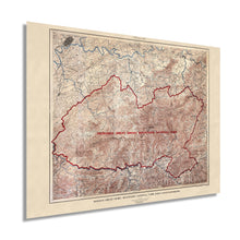
  • VINTAGE MAP REPRODUCTION: You’ll love this high quality historic reproduction of 1926 Proposed Great Smoky Mountains National Park. Our museum quality maps are archival grade, which means it will look great and last without fading for over 100 years. Our print to order maps are made in the USA and each map is inspected for quality. This beautiful artwork is a perfect addition to your themed decor. Vintage maps look great in the home, study or office. They make a perfect gift as well.
  • MUSEUM QUALITY: This high quality map print will be a great addition to your vintage-themed wall. Don't waste money on cheap-looking, thin paper posters. We use thick, fine art print quality matte paper. Our professional’s choice matte paper displays artwork in high detail without glare. The color is vibrant and text is easy to read. When framed, this map looks absolutely stunning.
  • A LOOK BACK AT HISTORY: This is an impressive, historic reproduction of 1926 Proposed Great Smoky Mountains National Park. This print is from an original found in the maps and geography division of the US Library of Congress. A true piece of history. See our product description section for more fascinating information about this historic map and its significance.
  • READY TO FRAME: This print includes a 0.2 inch border for a perfect frame fit and look. Our maps are designed to fit easy-to-find standard frame sizes, saving you money from having to pay for a custom frame. Each map is inspected for quality and shipped in a rigid tube.
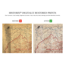
  • HISTORIX: We love history and art. Sometimes old maps have tears, folds, separations and other blemishes. We digitally restore and enhance maps while keeping its historical character. All our maps are proudly made in the USA. Customers all over the world love our vintage maps and we know you will too.


          Additional Information

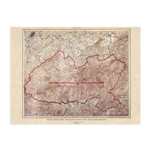
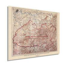
          Before being established in 1940 by President Franklin D. Roosevelt the Great Smoky National Park was a vision for a grand national park in the East to rival the iconic Rocky Mountain National Park. Congress authorized the building of a park however there was no centralized federal land around which to build a park.

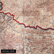
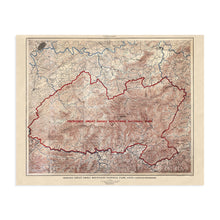
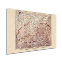
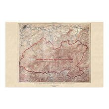
          This beautifully restored and enhanced 1926 map depicts the proposed land use for the establishment of the Great Smoky Mountain National Park by the US Geological Services. This raw illustration comes alive with our restoration and Museum quality printing process. Archival ink on heavy matte stock creates depth and character transporting the viewer to a time and place in history with never before seen detail. This is the perfect gift for any history lover and makes a handsome addition to any study, office, classroom, or library.

          Spanning across Tennessee and North Carolina this proposed map was a framework for what has become one of the United States’ greatest attractions, with millions of tourists annually basking in the grandeur of the rolling hills and early Appalachian history. The park also contains southern portions of the Appalachian Trail, a national treasure which presents one of the worlds longest through hikes, attracting more than 2 million hikers every year.

          Ready to frame, your museum quality restored print will come rolled in a sturdy cardboard tube to ensure 100% satisfaction. Reconnect with history in an aesthetically compelling and visually stunning way with our reproduction map of the Proposed Great Smoky Mountain National Park.

          *Free shipping for framed and canvas products limited to the 48 contiguous United States.