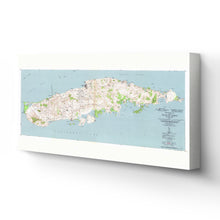
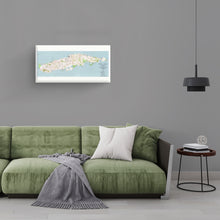
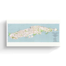
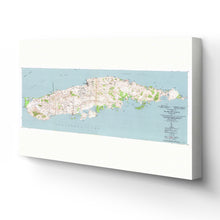
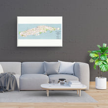
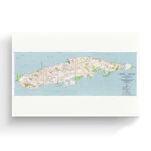
1951 Vieques Island Puerto Rico Topographic Map Canvas Wall Art – Historic Prints
100% Satisfaction Guaranteed: Free Returns
Free Standard Shipping
Get 10% OFF your First Order

Shop Now and Get Free Shipping to Anywhere in the United States and Puerto Rico.*

Follow us

Digitally Restored and Enhanced 1863 Gettysburg Map Canvas - Canvas Wrap Vintage Pennsylvania Map - Historic Map of Pennsylvania Poster - Old Gettysburg Battlefield Map of Pennsylvania Wall Art
  • Load image into Gallery viewer, Digitally Restored and Enhanced 1863 Gettysburg Map Canvas - Canvas Wrap Vintage Pennsylvania Map - Historic Map of Pennsylvania Poster - Old Gettysburg Battlefield Map of Pennsylvania Wall Art
  • Load image into Gallery viewer, Digitally Restored and Enhanced 1863 Gettysburg Map Canvas - Canvas Wrap Vintage Pennsylvania Map - Historic Map of Pennsylvania Poster - Old Gettysburg Battlefield Map of Pennsylvania Wall Art
  • Load image into Gallery viewer, Digitally Restored and Enhanced 1863 Gettysburg Map Canvas - Canvas Wrap Vintage Pennsylvania Map - Historic Map of Pennsylvania Poster - Old Gettysburg Battlefield Map of Pennsylvania Wall Art
  • Load image into Gallery viewer, Digitally Restored and Enhanced 1863 Gettysburg Map Canvas - Canvas Wrap Vintage Pennsylvania Map - Historic Map of Pennsylvania Poster - Old Gettysburg Battlefield Map of Pennsylvania Wall Art
  • Load image into Gallery viewer, Digitally Restored and Enhanced 1863 Gettysburg Map Canvas - Canvas Wrap Vintage Pennsylvania Map - Historic Map of Pennsylvania Poster - Old Gettysburg Battlefield Map of Pennsylvania Wall Art
  • Load image into Gallery viewer, Digitally Restored and Enhanced 1863 Gettysburg Map Canvas - Canvas Wrap Vintage Pennsylvania Map - Historic Map of Pennsylvania Poster - Old Gettysburg Battlefield Map of Pennsylvania Wall Art
  • Load image into Gallery viewer, Digitally Restored and Enhanced 1863 Gettysburg Map Canvas - Canvas Wrap Vintage Pennsylvania Map - Historic Map of Pennsylvania Poster - Old Gettysburg Battlefield Map of Pennsylvania Wall Art
  • Load image into Gallery viewer, Digitally Restored and Enhanced 1863 Gettysburg Map Canvas - Canvas Wrap Vintage Pennsylvania Map - Historic Map of Pennsylvania Poster - Old Gettysburg Battlefield Map of Pennsylvania Wall Art
  • Load image into Gallery viewer, Digitally Restored and Enhanced 1863 Gettysburg Map Canvas - Canvas Wrap Vintage Pennsylvania Map - Historic Map of Pennsylvania Poster - Old Gettysburg Battlefield Map of Pennsylvania Wall Art

1951 Vieques Map Art - Canvas Wrap Vintage Mapa de Puerto Rico - Old Puerto Rico Map -Topographic Map of the Island of Vieques Puerto Rico Wall Art Poster

Regular price
$146.99
Sale price
$146.99
Regular price
$293.99
Sold out
Brand : Historic Prints
Unit price
per 
Shipping calculated at checkout.

Feature Points

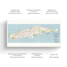
  • VINTAGE MAP CANVAS ART: You’ll love this high-quality canvas art reproduction of 1951 1951 Vieques Island Map Canvas Art. Our ready-to-hang maps are printed and framed in the USA by professional art framers using the highest quality materials. Each order is inspected for quality. This beautiful artwork is a perfect addition to your themed decor. Vintage maps look great in the home, study or office. They also make an unforgettable gift. 
  • A LOOK BACK AT HISTORY: This is an impressive, historic reproduction of 1951 Map of Vieques Island Puerto Rico Canvas Wall Art. A true piece of history. Historic prints beautifully link the past with the present. You may find yourself staring at your historic wall art for hours in amazement. See our product description section for more fascinating information about this historic map and its significance.
  • QUALITY CANVAS: To display this amazing piece of history, we use museum-quality heavyweight (400gsm), satin/gloss, American made canvas. Our canvas is OBA-free which allows the print to retain its color quality for generations. The canvas displays vintage map art with accurate color reproduction. This high quality canvas print will be a wonderful addition to your vintage-themed wall.
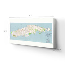
  • READY TO HANG: This high-quality canvas wrap wall art displays beautifully in almost any environment. The stretcher bar is made out of kiln-dried poplar wood. This canvas wall art has a 1.5 inch wrap on each side. Our canvas wrap prints are made-to-order in the USA by professional art framers. Frames arrive ready-to-hang, preinstalled with hanging hardware.
  • HISTORIC PRINTS: We love history and art. Sometimes old maps have tears, folds, stamps, separations and other blemishes. We digitally restore and enhance maps while keeping its historical character. Customers all over the world love our historic prints and we know you will too.

Additional Information

Published following the conclusion of World War II, this map of Vieques, Puerto Rico shows topographical features, and the island was an important US Naval Base that contributed to the Allies efforts in the Atlantic theater. The island lies to the eastern shore of mainland Puerto Rico and is only twenty miles from tip to tip. The US Navy expanded the Roosevelt Road Naval Station from mainland Puerto Rico to Vieques in 1941. The base remained in operation after the war ended for military exercises and as a ballistic testing location. The military withdrew its presence from the island in 2003 after protests regarding the ecological impact of the missile testing.

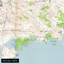
Known for white-sand beaches and clear blue water, the island enjoys a thriving tourism economy in the modern era, but at the time of this production, its economy was primarily driven by agriculture, particularly sugarcane farming. This map depicts the neighborhoods that make up the island, and the accuracy of the topographic features stand out.

The United States annexed Puerto Rico from Spain in 1898 following the Treaty of Paris in the aftermath of the Spanish-American War. Vieques’ economy was almost entirely dependent on sugarcane production at the beginning of the 20th century. The island is perhaps most well known for its unique, bioluminescent bays that glow in the evening and attract tourists from across the globe. The Spanish built Fuerte de Vieques was completed in 1845 and is a striking artifact of colonial architecture.

Our ready-to-hang canvas wall art prints are made in the USA using the highest quality materials with professional craftsmanship. This beautiful artwork is a perfect addition to your themed decor. Historic prints look great in the home, study or office. They also make an unforgettable gift.

*Free shipping for framed and canvas products limited to the 48 contiguous United States.