


Feature Points
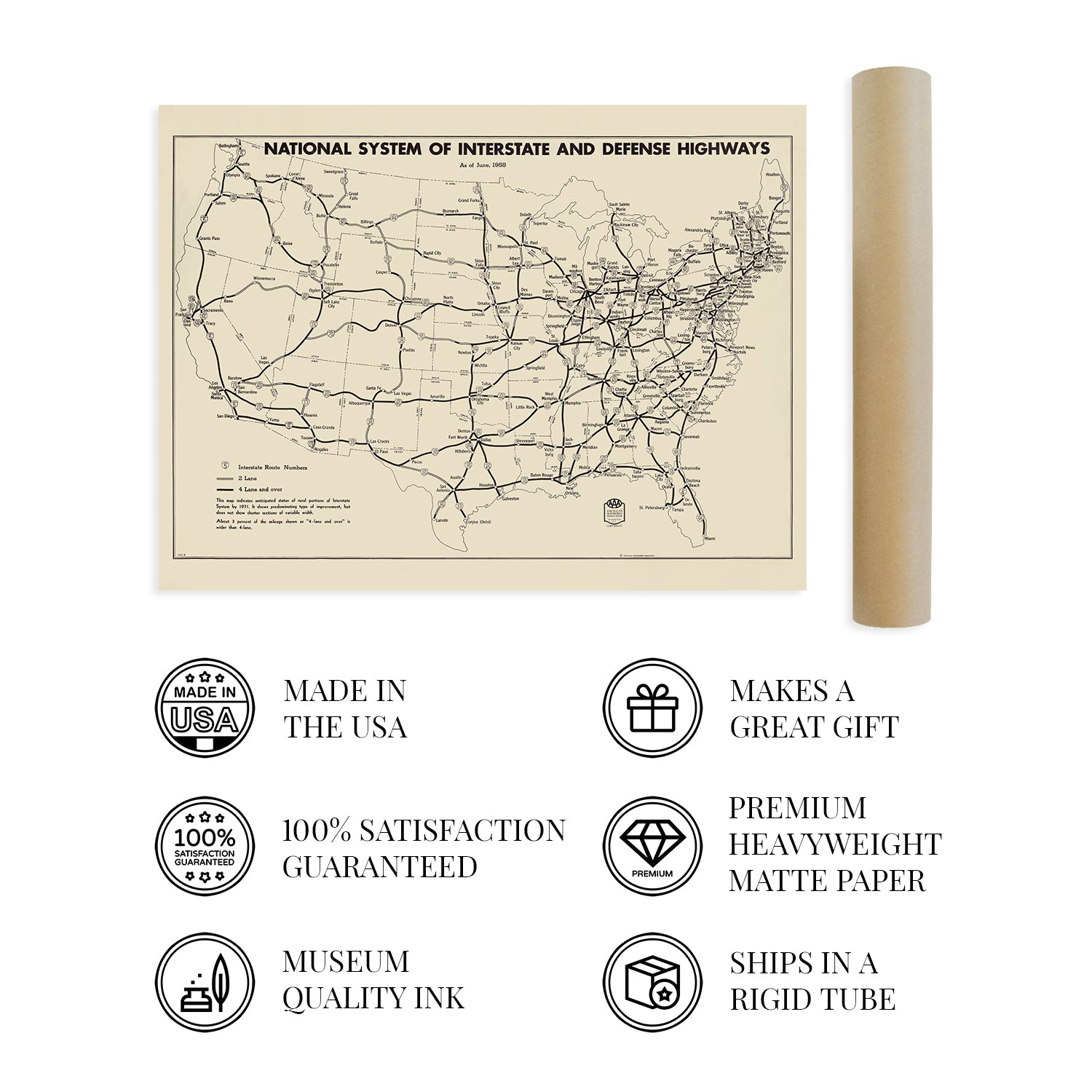
- VINTAGE MAP REPRODUCTION: You’ll love this high quality historic reproduction of 1958 Map of United States National System of Interstate & Defense Highways. Our museum quality prints are archival grade, which means it will look great and last without fading for over 100 years. Our print to order maps are made in the USA and each map is inspected for quality. This beautiful artwork is a perfect addition to your themed decor. Vintage maps look great in the home, study or office. They make a perfect gift as well.
- MUSEUM QUALITY: This high quality map print will be a great addition to your vintage-themed wall. Don't waste money on cheap-looking, thin paper posters. We use thick, fine art print quality matte paper. Our professional’s choice matte paper displays artwork in high detail without glare. The color is vibrant and text is easy to read. When framed, this map looks absolutely stunning.
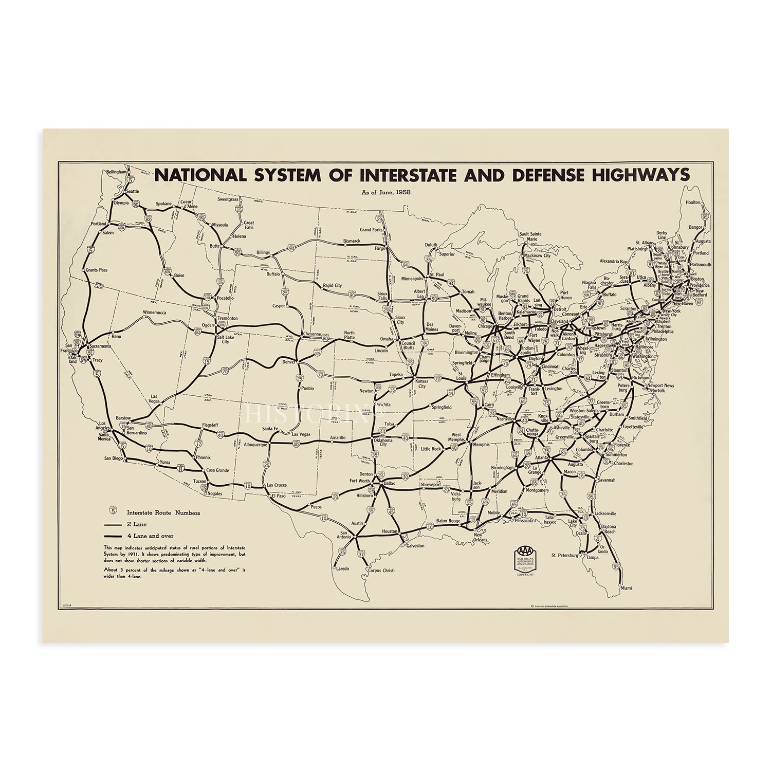
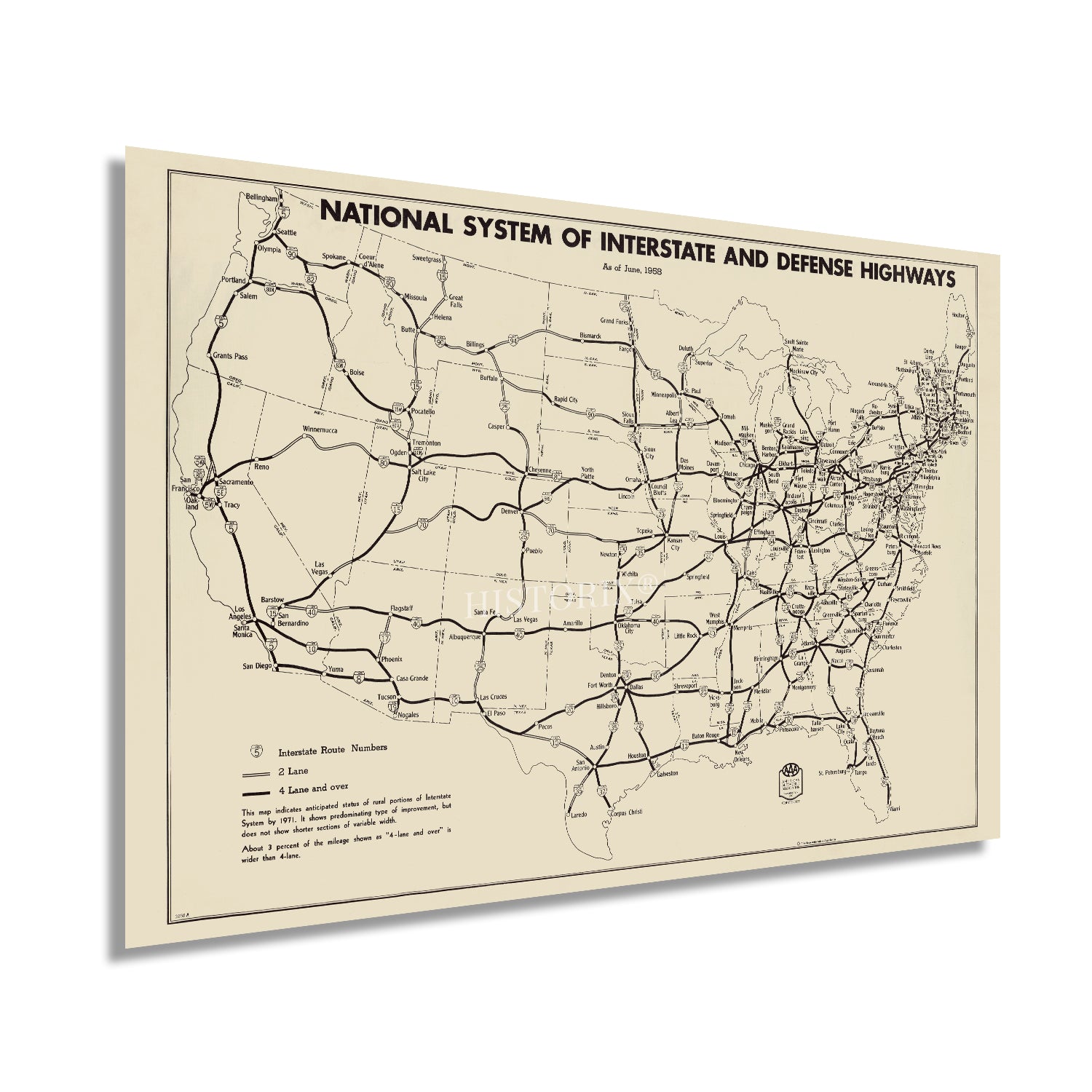
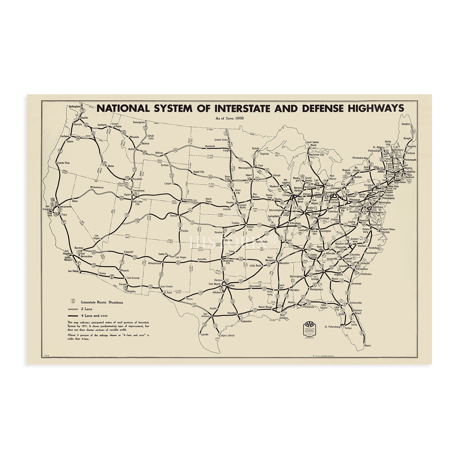
- A LOOK BACK AT HISTORY: This is an impressive, historic reproduction of 1958 United States Map Poster. A true piece of history. See our product description section for more fascinating information about this historic map and its significance.
- READY TO FRAME: This print includes a 0.2 inch border for a perfect frame fit and look. Our maps are designed to fit easy-to-find standard frame sizes, saving you money from having to pay for a custom frame. Each map is inspected for quality and shipped in a rigid tube.
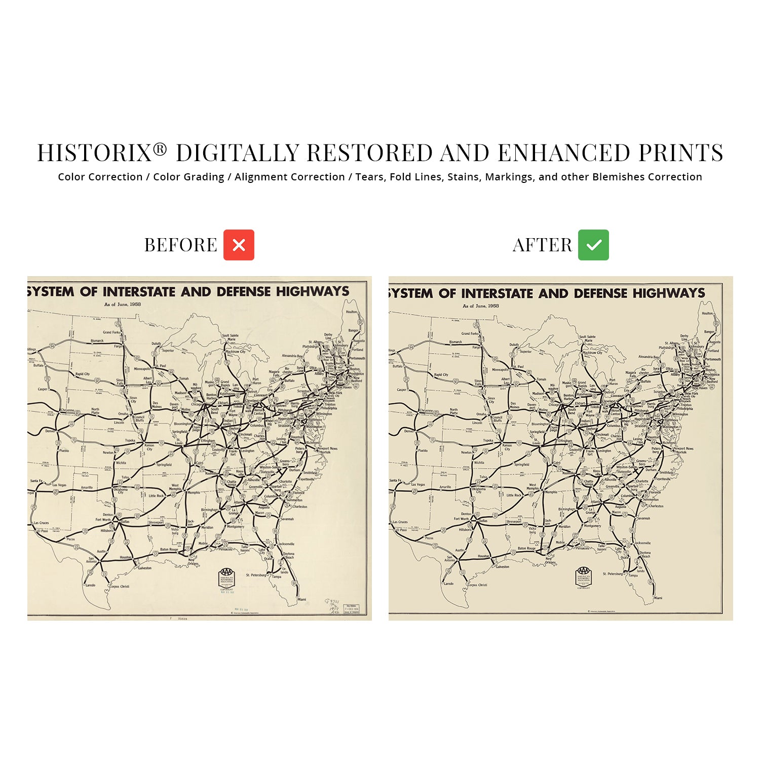
- HISTORIX: We love history and art. Sometimes old maps have tears, folds, separations and other blemishes. We digitally restore and enhance maps while keeping its historical character. All our maps are proudly made in the USA. Customers all over the world love our vintage maps and we know you will too.
Additional Information
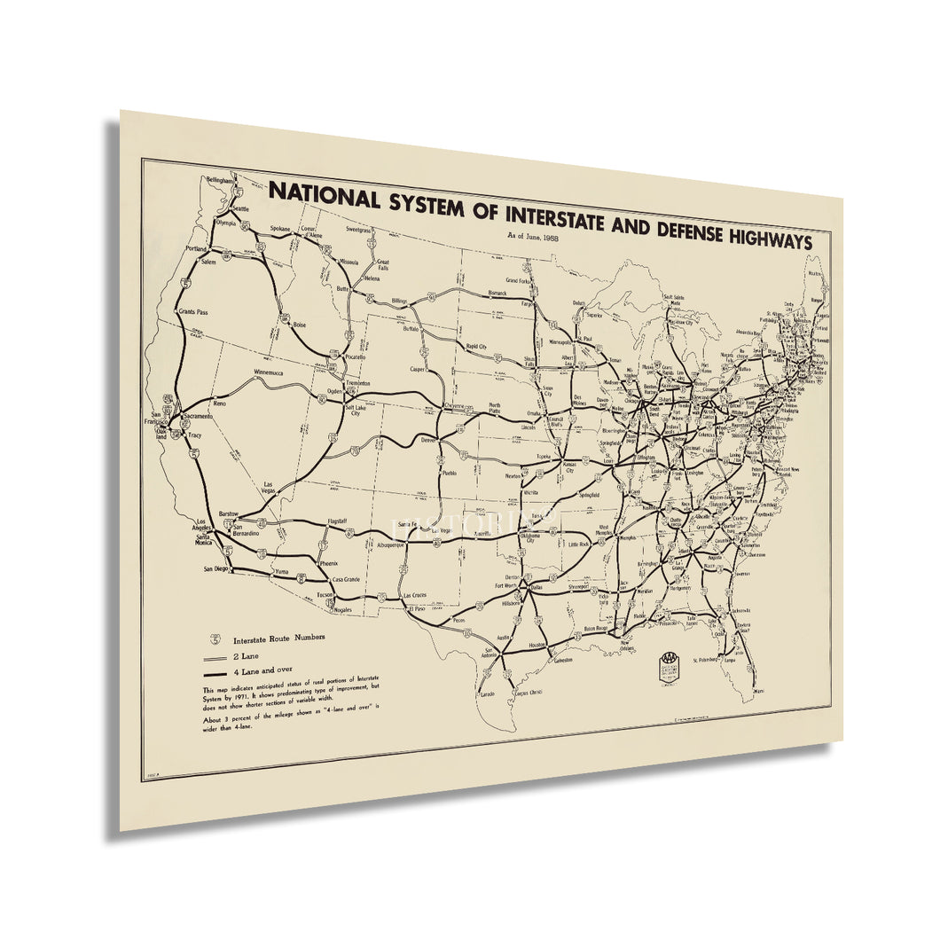
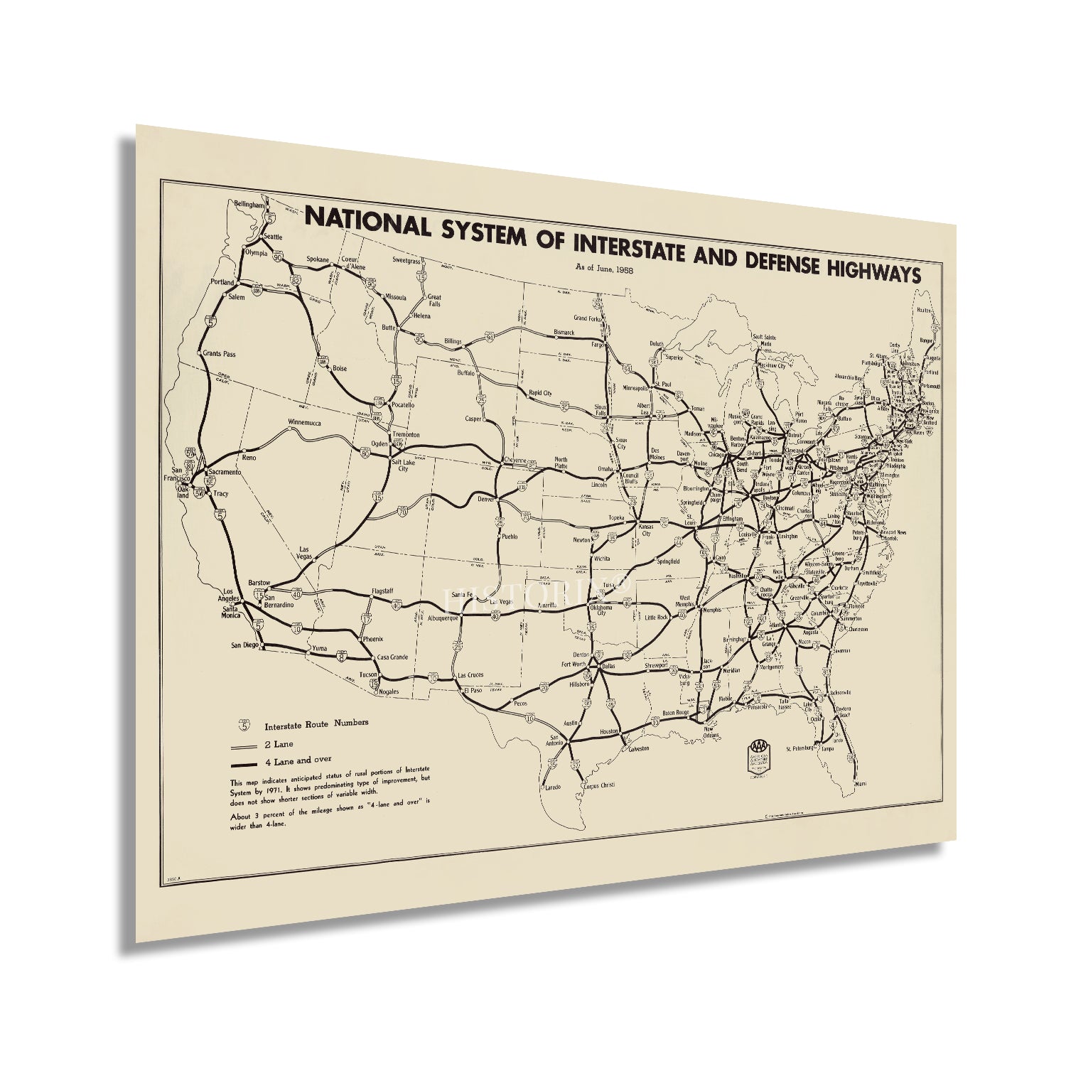
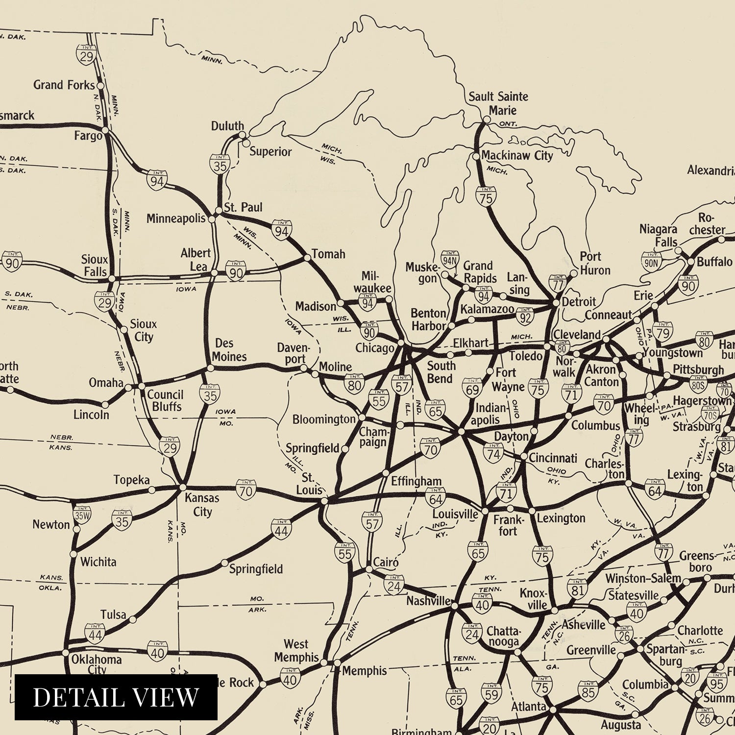
Published in 1958, this depiction of the extensive United States Highway System shows it following decades of planning, construction, and development. The Federal Aid Road Act of 1916 established the need for a comprehensive network of roadways to connect the states and allow for greater accessibility, trade, and tourism throughout the United States. The popularity of automobiles allowed residents greater freedom, and the need for a numbered system was outlined in 1926. In 1953 President Dwight Eisenhower developed a more detailed plan to establish high-speed transit lines, which led to the passage of the Federal Highway Act of 1956.
Supply chain and logistic issues had become apparent during the war efforts in the previous decade, illustrating the need for the movement of supplies, munitions, and agricultural products from the interior of the country to ports on the east and west coast. The necessity to efficiently and quickly transport troops across bases also facilitated the need for a heightened transportation infrastructure across the nation. This legislation also outlined safety measures, restrictions, and other technical aspects of the federal highway system.
This production was created by the American Automobile Association, which began publishing maps in 1905. By the 1950s, America was experiencing a period of significant prosperity and a population boom following the return of veterans after the conclusion of World War II. This unique illustration immediately transports the viewer back in time and creates an indelible bond between the past and present, and is an authentic piece of cartographical history.
Our museum quality giclee print comes printed with archival ink on premium heavyweight matte paper. Shipped in a sturdy cardboard tube your print will arrive ready to be framed. This eye-catching vintage map reproduction print makes the perfect gift for anyone that loves history and imagery.

