Feature Points
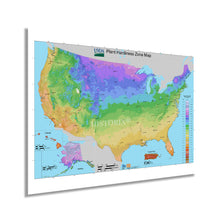
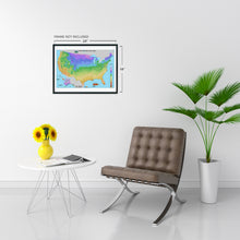
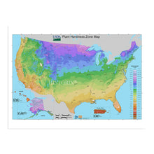
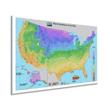
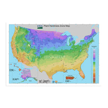
- HISTORIC PRINTS: You’ll love this high quality print of 2012 USDA Plant Hardiness Zone USA Map Poster. Our museum quality prints are archival grade, which means it will look great and last without fading for over 100 years. Our print to order maps are made in the USA and each map is inspected for quality. Maps are great for education in the classroom. Maps also make for beautiful wall art in the home, study or office. A great gift for travelers or map enthusiasts.
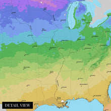
- MUSEUM QUALITY: This high quality map print of 2012 USDA Map of United States will be a great addition to your wall art or classroom. Don't waste money on cheap-looking, thin paper posters. We use thick, fine art print quality matte paper. Our professional’s choice matte paper displays artwork in high detail without glare. The color is vibrant and text is easy to read. Our maps can be pinned on the wall or framed for a stunning look.
- ACCURATE MAP: Our map prints are utilized by academics, business people, and others looking for accurate, detailed maps. See our product description section for more fascinating information about this map and its significance.
- READY TO FRAME: This print includes a 0.2 inch border for a perfect frame fit and look. Our maps are designed to fit easy-to-find standard frame sizes, saving you money from having to pay for a custom frame. Each map is inspected for quality and shipped in a rigid tube.
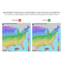
- HISTORIX: We love history and art. Sometimes old maps have tears, folds, separations and other blemishes. We digitally restore and enhance maps while keeping its historical character. All our maps are proudly made in the USA. Customers all over the world love our historic maps and we know you will too.
Additional Information
The rich details and technical analytics present in this unique depiction differentiate to from other styles of cartographical pieces. The distinctive style is immediately recognizable and informs the viewer with historical data such as average rainfall as well as high and low-temperature records. These maps define thirteen zones and are widely used for gardening, landscaping, and agricultural purposes. The United States Department of Agriculture produces these maps annually, and the first official publication was completed in 1960. Though, attempts at creating a map of these zones have been attempted since 1927.Â
Advances in meteorological technology along with other significant developments like computers, accurate digital thermometers, and satellite imagery would cause considerable gains in the development of these pieces, which were completely revamped in 1990. This depiction was completed after another overhaul by the Arbor Day Foundation in 2006 further altered the aesthetic and performed revisions based on current data. This map was also the first update since 2006 that increased the zones by two to reflect better definitions for tropical and semitropical plants and include Hawaii and Puerto Rico. Zone boundaries were also shifted in the 2012 publication to reflect changes to regional climates and seasonality.
This publication is also interesting as the zones reflected higher temperatures; a half zone warmer than the 1990 map. These unique pieces of cartographical history are among some of the lesser-known works, though they offer an interesting perspective on changing weather patterns. They are also an invaluable tool for arborists and horticulturalists.
Our museum quality giclee print comes printed with archival ink on premium heavyweight matte paper. Shipped in a cardboard tube your print will arrive ready to be framed. This eye-catching vintage map reproduction print makes the perfect gift for anyone that loves history.


