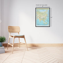
Feature Points
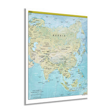
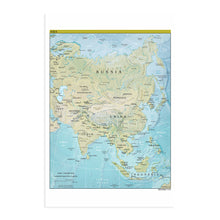
- HISTORIC PRINTS: You’ll love this high quality print of 2021 Asia Map Poster. Our museum quality prints are archival grade, which means it will look great and last without fading for over 100 years. Our print to order maps are made in the USA and each map is inspected for quality. Maps are great for education in the classroom. Maps also make for beautiful wall art in the home, study or office. A great gift for travelers or map enthusiasts.
- MUSEUM QUALITY: This high quality map print will be a great addition to your wall art or classroom. Don't waste money on cheap-looking, thin paper posters. We use thick, fine art print quality matte paper. Our professional’s choice matte paper displays artwork in high detail without glare. The color is vibrant and text is easy to read. Our maps can be pinned on the wall or framed for a stunning look.
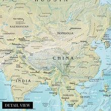
- ACCURATE MAP: Our map prints are utilized by academics, business people, and others looking for accurate, detailed maps. See our product description section for more fascinating information about this map and its significance.
- READY TO FRAME: This print includes a 0.2 inch border for a perfect frame fit and look. Our maps are designed to fit easy-to-find standard frame sizes, saving you money from having to pay for a custom frame. Each map is inspected for quality and shipped in a rigid tube.
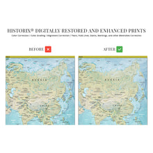
- HISTORIX: We love history and art. Sometimes old maps have tears, folds, separations and other blemishes. We digitally restore and enhance maps while keeping its historical character. All our maps are proudly made in the USA. Customers all over the world love our historic maps and we know you will too.
Â
Additional Information
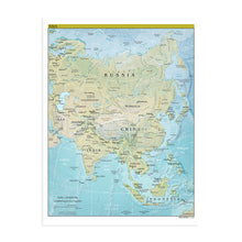
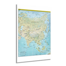
This depiction of the largest continent by landmass and population shows Asia in a period of significant cultural, economic, and political transformation during the second decade of the twenty-first century. Because of its incredibly diverse geography and numerous completely distinct cultures, Asia cannot be defined as a single place and, as such, has long been a fascination for Western cultures. Historically the border of Asia and Europe is merely a political construct rather than a defined geopolitical boundary. However, in the modern era, the Middle East has become the accepted dividing line.
Asia also contains some of the most diverse climates on the planet, from sub-tropical rainforests in Southeast Asia to the world's highest peak at the iconic Mount Everest in Nepal. Home to numerous attractions like the Taj Mahal, Great Wall of China, and the Angkor Wat in Cambodia. From the Indonesian archipelago to the distinct cultures of Japan, India, China, Mongolia, and Southeast Asia, the continent bears the largest diversity of ethnic groups with unique traditions and values. The region is also home to a wide variety of religions that have spread across the globe.
With the presence of American forces in the region since the opening of Japan in 1853 by Commodore Matthew Perry, the continent has played a significant role in international conflicts, economics, and technological advancement. Central Intelligence Agency maps have been produced since 1941 and bear a remarkable amount of detail and geopolitical information used by political and military leaders to develop policy and strategy.
Our museum quality giclee print comes printed with archival ink on premium heavyweight matte paper. Shipped in a sturdy cardboard tube your print will arrive ready to be framed. This eye-catching vintage map reproduction print makes the perfect gift for anyone that loves history and imagery.


