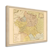
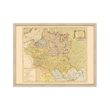
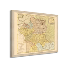
1770 Reino de Polonia y Gran Holanda de Lituania Mapa enmarcado arte de pared – Historic Prints
100% Satisfaction Guaranteed: Free Returns
Free Standard Shipping
Get 10% OFF your First Order

Shop Now and Get Free Shipping to Anywhere in the United States and Puerto Rico.*

Follow us

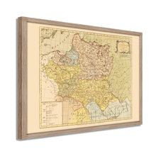
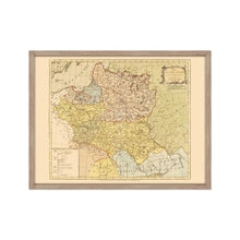
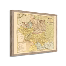
Digitally Restored and Enhanced 1770 Poland Map Poster - Framed Vintage Poland Wall Art - Old Map of Lithuania - History Map of the Kingdom of Poland and the Grand Dutchy of Lithuania
  • Cargar imagen en el visor de la galería, Digitally Restored and Enhanced 1770 Poland Map Poster - Framed Vintage Poland Wall Art - Old Map of Lithuania - History Map of the Kingdom of Poland and the Grand Dutchy of Lithuania
  • Cargar imagen en el visor de la galería, Digitally Restored and Enhanced 1770 Poland Map Poster - Framed Vintage Poland Wall Art - Old Map of Lithuania - History Map of the Kingdom of Poland and the Grand Dutchy of Lithuania
  • Cargar imagen en el visor de la galería, Digitally Restored and Enhanced 1770 Poland Map Poster - Framed Vintage Poland Wall Art - Old Map of Lithuania - History Map of the Kingdom of Poland and the Grand Dutchy of Lithuania
  • Cargar imagen en el visor de la galería, Digitally Restored and Enhanced 1770 Poland Map Poster - Framed Vintage Poland Wall Art - Old Map of Lithuania - History Map of the Kingdom of Poland and the Grand Dutchy of Lithuania
  • Cargar imagen en el visor de la galería, Digitally Restored and Enhanced 1770 Poland Map Poster - Framed Vintage Poland Wall Art - Old Map of Lithuania - History Map of the Kingdom of Poland and the Grand Dutchy of Lithuania
  • Cargar imagen en el visor de la galería, Digitally Restored and Enhanced 1770 Poland Map Poster - Framed Vintage Poland Wall Art - Old Map of Lithuania - History Map of the Kingdom of Poland and the Grand Dutchy of Lithuania
  • Cargar imagen en el visor de la galería, Digitally Restored and Enhanced 1770 Poland Map Poster - Framed Vintage Poland Wall Art - Old Map of Lithuania - History Map of the Kingdom of Poland and the Grand Dutchy of Lithuania
  • Cargar imagen en el visor de la galería, Digitally Restored and Enhanced 1770 Poland Map Poster - Framed Vintage Poland Wall Art - Old Map of Lithuania - History Map of the Kingdom of Poland and the Grand Dutchy of Lithuania
  • Cargar imagen en el visor de la galería, Digitally Restored and Enhanced 1770 Poland Map Poster - Framed Vintage Poland Wall Art - Old Map of Lithuania - History Map of the Kingdom of Poland and the Grand Dutchy of Lithuania
  • Cargar imagen en el visor de la galería, Digitally Restored and Enhanced 1770 Poland Map Poster - Framed Vintage Poland Wall Art - Old Map of Lithuania - History Map of the Kingdom of Poland and the Grand Dutchy of Lithuania
  • Cargar imagen en el visor de la galería, Digitally Restored and Enhanced 1770 Poland Map Poster - Framed Vintage Poland Wall Art - Old Map of Lithuania - History Map of the Kingdom of Poland and the Grand Dutchy of Lithuania
  • Cargar imagen en el visor de la galería, Digitally Restored and Enhanced 1770 Poland Map Poster - Framed Vintage Poland Wall Art - Old Map of Lithuania - History Map of the Kingdom of Poland and the Grand Dutchy of Lithuania
  • Cargar imagen en el visor de la galería, Digitally Restored and Enhanced 1770 Poland Map Poster - Framed Vintage Poland Wall Art - Old Map of Lithuania - History Map of the Kingdom of Poland and the Grand Dutchy of Lithuania
  • Cargar imagen en el visor de la galería, Digitally Restored and Enhanced 1770 Poland Map Poster - Framed Vintage Poland Wall Art - Old Map of Lithuania - History Map of the Kingdom of Poland and the Grand Dutchy of Lithuania
  • Cargar imagen en el visor de la galería, Digitally Restored and Enhanced 1770 Poland Map Poster - Framed Vintage Poland Wall Art - Old Map of Lithuania - History Map of the Kingdom of Poland and the Grand Dutchy of Lithuania
  • Cargar imagen en el visor de la galería, Digitally Restored and Enhanced 1770 Poland Map Poster - Framed Vintage Poland Wall Art - Old Map of Lithuania - History Map of the Kingdom of Poland and the Grand Dutchy of Lithuania

HISTORIX Vintage 1770 Póster de mapa de Polonia - Mapa de historia del Reino de Polonia y Lituania Póster de arte de pared

Precio habitual
$175.99
Precio de venta
$175.99
Precio habitual
$255.99
Agotado
Brand : Historic Prints
Precio unitario
por 
Los gastos de envío se calculan en la pantalla de pagos.

Puntos característicos

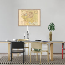
  • MAPA VINTAGE ENMARCADO: Te encantará esta reproducción histórica enmarcada en negro de alta calidad del póster de mapa de pared de Polonia de 1770. Nuestros mapas listos para colgar están impresos y enmarcados en los EE. UU. por enmarcadores de arte profesionales que utilizan materiales de la más alta calidad. Cada pedido es inspeccionado por calidad. Esta hermosa obra de arte es un complemento perfecto para su decoración temática. Los mapas antiguos se ven geniales en el hogar, el estudio o la oficina. También hacen un regalo inolvidable.
  • UNA MIRADA ATRÁS A LA HISTORIA: Esta es una impresionante reproducción histórica del póster del mapa de Polonia de 1770. Un verdadero pedazo de historia. Las impresiones históricas vinculan maravillosamente el pasado con el presente. Es posible que te encuentres mirando tu arte mural histórico durante horas con asombro. Consulte nuestra sección de descripción del producto para obtener más información fascinante sobre este mapa histórico y su significado.
  • CALIDAD PREMIUM: Para mostrar esta increíble pieza de la historia, utilizamos papel mate de calidad de museo de gramaje pesado (230 g/m²), con impresión de bellas artes. Nuestro papel no contiene ácido, lo que permite que la impresión conserve su calidad de color durante generaciones. Nuestro papel muestra arte de mapas antiguos con una reproducción precisa del color. Esta impresión de alta calidad será una maravillosa adición a su pared de estilo vintage.
  • LISTO PARA COLGAR: este marco de alta calidad muestra bellamente el arte en casi cualquier entorno. El marco está fabricado en madera de chopo (para blanco y negro) y de pino (para nogal y natural) con acabado mate. El perfil del marco mide 1,5 pulgadas de alto y 0,75 (para el tamaño 18x24) y 1,125 (para el tamaño 24x36) pulgadas de ancho. Para proteger las obras de arte, utilizamos acrílico para marcos de alta calidad, liviano y resistente a los golpes. Los marcos llegan listos para colgar, preinstalados con herrajes para colgar.
  • ESTAMPAS HISTÓRICAS: Amamos la historia y el arte. A veces, los mapas antiguos tienen rasgaduras, pliegues, sellos, separaciones y otras imperfecciones. Restauramos y mejoramos mapas digitalmente manteniendo su carácter histórico. Nuestras impresiones enmarcadas están hechas a pedido en los EE. UU. por enmarcadores de arte profesionales. Clientes de todo el mundo adoran nuestros estampados históricos y sabemos que a ti también.


Información Adicional

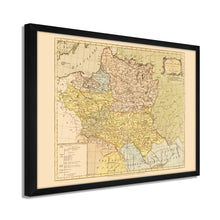
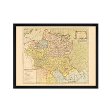
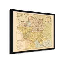
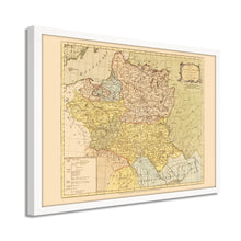
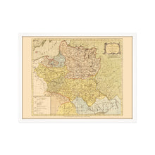
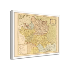
Publicado en la última parte del siglo XIX, esta representación distinta y ornamentada de Polonia y Lituania muestra las naciones en un período de reforma interna masiva y mayor poder político de las clases sociales urbanas progresistas. Estas condiciones crearon una economía más robusta para el país, y Varsovia, la ciudad más poblada, se convirtió en el principal centro de comercio.

Producida por el cartógrafo alemán Job Mayer y publicada por el abogado londinense John Bowles, esta impresionante representación transporta inmediatamente al espectador al pasado. La Confederación de Abogados de 1768 a 1782 fue una rebelión de la nobleza que buscaba conservar la independencia de la nación, así como el establecimiento tradicional de la cultura noble. Después de la supresión de la Confederación de Abogados, la mancomunidad de Polonia se dividió en Prusia, Rusia y Austria, lo que se conoció como la Primera Partición de Polonia. Los historiadores consideran que esto sucedió debido a la pérdida de influencia significativa de Polonia en el noreste de Europa en la segunda mitad del siglo XVIII. Otro factor que contribuyó fue el cambio de poderes de Rusia y Europa durante este período.

El interés de los ingleses en la política de Europa del Este alcanzó su punto máximo en el siglo XVIII cuando los disturbios civiles en las colonias inglesas en América estaban influyendo en el sentimiento geopolítico en Europa Occidental e Inglaterra. A medida que cambian las fronteras y se forman nuevas naciones, estos mapas históricos brindan una rara visión del pasado y brindan al espectador un sentido real de la historia. Esta es una pieza genuina de la historia cartográfica de Europa del Este.

Nuestro arte de pared listo para colgar está impreso y enmarcado en los Estados Unidos utilizando materiales de la más alta calidad con artesanía profesional. Esta hermosa obra de arte es un complemento perfecto para su decoración temática. Las impresiones históricas se ven geniales en el hogar, el estudio o la oficina. También hacen un regalo inolvidable.

*Free shipping for framed and canvas products limited to the 48 contiguous United States.