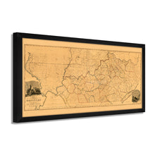
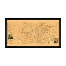
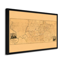
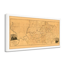
1818 Mapa del estado de Kentucky de la encuesta real Arte de pared enmarcado – Historic Prints
100% Satisfaction Guaranteed: Free Returns
Free Standard Shipping
Get 10% OFF your First Order

Shop Now and Get Free Shipping to Anywhere in the United States and Puerto Rico.*

Follow us

Digitally Restored and Enhanced 1818 Kentucky State Map - Framed Vintage Map of Kentucky Poster - Historic Kentucky Map - Restored State Map of Kentucky Wall Art from Actual Survey
  • Cargar imagen en el visor de la galería, Digitally Restored and Enhanced 1818 Kentucky State Map - Framed Vintage Map of Kentucky Poster - Historic Kentucky Map - Restored State Map of Kentucky Wall Art from Actual Survey
  • Cargar imagen en el visor de la galería, Digitally Restored and Enhanced 1818 Kentucky State Map - Framed Vintage Map of Kentucky Poster - Historic Kentucky Map - Restored State Map of Kentucky Wall Art from Actual Survey
  • Cargar imagen en el visor de la galería, Digitally Restored and Enhanced 1818 Kentucky State Map - Framed Vintage Map of Kentucky Poster - Historic Kentucky Map - Restored State Map of Kentucky Wall Art from Actual Survey
  • Cargar imagen en el visor de la galería, Digitally Restored and Enhanced 1818 Kentucky State Map - Framed Vintage Map of Kentucky Poster - Historic Kentucky Map - Restored State Map of Kentucky Wall Art from Actual Survey
  • Cargar imagen en el visor de la galería, Digitally Restored and Enhanced 1818 Kentucky State Map - Framed Vintage Map of Kentucky Poster - Historic Kentucky Map - Restored State Map of Kentucky Wall Art from Actual Survey
  • Cargar imagen en el visor de la galería, Digitally Restored and Enhanced 1818 Kentucky State Map - Framed Vintage Map of Kentucky Poster - Historic Kentucky Map - Restored State Map of Kentucky Wall Art from Actual Survey
  • Cargar imagen en el visor de la galería, Digitally Restored and Enhanced 1818 Kentucky State Map - Framed Vintage Map of Kentucky Poster - Historic Kentucky Map - Restored State Map of Kentucky Wall Art from Actual Survey
  • Cargar imagen en el visor de la galería, Digitally Restored and Enhanced 1818 Kentucky State Map - Framed Vintage Map of Kentucky Poster - Historic Kentucky Map - Restored State Map of Kentucky Wall Art from Actual Survey
  • Cargar imagen en el visor de la galería, Digitally Restored and Enhanced 1818 Kentucky State Map - Framed Vintage Map of Kentucky Poster - Historic Kentucky Map - Restored State Map of Kentucky Wall Art from Actual Survey
  • Cargar imagen en el visor de la galería, Digitally Restored and Enhanced 1818 Kentucky State Map - Framed Vintage Map of Kentucky Poster - Historic Kentucky Map - Restored State Map of Kentucky Wall Art from Actual Survey
  • Cargar imagen en el visor de la galería, Digitally Restored and Enhanced 1818 Kentucky State Map - Framed Vintage Map of Kentucky Poster - Historic Kentucky Map - Restored State Map of Kentucky Wall Art from Actual Survey
  • Cargar imagen en el visor de la galería, Digitally Restored and Enhanced 1818 Kentucky State Map - Framed Vintage Map of Kentucky Poster - Historic Kentucky Map - Restored State Map of Kentucky Wall Art from Actual Survey
  • Cargar imagen en el visor de la galería, Digitally Restored and Enhanced 1818 Kentucky State Map - Framed Vintage Map of Kentucky Poster - Historic Kentucky Map - Restored State Map of Kentucky Wall Art from Actual Survey
  • Cargar imagen en el visor de la galería, Digitally Restored and Enhanced 1818 Kentucky State Map - Framed Vintage Map of Kentucky Poster - Historic Kentucky Map - Restored State Map of Kentucky Wall Art from Actual Survey
  • Cargar imagen en el visor de la galería, Digitally Restored and Enhanced 1818 Kentucky State Map - Framed Vintage Map of Kentucky Poster - Historic Kentucky Map - Restored State Map of Kentucky Wall Art from Actual Survey
  • Cargar imagen en el visor de la galería, Digitally Restored and Enhanced 1818 Kentucky State Map - Framed Vintage Map of Kentucky Poster - Historic Kentucky Map - Restored State Map of Kentucky Wall Art from Actual Survey

Mapa del estado de Kentucky de 1818 - Mapa vintage enmarcado de Kentucky - Mapa histórico de Kentucky - Mapa restaurado del estado de Kentucky Wall Art from Actual Survey Wall Art Póster

Precio habitual
$166.99
Precio de venta
$166.99
Precio habitual
$333.99
Agotado
Brand : Historic Prints
Precio unitario
por 

Puntos característicos

  • MAPA VINTAGE ENMARCADO: Te encantará esta reproducción histórica enmarcada en negro de alta calidad del mapa del estado de Kentucky de 1818. Nuestros mapas listos para colgar están impresos y enmarcados en los EE. UU. por enmarcadores de arte profesionales que utilizan materiales de la más alta calidad. Cada pedido es inspeccionado por calidad. Esta hermosa obra de arte es un complemento perfecto para su decoración temática. Los mapas antiguos se ven geniales en el hogar, el estudio o la oficina. También hacen un regalo inolvidable.
  • UNA MIRADA ATRÁS A LA HISTORIA: Esta es una impresionante reproducción histórica del mapa de Kentucky de 1818 enmarcado. Un verdadero pedazo de historia. Las impresiones históricas vinculan maravillosamente el pasado con el presente. Es posible que te encuentres mirando tu arte mural histórico durante horas con asombro. Consulte nuestra sección de descripción del producto para obtener más información fascinante sobre este mapa histórico y su significado.
  • CALIDAD PREMIUM: Para mostrar esta increíble pieza de la historia, utilizamos papel mate de calidad de museo de gramaje pesado (230 g/m²), con impresión de bellas artes. Nuestro papel no contiene ácido, lo que permite que la impresión conserve su calidad de color durante generaciones. Nuestro papel muestra arte de mapas antiguos con una reproducción precisa del color. Esta impresión de alta calidad será una maravillosa adición a su pared de estilo vintage.
  • LISTO PARA COLGAR: este marco de alta calidad muestra bellamente el arte en casi cualquier entorno. El marco está fabricado en madera de chopo (para blanco y negro) y de pino (para nogal y natural) con acabado mate. El perfil del marco mide 1,5 pulgadas de alto y 0,75 (para el tamaño 12x24) y 1,125 (para el tamaño 24x36) pulgadas de ancho. Para proteger las obras de arte, utilizamos acrílico para marcos de alta calidad, liviano y resistente a los golpes. Los marcos llegan listos para colgar, preinstalados con herrajes para colgar.
  • ESTAMPAS HISTÓRICAS: Amamos la historia y el arte. A veces, los mapas antiguos tienen rasgaduras, pliegues, sellos, separaciones y otras imperfecciones. Restauramos y mejoramos mapas digitalmente manteniendo su carácter histórico. Nuestras impresiones enmarcadas están hechas a pedido en los EE. UU. por enmarcadores de arte profesionales. Clientes de todo el mundo adoran nuestros estampados históricos y sabemos que a ti también.


Información Adicional

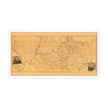
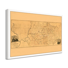
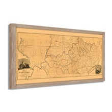
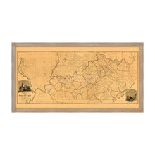
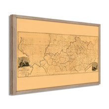
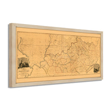
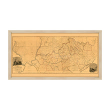
Publicado veinticinco años después de la inclusión de Kentucky en los Estados Unidos como el decimoquinto estado, este mapa fue elaborado por el prolífico topógrafo de Kentucky Luke Munsell. Esta ilustración detallada muestra el país en una época de crecimiento, aunque a principios del siglo XIX seguía siendo en gran parte agrícola. El estado se había separado de Virginia en su formación y se hizo conocido por sus colinas ondulantes y su producción borbónica. Bourbon, en el condado de Kentucky, es el único lugar en el que se puede producir Bourbon verdadero, y el sólido cultivo de maíz del estado estimuló su destilación. Kentucky también dependía del cultivo de tabaco para sustentar su economía.

La ciudad más grande de Kentucky, Louisville, era un importante puerto de envío, y los viajes interestatales permitieron que la ciudad floreciera ya que los barcos tenían que descargarse antes de continuar río abajo debido a la proximidad de las ciudades a las Cataratas de Ohio. Louisville fue un importante bastión de la Unión durante la Guerra Civil y el estado permaneció firmemente en la Unión durante el conflicto.

La capital del estado, Frankfort, se estableció en 1786 y alberga una de las destilerías más antiguas de Estados Unidos, Buffalo Trace, que se construyó en 1792. La industria minera del carbón del estado estaba surgiendo durante este período y se convertiría en uno de los principales impulsores de la economía de Kentucky. para el próximo siglo. El suelo fértil de los pastos Bluegrass también apoyó ricos intereses agrícolas. La profunda historia y la rica herencia de Kentucky han perdurado hasta el día de hoy, y la estética distintiva de esta ilustración permite que el espectador sea transportado en el tiempo.

Nuestro arte de pared listo para colgar está impreso y enmarcado en los Estados Unidos utilizando materiales de la más alta calidad con artesanía profesional. Esta hermosa obra de arte es un complemento perfecto para su decoración temática. Las impresiones históricas se ven geniales en el hogar, el estudio o la oficina. También hacen un regalo inolvidable.

*Free shipping for framed and canvas products limited to the 48 contiguous United States.