1861 Mapa seccional del estado de Illinois Arte de pared enmarcado – Historic Prints
100% Satisfaction Guaranteed: Free Returns
Free Standard Shipping
Get 10% OFF your First Order

Shop Now and Get Free Shipping to Anywhere in the United States and Puerto Rico.*

Follow us

Digitally Restored and Enhanced 1861 Illinois State Map - Framed Vintage Map of Illinois Wall Art - Old State of Illinois Map Poster - Sectional Map of the State of Illinois Poster
  • Cargar imagen en el visor de la galería, Digitally Restored and Enhanced 1861 Illinois State Map - Framed Vintage Map of Illinois Wall Art - Old State of Illinois Map Poster - Sectional Map of the State of Illinois Poster
  • Cargar imagen en el visor de la galería, Digitally Restored and Enhanced 1861 Illinois State Map - Framed Vintage Map of Illinois Wall Art - Old State of Illinois Map Poster - Sectional Map of the State of Illinois Poster
  • Cargar imagen en el visor de la galería, Digitally Restored and Enhanced 1861 Illinois State Map - Framed Vintage Map of Illinois Wall Art - Old State of Illinois Map Poster - Sectional Map of the State of Illinois Poster
  • Cargar imagen en el visor de la galería, Digitally Restored and Enhanced 1861 Illinois State Map - Framed Vintage Map of Illinois Wall Art - Old State of Illinois Map Poster - Sectional Map of the State of Illinois Poster
  • Cargar imagen en el visor de la galería, Digitally Restored and Enhanced 1861 Illinois State Map - Framed Vintage Map of Illinois Wall Art - Old State of Illinois Map Poster - Sectional Map of the State of Illinois Poster
  • Cargar imagen en el visor de la galería, Digitally Restored and Enhanced 1861 Illinois State Map - Framed Vintage Map of Illinois Wall Art - Old State of Illinois Map Poster - Sectional Map of the State of Illinois Poster
  • Cargar imagen en el visor de la galería, Digitally Restored and Enhanced 1861 Illinois State Map - Framed Vintage Map of Illinois Wall Art - Old State of Illinois Map Poster - Sectional Map of the State of Illinois Poster
  • Cargar imagen en el visor de la galería, Digitally Restored and Enhanced 1861 Illinois State Map - Framed Vintage Map of Illinois Wall Art - Old State of Illinois Map Poster - Sectional Map of the State of Illinois Poster
  • Cargar imagen en el visor de la galería, Digitally Restored and Enhanced 1861 Illinois State Map - Framed Vintage Map of Illinois Wall Art - Old State of Illinois Map Poster - Sectional Map of the State of Illinois Poster
  • Cargar imagen en el visor de la galería, Digitally Restored and Enhanced 1861 Illinois State Map - Framed Vintage Map of Illinois Wall Art - Old State of Illinois Map Poster - Sectional Map of the State of Illinois Poster
  • Cargar imagen en el visor de la galería, Digitally Restored and Enhanced 1861 Illinois State Map - Framed Vintage Map of Illinois Wall Art - Old State of Illinois Map Poster - Sectional Map of the State of Illinois Poster
  • Cargar imagen en el visor de la galería, Digitally Restored and Enhanced 1861 Illinois State Map - Framed Vintage Map of Illinois Wall Art - Old State of Illinois Map Poster - Sectional Map of the State of Illinois Poster
  • Cargar imagen en el visor de la galería, Digitally Restored and Enhanced 1861 Illinois State Map - Framed Vintage Map of Illinois Wall Art - Old State of Illinois Map Poster - Sectional Map of the State of Illinois Poster
  • Cargar imagen en el visor de la galería, Digitally Restored and Enhanced 1861 Illinois State Map - Framed Vintage Map of Illinois Wall Art - Old State of Illinois Map Poster - Sectional Map of the State of Illinois Poster
  • Cargar imagen en el visor de la galería, Digitally Restored and Enhanced 1861 Illinois State Map - Framed Vintage Map of Illinois Wall Art - Old State of Illinois Map Poster - Sectional Map of the State of Illinois Poster
  • Cargar imagen en el visor de la galería, Digitally Restored and Enhanced 1861 Illinois State Map - Framed Vintage Map of Illinois Wall Art - Old State of Illinois Map Poster - Sectional Map of the State of Illinois Poster

Mapa del estado de Illinois de 1861 - Mapa vintage enmarcado de Illinois - Mapa antiguo del estado de Illinois - Mapa seccional del estado de Illinois Wall Art Poster Print

Precio habitual
$172.99
Precio de venta
$172.99
Precio habitual
$345.99
Agotado
Brand : Historic Prints
Precio unitario
por 
Los gastos de envío se calculan en la pantalla de pagos.

Puntos característicos

  • MAPA VINTAGE ENMARCADO: Te encantará esta reproducción histórica enmarcada de alta calidad del mapa del estado de Illinois de 1861. Nuestros mapas listos para colgar están impresos y enmarcados en los EE. UU. por enmarcadores de arte profesionales que utilizan materiales de la más alta calidad. Cada pedido es inspeccionado por calidad. Esta hermosa obra de arte es un complemento perfecto para su decoración temática. Los mapas antiguos se ven geniales en el hogar, el estudio o la oficina. También hacen un regalo inolvidable.
  • UNA MIRADA ATRÁS A LA HISTORIA: Esta es una impresionante reproducción histórica de 1861 Illinois Map Print. Un verdadero pedazo de historia. Las impresiones históricas vinculan maravillosamente el pasado con el presente. Es posible que te encuentres mirando tu arte mural histórico durante horas con asombro. Consulte nuestra sección de descripción del producto para obtener más información fascinante sobre este mapa histórico y su significado.
  • CALIDAD PREMIUM: Para mostrar esta increíble pieza de la historia, utilizamos papel mate de calidad de museo de gramaje pesado (230 g/m²), con impresión de bellas artes. Nuestro papel no contiene ácido, lo que permite que la impresión conserve su calidad de color durante generaciones. Nuestro papel muestra arte de mapas antiguos con una reproducción precisa del color. Esta impresión de alta calidad será una maravillosa adición a su pared de estilo vintage.
  • LISTO PARA COLGAR: este marco de alta calidad muestra bellamente el arte en casi cualquier entorno. El marco está fabricado en madera de chopo (para blanco y negro) y de pino (para nogal y natural) con acabado mate. El perfil del marco mide 1,5 pulgadas de alto y 0,75 pulgadas de ancho. Para proteger las obras de arte, utilizamos acrílico para marcos de alta calidad, liviano y resistente a los golpes. Los marcos llegan listos para colgar, preinstalados con herrajes para colgar.
  • ESTAMPAS HISTÓRICAS: Amamos la historia y el arte. A veces, los mapas antiguos tienen rasgaduras, pliegues, sellos, separaciones y otras imperfecciones. Restauramos y mejoramos mapas digitalmente manteniendo su carácter histórico. Nuestras impresiones enmarcadas están hechas a pedido en los EE. UU. por enmarcadores de arte profesionales. Clientes de todo el mundo adoran nuestros estampados históricos y sabemos que a ti también.


Información Adicional

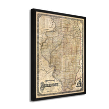
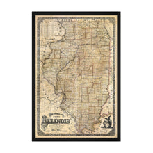
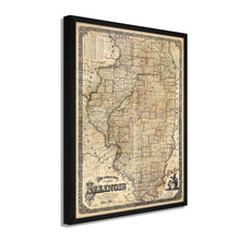
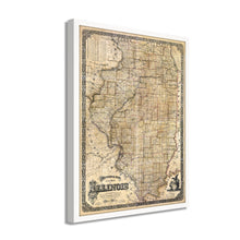
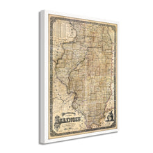
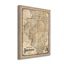
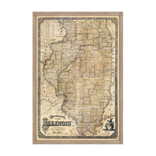
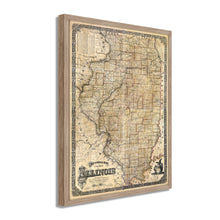
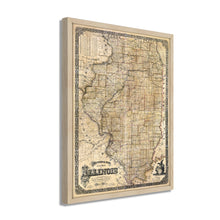
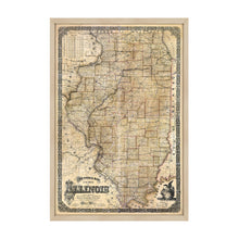
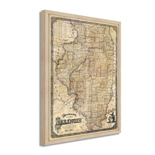
Mapa seccional de 1861 del estado de Illinois: muestra los límites exactos de los condados establecidos por ley y la topografía general del estado como pueblos, arroyos, lagos, estanques, acantilados, vías férreas, carreteras estatales y comunes, etc. también el campo de carbón principal, distritos minerales, afloramientos de bancos de carbón, minas, etc.

La publicación de este mapa coincidió con la salida del presidente Abraham Lincoln de su estado natal para ser inaugurado en Washington DC, así como con el estallido de la Guerra Civil Estadounidense. Aunque el estado no vería batallas significativas en su territorio, sus industrias de procesamiento y fabricación de carne, especialmente las que salen de Chicago, serían fundamentales en la derrota final de la confederación por parte de la Unión. El estado también fue una fuente importante de tropas de la Unión. Además, la proximidad del estado al río Mississippi proporcionó un punto de partida para que el general Ulysses S. Grant comenzara su asalto y asegurara la ruta comercial vital para la Unión.

La expansión de los ferrocarriles a Chicago, así como sus bulliciosas economías manufactureras, habían atraído a miles de inmigrantes de Europa occidental, donde la hambruna y los disturbios civiles obligaban a muchos inmigrantes a encontrar nuevos hogares. Desde la década de 1850, Chicago se había convertido en una de las ciudades más destacadas y desempeñó un papel central en el desarrollo de la vida económica, política y cultural estadounidense. Su ubicación en el lago Michigan permitió a la ciudad controlar el acceso a los Grandes Lagos, lo que le otorgó un poder económico significativo.

Antes de la década de 1860, Chicago había experimentado una rápida expansión y el estado en su conjunto estaba experimentando una prosperidad económica gracias a las 30 barandillas que crearon el centro del Medio Oeste. Este mapa seccional representa el gran estado con notable detalle y transporta al espectador atrás en el tiempo con su estética distintiva, y estos mapas fueron valorados en su época por residentes y comerciantes por igual.

Nuestro arte de pared listo para colgar está impreso y enmarcado en los Estados Unidos utilizando materiales de la más alta calidad con artesanía profesional. Esta hermosa obra de arte es un complemento perfecto para su decoración temática. Las impresiones históricas se ven geniales en el hogar, el estudio o la oficina. También hacen un regalo inolvidable.

*Free shipping for framed and canvas products limited to the 48 contiguous United States.