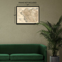
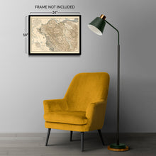
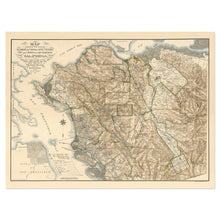
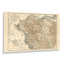
1894 Alameda & Contra Costa County San Francisco California Map Poster – Historic Prints
100% Satisfaction Guaranteed: Free Returns
Free Standard Shipping
Get 10% OFF your First Order

Shop Now and Get Free Shipping to Anywhere in the United States and Puerto Rico.*

Follow us

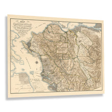
Digitally Restored and Enhanced 1894 Alameda & Contra Costa Map Print - Old Map of Alameda and Contra Costa County San Francisco California Wall Art Poster
  • Cargar imagen en el visor de la galería, Digitally Restored and Enhanced 1894 Alameda & Contra Costa Map Print - Old Map of Alameda and Contra Costa County San Francisco California Wall Art Poster
  • Cargar imagen en el visor de la galería, Digitally Restored and Enhanced 1894 Alameda & Contra Costa Map Print - Old Map of Alameda and Contra Costa County San Francisco California Wall Art Poster
  • Cargar imagen en el visor de la galería, Digitally Restored and Enhanced 1894 Alameda & Contra Costa Map Print - Old Map of Alameda and Contra Costa County San Francisco California Wall Art Poster
  • Cargar imagen en el visor de la galería, Digitally Restored and Enhanced 1894 Alameda & Contra Costa Map Print - Old Map of Alameda and Contra Costa County San Francisco California Wall Art Poster
  • Cargar imagen en el visor de la galería, Digitally Restored and Enhanced 1894 Alameda & Contra Costa Map Print - Old Map of Alameda and Contra Costa County San Francisco California Wall Art Poster
  • Cargar imagen en el visor de la galería, Digitally Restored and Enhanced 1894 Alameda & Contra Costa Map Print - Old Map of Alameda and Contra Costa County San Francisco California Wall Art Poster
  • Cargar imagen en el visor de la galería, Digitally Restored and Enhanced 1894 Alameda & Contra Costa Map Print - Old Map of Alameda and Contra Costa County San Francisco California Wall Art Poster
  • Cargar imagen en el visor de la galería, Digitally Restored and Enhanced 1894 Alameda & Contra Costa Map Print - Old Map of Alameda and Contra Costa County San Francisco California Wall Art Poster

1894 Alameda & Contra Costa Map Print - Old Map of Alameda and Contra Costa County San Francisco California Wall Art Poster

Precio habitual
$39.99
Precio de venta
$39.99
Precio habitual
$79.99
Agotado
Brand : Historic Prints
Precio unitario
por 
Los gastos de envío se calculan en la pantalla de pagos.

Feature Points

  • VINTAGE MAP REPRODUCTION: You'll love this high quality historic reproduction of 1894 Alameda & Contra Costa Map Print. Our museum quality prints are archival grade, which means it will look great and last without fading for over 100 years. Our print to order maps are made in the USA and each map is inspected for quality. This beautiful artwork is a perfect addition to your themed decor. Vintage maps look great in the home, study or office. They make a perfect gift as well.
  • MUSEUM QUALITY: This high quality map print will be a great addition to your vintage-themed wall. Don't waste money on cheap-looking, thin paper posters. We use thick, fine art print quality matte paper. Our professional's choice matte paper displays artwork in high detail without glare. The color is vibrant and text is easy to read. When framed, this map looks absolutely stunning.
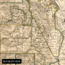
  • A LOOK BACK AT HISTORY: This is an impressive, historic reproduction of 1894 Alameda & Contra Costa San Francisco California Map Poster. A true piece of history. See our product description section for more fascinating information about this historic map and its significance.
  • READY TO FRAME: This print includes a 0.2 inch border for a perfect frame fit and look. Our maps are designed to fit easy-to-find standard frame sizes, saving you money from having to pay for a custom frame. Each map is inspected for quality and shipped in a rigid tube.
  • HISTORIX: We love history and art. Sometimes old maps have tears, folds, separations and other blemishes. We digitally restore and enhance maps while keeping its historical character. All our maps are proudly made in the USA. Customers all over the world love our vintage maps and we know you will too.


Additional Information

Alameda and Contra Costa Counties have been essential areas in California's Northern Coast for centuries as the regions developed with bustling ports. This map was produced in a period of significant growth and prosperity, which the region had enjoyed since the middle of the nineteenth century when vast gold reserves were discovered in the Sierra Nevada Mountains, bringing considerable wealth to the cities as a banking hub on the West Coast. During the nineteenth century, San Francisco rivaled Los Angeles, Seattle, and Portland, Oregon, as a trading port for goods being imported to the United States from Asia and exporting American-made goods to foreign markets.

As the nation approached the turn of the century, the Bay Area, along with the rest of the country, was being transformed in the years of the Industrial Revolution and a period of peace following the conclusion of the American Civil War in addition to technological advances in transportation, architecture, and culture as America became one of the most influential nations in the world and continued to develop. This map was produced by the prolific San Francisco-based lithography firm Britton & Rey, who created numerous works during the nineteenth century.

This map's distinctive style and classic aesthetic immediately transport the viewer back in time, creating a lasting bond between the past and present that illustrates the evolution and growth of the region through the following centuries. This is an authentic piece of cartographical history.

*Free shipping for framed and canvas products limited to the 48 contiguous United States.